Osage Beach is a city located in both Camden and Miller counties in Missouri, United States. Situated along the Lake of the Ozarks, the city is a major tourism destination and serves as a regional commercial hub. The city is a center for lodging, shopping, dining, and business activity. Based on 2024 census, the city home to approximately 5,100 residents while welcoming over three million visitors each year.
Osage Beach maintains a park system that includes City Park, Peanick Park, and the Osage Beach Sports Complex, offering recreation areas, ball fields, and walking trails. The city was formally incorporated in 1965.
History
The development of Osage Beach is closely linked to the creation of the Lake of the Ozarks. Osage Beach was founded in 1886 as Zebra before being renamed as Osage Beach in 1935. Osage Beach was incorporated in 1959.[4][5]
Formation of the Lake: In 1931, the Union Electric Company of St. Louis completed the construction of Bagnell Dam on the Osage River, creating the Lake of the Ozarks. The new reservoir quickly became a draw for visitors interested in boating, fishing, and resort recreation.[6]
Early Development: During the 1930s and 1940s, the shoreline began to see the establishment of cabins, fishing camps, and small businesses catering to lake tourism. The area that would become Osage Beach developed as an accessible point on the lake due to its proximity to U.S. Highway 54.[7]
Incorporation: The City of Osage Beach was first incorporated in 1959. Following a temporary dis-incorporation, voters approved a second and final incorporation in 1965.[8][9]
Growth: The city grew rapidly as a resort and second-home destination during the 1960s and 1970s. Its central location on the Lake of the Ozarks led to the establishment of marinas, hotels, and resorts. Commercial growth in the 1980s and 1990s included the 1985 opening of the Osage Beach Premium Outlets (originally the Factory Outlet Mall).
Geography
According to the United States Census Bureau, the city has a total area of 10.33 square miles (26.75km2), of which 9.75 square miles (25.25km2) is land and 0.58 square miles (1.50km2) is water.[10] The city is located on the shores of the Lake of the Ozarks.
At the 2010 census there were 4,351 people, 2,038 households, and 1,166 families living in the city. The population density was 446.3 inhabitants per square mile (172.3/km2). There were 5,261 housing units at an average density of 539.6 per square mile (208.3/km2). The racial makeup of the city was 93.6% White, 1.1% African American, 0.6% Native American, 1.1% Asian, 0.2% Pacific Islander, 2.4% from other races, and 1.1% from two or more races. Hispanic or Latino of any race were 4.8%.[13]
Of the 2,038 households 19.9% had children under the age of 18 living with them, 44.3% were married couples living together, 8.0% had a female householder with no husband present, 5.0% had a male householder with no wife present, and 42.8% were non-families. 35.3% of households were one person and 13% were one person aged 65 or older. The average household size was 2.04 and the average family size was 2.57.
The median age was 48.9 years. 15.8% of residents were under the age of 18; 8.6% were between the ages of 18 and 24; 20.2% were from 25 to 44; 31.3% were from 45 to 64; and 24% were 65 or older. The gender makeup of the city was 48.9% male and 51.1% female.
2000 census
At the 2000 census there were 3,662 people, 1,687 households, and 1,035 families living in the city. The population density was 389.8 inhabitants per square mile (150.5/km2). There were 4,055 housing units at an average density of 431.6 per square mile (166.6/km2). The racial makeup of the city was 97.35% White, 0.76% African American, 0.41% Native American, 0.49% Asian, 0.16% from other races, and 0.82% from two or more races. Hispanic or Latino of any race were 1.20% of the total population.[3] Of the 1,687 households 19.1% had children under the age of 18 living with them, 51.2% were married couples living together, 7.2% had a female householder with no husband present, and 38.6% were non-families. 31.6% of households were one person and 10.9% were one person aged 65 or older. The average household size was 2.09 and the average family size was 2.58.
The age distribution was 16.0% under the age of 18, 7.4% from 18 to 24, 26.9% from 25 to 44, 29.3% from 45 to 64, and 20.3% 65 or older. The median age was 45 years. For every 100 females there were 96.8 males. For every 100 females age 18 and over, there were 94.9 males.
The median household income was $38,448 and the median family income was $49,554. Males had a median income of $30,444 versus $21,440 for females. The per capita income for the city was $22,685. About 4.5% of families and 6.7% of the population were below the poverty line, including 5.3% of those under age 18 and 6.4% of those age 65 or over.
Osage Beach is split between two television markets. While Camden County is part of the Springfield television market, Miller County is part of the Columbia/Jefferson City market. Charter Communications' cable system carries stations from both cities. DirecTV and Dish Network subscribers in the city receive Springfield stations, mainly because the bulk of the city is in Camden County.
Television
The following is a list of television stations that broadcast from and/or are licensed to Osage Beach, Missouri.
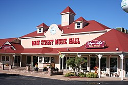
As Osage Beach is predominantly a resort town, as such it boasts several tourist attractions and amenities, including an outlet mall with major national brands.[16]
Healthcare
Osage Beach is home to Lake Regional Hospital. Part of the Lake Regional Health system, this general medical and surgical hospital houses a trauma center and has a total of 116 beds.[citation needed]
In popular media
The TV series Ozark is set in Osage Beach. In November 2017, it was reported that the series helped increase tourism and notoriety of the Lake of the Ozarks, but did not have a significant economic impact.[17] In February 2018, a restaurant called "Marty Byrde's" was opened in Lake Ozark, Missouri, that is inspired by the series, and includes menu items based on the show, including "Ruth's Smoked Wings".[18]
This page is based on this Wikipedia article Text is available under the CC BY-SA 4.0 license; additional terms may apply. Images, videos and audio are available under their respective licenses.