Bloomsdale, Missouri

Last updated

Bloomsdale, Missouri
Highway 61 Roadside Park (Bloomsdale).jpg
View of Bloomsdale from roadside park on Highway 61
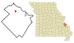
Ste. Genevieve County Missouri Incorporated and Unincorporated areas Bloomsdale Highlighted.svg
Location of Bloomsdale, Missouri
Coordinates: 38°00′53″N90°13′17″W / 38.01472°N 90.22139°W / 38.01472; -90.22139 [1]
Country United States
State Missouri
County Ste. Genevieve
Township Jackson Township, Sainte Genevieve County, Missouri
Area
[2]
  Total1.64 sq mi (4.24 km2)
  Land1.63 sq mi (4.22 km2)
  Water0.01 sq mi (0.02 km2)
Elevation
[1]
518 ft (158 m)
Population
 (2020)
  Total639
  Density392.75/sq mi (151.60/km2)
Time zone UTC-6 (Central (CST))
  Summer (DST) UTC-5 (CDT)
FIPS code 29-06454 [3]
GNIS feature ID2394199 [1]

Bloomsdale is a city in Ste. Genevieve County, Missouri, United States. The population was 639 at the 2020 census.

Contents

Etymology

The name of the town is most likely derived from the name of a Catholic priest, Father Blume.

History

Bloomsdale was known as early as 1839 as "La Fourche à Duclos", meaning "the fork of Duclos" and named for the creek by the same name. Its parish priest, a Father Blume, wished his parishioners to all reside on one side of the stream, and so bought land for a settlement on what is now called Establishment Creek moved to the present site of Bloomsdale. One account has it that "Blumesdale" was mailed to Washington, D.C., as the name of the town's post office. But the name was illegible, so the story goes, so Washington called the office Bloomsdale. More likely, Washington anglicized the German name Blume ("flower") to Bloom. Either way, the name honors Father Blume. [4]

Geography

Bloomsdale is located in the eastern part of Jackson Township, near Establishment Creek.

According to the United States Census Bureau, the city has a total area of 1.64 square miles (4.25 km2), of which 1.63 square miles (4.22 km2) is land and 0.01 square miles (0.03 km2) is water. [5]

Demographics

Historical population
CensusPop.Note
1970 411
1980 397−3.4%
1990 353−11.1%
2000 41918.7%
2010 52124.3%
2020 63922.6%
U.S. Decennial Census [6] 2020 [7]

2010 census

As of the census [8] of 2010, there were 521 people, 202 households, and 136 families living in the city. The population density was 319.6 inhabitants per square mile (123.4/km2). There were 216 housing units at an average density of 132.5 per square mile (51.2/km2). The racial makeup of the city was 98.66% White, 0.58% Black or African American, 0.19% Native American, and 0.58% from two or more races.

There were 202 households, of which 36.6% had children under the age of 18 living with them, 56.4% were married couples living together, 6.9% had a female householder with no husband present, 4.0% had a male householder with no wife present, and 32.7% were non-families. 30.2% of all households were made up of individuals, and 11.4% had someone living alone who was 65 years of age or older. The average household size was 2.58 and the average family size was 3.25.

The median age in the city was 35.3 years. 30.7% of residents were under the age of 18; 5.4% were between the ages of 18 and 24; 26.4% were from 25 to 44; 21.1% were from 45 to 64; and 16.5% were 65 years of age or older. The gender makeup of the city was 48.9% male and 51.1% female.

2000 census

As of the census [3] of 2000, there were 419 people, 173 households, and 120 families living in the city. The population density was 259.9 inhabitants per square mile (100.3/km2). There were 179 housing units at an average density of 111.1 per square mile (42.9/km2). The racial makeup of the city was 98.81% White, 0.48% Native American, and 0.72% from two or more races. Hispanic or Latino of any race were 0.48% of the population.

There were 173 households, out of which 30.6% had children under the age of 18 living with them, 60.7% were married couples living together, 8.1% had a female householder with no husband present, and 30.1% were non-families. 27.2% of all households were made up of individuals, and 15.0% had someone living alone who was 65 years of age or older. The average household size was 2.42 and the average family size was 2.94.

In the city the population was spread out, with 24.8% under the age of 18, 8.5% from 18 to 24, 27.2% from 25 to 44, 22.7% from 45 to 64, and 16.9% who were 65 years of age or older. The median age was 36 years. For every 100 females there were 96.7 males. For every 100 females age 18 and over, there were 94.4 males.

The median income for a household in the city was $43,125, and the median income for a family was $61,429. Males had a median income of $39,688 versus $22,857 for females. The per capita income for the city was $17,714. About 3.8% of families and 6.1% of the population were below the poverty line, including none of those under age 18 and 16.7% of those age 65 or over.

Related Research Articles

<span class="mw-page-title-main">Purdy, Missouri</span> City in Missouri, United States

Purdy is a city in Purdy Township, Barry County, Missouri, United States, on the foothills of the Ozarks, eight miles south of Monett and twelve miles north of Cassville along Highway 37. The population was 1,098 at the 2010 census.

<span class="mw-page-title-main">Wheaton, Missouri</span> City in Missouri, United States

Wheaton is a city in Wheaton Township, Barry County, Missouri, United States. The population was 696 at the 2010 census.

<span class="mw-page-title-main">Gunn City, Missouri</span> Village in Missouri, United States

Gunn City is a village in Cass County, Missouri, United States. The population was 118 at the 2010 census. It is part of the Kansas City metropolitan area.

<span class="mw-page-title-main">Lake Lafayette, Missouri</span> City in Missouri, United States

Lake Lafayette is a city in Lafayette County, Missouri, and is part of the Kansas City metropolitan area within the United States. The population was 327 at the 2010 census.

<span class="mw-page-title-main">Lewistown, Missouri</span> City in Missouri, United States

Lewistown is a city in Lewis County, Missouri, United States. The population was 521 at the 2020 census. It is part of the Quincy, IL–MO Micropolitan Statistical Area. It is located on Missouri Route 6 near the junction of Route 6 with Missouri Route 16. Lewistown is in the Lewis County C-1 school district.

<span class="mw-page-title-main">Wheeling, Missouri</span> City in Missouri, United States

Wheeling is a city in eastern Livingston County, Missouri, United States. The population was 220 at the 2020 census.

<span class="mw-page-title-main">Bagnell, Missouri</span> Town in Missouri, United States

Bagnell is a town in Miller County, Missouri, United States. The population was 93 at the 2010 census.

<span class="mw-page-title-main">Catron, Missouri</span> City in Missouri, United States

Catron is a city in New Madrid County, Missouri, United States. The population was 67 at the 2010 census.

<span class="mw-page-title-main">Wardell, Missouri</span> City in Missouri, United States

Wardell is a city in Pemiscot County, Missouri, United States. The population was 310 at the 2020 census. It annexed North Wardell in 2007.

<span class="mw-page-title-main">Crystal Lakes, Missouri</span> City in Missouri, United States

Crystal Lakes is a city in western Ray County, Missouri, and part of the Kansas City metropolitan area within the United States. The population was 390 at the 2020 census.

<span class="mw-page-title-main">Breckenridge Hills, Missouri</span> City in Missouri, United States

Breckenridge Hills is a city in St. Louis County, Missouri, United States. As of the 2010 census, the city population was 4,746.

<span class="mw-page-title-main">Flordell Hills, Missouri</span> City in Missouri, United States

Flordell Hills is a city in St. Louis County, Missouri, United States. The population was 822 at the 2010 census.

<span class="mw-page-title-main">Green Park, Missouri</span> City in Missouri, United States

Green Park is a city in St. Louis County, Missouri, United States. The population was 2,622 at the 2010 census.

<span class="mw-page-title-main">Hazelwood, Missouri</span> City in Missouri, United States

Hazelwood is a city in St. Louis County, Missouri, within Greater St. Louis. It is a second-ring northern suburb of St. Louis. Based on the 2020 United States census, the city had a total population of 25,485. It is located north of St. Louis-Lambert International Airport and is situated on Interstates 270 and 170, as well as the much-traveled Lindbergh Boulevard and Highway 370.

<span class="mw-page-title-main">St. Mary, Missouri</span> City in Missouri, United States

St. Mary is a city in Ste. Genevieve County, Missouri, United States. The population was 309 at the 2020 census.

<span class="mw-page-title-main">Bell City, Missouri</span> City in Missouri, United States

Bell City is a city in northeastern Stoddard County, Missouri, United States. It was founded as a sawmill town circa 1900, and lies at the foothills of Crowley's Ridge on Missouri Route 91. The population was 448 at the 2010 census. Dorothy Burton is the current mayor.

<span class="mw-page-title-main">Sheridan, Missouri</span> City in Missouri, United States

Sheridan is a city in northwest Worth County, Missouri, United States, near the Platte River. The population was 195 at the 2010 census.

<span class="mw-page-title-main">Cowgill, Missouri</span> City in Missouri, United States

Cowgill is a city in southern Caldwell County, Missouri, and is part of the Kansas City metropolitan area with the United States. The population was 168 at the 2020 census.

<span class="mw-page-title-main">Warson Woods, Missouri</span> City in Missouri, United States

Warson Woods is a city in St. Louis County, Missouri, United States. The population was 1,962 at the 2010 census.

<span class="mw-page-title-main">Summersville, Missouri</span> City in Missouri, United States

Summersville is a city in Shannon and Texas counties in the U.S. state of Missouri. The population was 453 at the 2020 census.

References

  1. 1 2 3 U.S. Geological Survey Geographic Names Information System: Bloomsdale, Missouri
  2. "ArcGIS REST Services Directory". United States Census Bureau. Retrieved August 28, 2022.
  3. 1 2 "U.S. Census website". United States Census Bureau . Retrieved January 31, 2008.
  4. State Historical Society of Missouri: Ste. Genevieve County http://shs.umsystem.edu/manuscripts/ramsay/ramsay_sainte_genevieve.html
  5. "US Gazetteer files 2010". United States Census Bureau. Archived from the original on January 25, 2012. Retrieved July 8, 2012.
  6. "Census of Population and Housing". Census.gov. Retrieved June 4, 2015.
  7. "2020 Census Data". data.census.gov.
  8. "U.S. Census website". United States Census Bureau . Retrieved July 8, 2012.