Ste. Genevieve Township, Ste. Genevieve County, Missouri

Last updated
Ste. Genevieve Township
Map of Missouri highlighting Sainte Genevieve County.svg
Location of Ste. Genevieve County
Coordinates: 37°56′48″N90°06′53″W / 37.94655°N 90.11466°W / 37.94655; -90.11466 Coordinates: 37°56′48″N90°06′53″W / 37.94655°N 90.11466°W / 37.94655; -90.11466 [1]
Country United States
State Missouri
County Ste. Genevieve
Area
  Total128 sq mi (330 km2)
  Land125 sq mi (320 km2)
  Water4 sq mi (10 km2)  2.72%
GNIS Feature ID 767326

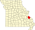
Ste. Genevieve Township is a subdivision of Ste. Genevieve County, Missouri, in the United States of America, and is one of the five townships located in Ste. Genevieve County.

Contents

Name

The township was named for the city of Ste. Genevieve, which in turn was named for the Catholic saint Genevieve, the patron saint of Paris. [2]

History

The area of Ste. Genevieve Township was the site of the earliest European settlement in Missouri dating back to the early 1700s. The French colonial settlers partially came from Lower Louisiana, Quebec in Canada, and France. These Creole Habitants farmed the rich bottomlands along the Mississippi River, particularly the Grand Champ bottom, while coureur des bois trapped and traded furs. The local economy provided food and goods for the needs of the Upper Louisiana colony and New Orleans. Transportation to New Orleans was made by boat, while local transportation moved on local roads or traces. The King's Road or Kingshighway (French: le Chemin du Roi or Rue Royale) was begun in 1779 and connected the communities and outposts on the west bank of the Mississippi River. The area known today as Ste. Genevieve Township was split between two French colonial districts: Ste. Genevieve District and New Bourbon District. Upper Louisiana was transferred to the United States in 1804, and in 1824 the state of Missouri was carved from the territory. With the creation of Missouri subsequently came the establishment of Ste. Genevieve County. Ste. Genevieve Township was one of two original townships in the county. [3]

Populated places

There are several incorporated and unincorporated communities in Ste. Genevieve Township.

The township also contains a number of churches: Our Lady Help of Christians Catholic Church, and St. Josephs Catholic Church, as well as the following cemeteries:. [4] [5]

Geography

Ste. Genevieve Township is located in the eastern portion of Ste. Genevieve County. A number of streams run through the township: Coal Creek, Copper Mine Creek, Dodge Creek, Hogg Creek, Mill Creek, Mississippi Slough, Mud Branch, Rough Creek, Sugar Bottom Creek. The following lakes are found in the township: Govro Lake, Hook Pond, Lake Ann, Lake Marian, Lake Susan. [6] [7]

2000 census

The 2000 census shows Ste. Genevieve Township consisting of 8,943 individuals. [8] The racial makeup of the town was 8,756 (97.0%) White, 100 (1.1%) African American, 25 (0.28%) Native American and Alaska Native, 24 (0.27%) Asian, and 1 (0.01%) from two or more races. [9]

2010 census

As of the census of 2010, there were 8,991 people, with a population density of 73 per square mile residing in the township. Males make up 4,496 (49.8%) of the population, while females make up 4,528 (50.2%). The median age for men is 38.7 years and for women is 39.7 years. The racial makeup of the town was 8,751 (97.33%) White, 77 (0.86%) African American, 20 (0.22%) Native American and Alaska Native, 41 (0.46%) Asian, and 11 (0.12%) from other races, and 89 (0.99%) from two or more races. [10] [11]

The average household size 2.57 persons. The estimated median household income in 2009 was $48,283 ($40,496 in 1999). 6.0% of the residents have an income below the poverty rate. [12] [13] [14]

Related Research Articles

Ste. Genevieve County, Missouri Eastern Missouri, United States

Sainte Genevieve County, often abbreviated Ste. Genevieve County, is a county located in the eastern portion of the U.S. state of Missouri. As of the 2010 census, the population was 18,145. The largest city and county seat is Ste. Genevieve. The county was officially organized on October 1, 1812, and is named after the Spanish district once located in the region, after Saint Genevieve, patroness of Paris, France. It includes the earliest settlement west of the Mississippi River outside New Spain, part of the French colonial mid-Mississippi valley villages. It is one of the last places where the Paw Paw French is still spoken.

Perry County, Missouri U.S. county in Missouri

Perry County is a county located in the southeastern portion of the U.S. state of Missouri. As of the 2010 census, the population was 18,971. Its county seat is Perryville. The county was officially organized on November 16, 1820 from Ste. Genevieve County and was named after Oliver Hazard Perry, a naval hero of the War of 1812.

Ste. Genevieve, Missouri City in Missouri, United States

Ste. Genevieve is a city in Ste. Genevieve Township and is the county seat of Ste. Genevieve County, Missouri, United States. The population was 4,410 at the 2010 census. Founded in 1735 by French Canadian colonists and settlers from east of the river, it was the first organized European settlement west of the Mississippi River in present-day Missouri.

Coffman, Missouri unincorporated community in Missouri, United States

Coffman is an unincorporated community in Saline Township in southern Sainte Genevieve County, Missouri, United States. It is located approximately fifteen miles southwest of Ste. Genevieve.

Jackson Township, Ste. Genevieve County, Missouri Civil Township in Missouri, United States

Jackson Township is a subdivision of Ste. Genevieve County, Missouri, in the United States of America, and is one of the five townships located in Ste. Genevieve County.

Cinque Hommes Township, Perry County, Missouri Civil Township in Missouri, United States

Cinque Hommes is one of the eight townships located in Perry County, Missouri, in the United States of America.

Saint Marys Township, Perry County, Missouri Civil Township in Missouri, United States

St. Marys is one of the eight townships located in Perry County, Missouri, in the United States of America.

Bois Brule Township, Perry County, Missouri Civil Township in Missouri, United States

Bois Brûlé is one of the eight townships located in Perry County, Missouri, in the United States of America.

Union Township, Perry County, Missouri Civil Township in Missouri, United States

Union is one of the eight townships located in Perry County, Missouri, in the United States of America.

Bois Brule Bottom

The Bois Brule Bottom is an alluvial floodplain in Bois Brule Township in Perry County, Missouri stretching between Bois Brule Creek to the west and the Mississippi River to the east.

Ozora, Missouri Census-designated place in Missouri, United States

Ozora is an unincorporated community and census-designated place located in Beauvais Township in Sainte Genevieve County, Missouri, United States. Ozora is located approximately eight miles south of Sainte Genevieve.

Zell, Missouri unincorporated community in Missouri, United States

Zell is an unincorporated community located in Ste. Genevieve Township in Ste. Genevieve County, Missouri, United States. Zell is located approximately six miles west of Sainte Genevieve.

Central Township, Perry County, Missouri Civil Township in Missouri, United States

Central Township is one of the eight townships located in Perry County, Missouri, United States.

Salem Township, Perry County, Missouri Civil Township in Missouri, United States

Salem Township is one of the eight townships located in Perry County, Missouri, in the United States of America.

Saline Township, Perry County, Missouri Civil Township in Missouri, United States

Saline Township is one of the eight townships located in Perry County, Missouri, in the United States of America.

Beauvais Township, Ste. Genevieve County, Missouri Civil Township in Missouri, United States

Beauvais Township is a subdivision of Ste. Genevieve County, Missouri, in the United States of America, and is one of the five townships located in Ste. Genevieve County.

River aux Vases (Mississippi River tributary)

River aux Vases is a creek that rises in Union Township in western Ste. Genevieve County, Missouri and flows into the Mississippi River about two miles north of St. Marys, Missouri.

Saline Township, Ste. Genevieve County, Missouri Civil Township in Missouri, United States

Saline Township is a subdivision of Ste. Genevieve County, Missouri, in the United States of America, and is one of the five townships located in Ste. Genevieve County.

Union Township, Ste. Genevieve County, Missouri Civil Township in Missouri, United States

Union Township is a subdivision of Ste. Genevieve County, Missouri, in the United States of America, and is one of the five townships located in Ste. Genevieve County.

Brickeys, Missouri unincorporated community

Brickey's or Brickeys is an unincorporated community located in Jackson Township in Sainte Genevieve County, Missouri, United States. The town lies 11 miles to the northwest of Ste. Genevieve on the Mississippi River.

References

  1. "Township of Sainte Genevieve". Geographic Names Information System. United States Geological Survey. Retrieved 2014-01-29.
  2. The State Historical Society of Missouri: Ste.Genevieve County Place Names http://shs.umsystem.edu/manuscripts/ramsay/ramsay_sainte_genevieve.html
  3. Robert Sidney Douglass (1912). Opening the Ozarks: History of Southeast Missouri: A Narrative Account of Its Historical Progress, Its People and Its Principal Interests, Volume 1. ISBN   9780722207536.
  4. City-Data. http://www.city-data.com/township/Ste.-Genevieve-Ste.-Genevieve-MO.html
  5. U.S. Geoview.info http://us.geoview.info/township_of_sainte_genevieve,4407298
  6. U.S. Geoview.info http://us.geoview.info/township_of_sainte_genevieve,4407298
  7. City-Data. http://www.city-data.com/township/Ste.-Genevieve-Ste.-Genevieve-MO.html
  8. DIANE Publishing (2000). Missouri: 2000 - Census of population and housing (2000): Missouri Summary Population and Housing Characteristics. ISBN   9781428986565.
  9. DIANE Publishing (2003). Census of population and housing (2000): Missouri Population and Housing Unit Counts. ISBN   9781428985896.
  10. Places of the USA: http://www.placesofusa.com/missouri/ste-genevieve-county/ste-genevieve-township/
  11. city.data. http://www.city-data.com/township/Ste.-Genevieve-Ste.-Genevieve-MO.html
  12. City-Data.com http://www.city-data.com/township/Ste.-Genevieve-Ste.-Genevieve-MO.html
  13. US-Census-Gov
  14. Missouri: 2010 - Population and Housing Unit Counts, 2010 Census of Population and Housing https://www.census.gov/prod/cen2010/cph-2-27.pdf