Chestnut Ridge, Missouri

Last updated

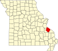
Chestnut Ridge is an unincorporated community in Ste. Genevieve County, in the U.S. state of Missouri. [1]

History

A post office called Chestnut Ridge was established in 1860, and remained in operation until 1877. [2] The community was named for the chestnut timber at a nearby ridge. [3]

Related Research Articles

<span class="mw-page-title-main">New Offenburg, Missouri</span> Unincorporated community in the American state of Missouri

New Offenburg is an unincorporated community in Sainte Genevieve County, Missouri, Missouri, United States. It is located approximately ten miles southwest of Ste. Genevieve on Route 32.

<span class="mw-page-title-main">Womack, Missouri</span> Unincorporated community in the American state of Missouri

Womack is an unincorporated community in Saline Township in the extreme southern part of Sainte Genevieve County, Missouri, United States. It is located approximately twenty miles southwest of Sainte Genevieve. Womack's post office is closed, with mail now delivered from Fredericktown.

<span class="mw-page-title-main">Sprott, Missouri</span> Unincorporated community in Missouri, United States

Sprott is an unincorporated community located in Union Township in Sainte Genevieve County, Missouri, United States. Sprott is located approximately nineteen miles southwest of Sainte Genevieve.

<span class="mw-page-title-main">Minnith, Missouri</span> Unincorporated community in the American state of Missouri

Minnith is an unincorporated community located in the southern part of Beauvais Township in Sainte Genevieve County, Missouri, United States. The town lies approximately 11 miles south of Ste. Genevieve. It is on the banks of Saline Creek on Missouri Route N.

Hadley is an unincorporated community in southern Reynolds County, in the U.S. state of Missouri. The community is in the southeast corner of the county and approximately 4.5 mile west of Leepr in adjacent Wayne County.

Dry Fork is a stream in Jefferson, St. Francois and Ste. Genevieve counties in the U.S. state of Missouri. It is a tributary of Plattin Creek.

Brushy Creek is a stream in southeastern Ste. Genevieve County in the U.S. state of Missouri. It is a tributary of Saline Creek. The headwaters of Brushy Creek are within the Mark Twain National Forest at 37°43′29″N90°06′13″W and the stream flows northeast to its confluence with Saline Creek about 1.5 miles southwest of the community of Minnith at 37°46′36″N90°04′17″W at an elevation of 440 feet.

Coldwater Creek is a stream in Ste. Genevieve County in the U.S. state of Missouri. It is a tributary of Saline Creek.

Establishment Creek is a stream in Ste. Genevieve County in the U.S. state of Missouri. It is a tributary of the Mississippi River.

Greasy Creek is a stream in Ste. Genevieve County in the U.S. state of Missouri. It is a tributary of Saline Creek.

Indian Creek is a stream in Ste. Genevieve County in the U.S. state of Missouri. It is a tributary of Establishment Creek.

Johns Creek is a stream in Ste. Genevieve County in the U.S. state of Missouri. It is a tributary of Saline Creek.

Jonca is an unincorporated community in Ste. Genevieve County, in the U.S. state of Missouri.

Jonca Creek is a stream in Ste. Genevieve County in the U.S. state of Missouri. It is a tributary to the River aux Vases.

Marlo is an unincorporated community in Ste. Genevieve County, in the U.S. state of Missouri.

Mertell Hill is a summit in Ste. Genevieve County in the U.S. state of Missouri. It has an elevation of 758 feet (231 m).

Mill is an unincorporated community in Ste. Genevieve County, in the U.S. state of Missouri.

Pickel is an unincorporated community in Ste. Genevieve County, in the U.S. state of Missouri.

Pikes Peak is a summit in Ste. Genevieve County in the U.S. state of Missouri. The peak has an elevation of 722 feet (220 m).

Quarry Town is an unincorporated community in Ste. Genevieve County, in the U.S. state of Missouri.

References

  1. U.S. Geological Survey Geographic Names Information System: Chestnut Ridge, Missouri
  2. "Post Offices". Jim Forte Postal History. Retrieved 22 December 2016.
  3. "Ste. Genevieve County Place Names, 1928–1945". The State Historical Society of Missouri. Archived from the original on June 24, 2016. Retrieved December 22, 2016.

37°47′53″N90°20′11″W / 37.79806°N 90.33639°W / 37.79806; -90.33639