New Offenburg, Missouri

Last updated

New Offenburg, Missouri
New Offenburg, Missouri sign.jpg
New Offenburg, Missouri sign
MOMap-doton-New Offenburg.png
Location of New Offenburg
Coordinates: 37°54′31″N90°11′50″W / 37.90861°N 90.19722°W / 37.90861; -90.19722
CountryUnited States
State Missouri
County Sainte Genevieve
Elevation
[1]
761 ft (232 m)
Time zone UTC-6 (Central (CST))
  Summer (DST) UTC-5 (CDT)
ZIP codes
63661
Area code 573
FIPS code 29-57116 [2]
GNIS feature ID724239 [1]

New Offenburg is an unincorporated community in Sainte Genevieve County, Missouri, Missouri, United States. [1] It is located approximately ten miles southwest of Ste. Genevieve on Route 32.

Contents

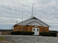
The community was named after Offenburg, a German city between the Black Forest and the river Rhine, the place where its early settlers originated from. [3]

History

In 1867 the settlers in New Offenburg founded a first Post Office ( Post Office ). The small settlement developed around this post office. New Offenburg was on the Missouri – Illinois Railroad, a major railroad that operated between 1921 and 1978. Today New Offenburg is on Missouri State Route 32.

German-speaking descendants of the immigrants at that time live in New Offenburg to this day and speak a dialect of Baden in addition to American English. Other speakers of the Baden dialects can be found in Weingarten and Zell.

Geography

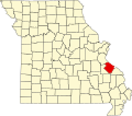
It is located 10 miles southwest of Ste. Genevieve. It has an altitude of 761 feet (232 meters). Coordinates are 37.9086642°N, -90.1973404°W. [4]

Climate

The climate in this area is characterized by hot, humid summers and generally cool winters. According to the Köppen Climate Classification system, New Offenburg has a humid subtropical climate, abbreviated "Cfa" on climate maps.

Climate data for New Offenburg, MO
MonthJanFebMarAprMayJunJulAugSepOctNovDecYear
Average high °F (°C)41.0
(5.0)
47.0
(8.3)
57.0
(13.9)
69.0
(20.6)
77.0
(25.0)
85.0
(29.4)
89.0
(31.7)
88.0
(31.1)
80.0
(26.7)
70.0
(21.1)
56.0
(13.3)
45.0
(7.2)
67.0
(19.4)
Daily mean °F (°C)31.0
(−0.6)
36.0
(2.2)
46.0
(7.8)
57.0
(13.9)
65.0
(18.3)
73.5
(23.1)
78.0
(25.6)
76.0
(24.4)
68.0
(20.0)
57.5
(14.2)
45.5
(7.5)
35.5
(1.9)
55.8
(13.2)
Average low °F (°C)21.0
(−6.1)
25.0
(−3.9)
35.0
(1.7)
45.0
(7.2)
53.0
(11.7)
62.0
(16.7)
67.0
(19.4)
64.0
(17.8)
56.0
(13.3)
45.0
(7.2)
35.0
(1.7)
26.0
(−3.3)
44.5
(7.0)
Average precipitation inches (mm)2.1
(53)
2.5
(64)
3.9
(99)
4.7
(120)
4.8
(120)
3.4
(86)
4.1
(100)
4.0
(100)
3.2
(81)
3.2
(81)
4.1
(100)
3.4
(86)
43.4
(1,090)
Average snowfall inches (cm)3.0
(7.6)
3.4
(8.6)
1.8
(4.6)
0.1
(0.25)
0
(0)
0
(0)
0
(0)
0
(0)
0
(0)
0
(0)
0.5
(1.3)
2.7
(6.9)
11.5
(29.25)
Average precipitation days55989766667680
Average snowy days1100000000013
Source: NOAA [5]

Education

New Offenburg is served by the St. Genevieve School District with Ste. Genevieve Sr. High School, Middle and elementary School. [6]

In Media

In 2013, the German documentary filmmaker Johannes Suhm shot the Documentation "New Offenburg - The Last Badeners in the USA" about the residents of the settlement.

Related Research Articles

<span class="mw-page-title-main">Missouri</span> U.S. state

Missouri is a state in the Midwestern region of the United States. Ranking 21st in land area, it is bordered by eight states : Iowa to the north, Illinois, Kentucky and Tennessee to the east, Arkansas to the south and Oklahoma, Kansas, and Nebraska to the west. In the south are the Ozarks, a forested highland, providing timber, minerals, and recreation. The Missouri River, after which the state is named, flows through the center and into the Mississippi River, which makes up the eastern border. With more than six million residents, it is the 19th-most populous state of the country. The largest urban areas are St. Louis, Kansas City, Springfield, and Columbia; the capital is Jefferson City.

<span class="mw-page-title-main">Jefferson City, Missouri</span> Capital city of Missouri, United States

Jefferson City, informally Jeff City, is the capital of the U.S. state of Missouri. It had a population of 43,228 at the 2020 census, ranking as the 15th most populous city in the state. It is also the county seat of Cole County and the principal city of the Jefferson City Metropolitan Statistical Area, the second-most-populous metropolitan area in Mid-Missouri and the fifth-largest in the state. Most of the city is in Cole County, with a small northern section extending into Callaway County. Jefferson City is named for Thomas Jefferson, the third President of the United States.

<span class="mw-page-title-main">Ste. Genevieve County, Missouri</span> County in Missouri, United States

Sainte Genevieve County, often abbreviated Ste. Genevieve County, is a county located in the eastern portion of the U.S. state of Missouri. As of the 2020 census, the population was 18,479. The largest city and county seat is Ste. Genevieve. The county was officially organized on October 1, 1812, and is named after the Spanish district once located in the region, after Saint Genevieve, patroness of Paris, France.

<span class="mw-page-title-main">Perry County, Missouri</span> County in Missouri, United States

Perry County is a county located in the southeastern portion of the U.S. state of Missouri. As of the 2020 census, the population was 18,956. Its county seat is Perryville. The county was officially organized on November 16, 1820 from Ste. Genevieve County and was named after Oliver Hazard Perry, a naval hero of the War of 1812.

<span class="mw-page-title-main">Bollinger County, Missouri</span> County in Missouri, United States

Bollinger County is a county located in the southeastern part of the U.S. state of Missouri. As of the 2020 census, the county's population was 10,567. The county seat, largest and only city, is Marble Hill. The largely rural county is supported by agriculture and construction. The county was officially organized in March, 1851 from portions of Wayne, Cape Girardeau and Stoddard Counties, and named in honor of George Frederick Bollinger, an early settler.

<span class="mw-page-title-main">Subiaco, Arkansas</span> Town in Arkansas, United States

Subiaco is a town in Logan County, Arkansas, United States. The population was 572 at the 2010 census.

<span class="mw-page-title-main">Hernando, Mississippi</span> City in Mississippi, United States

Hernando is a city in, and the county seat of, DeSoto County, which is on the northwestern border of Mississippi, United States. The population was 17,138 according to the 2020 census records. DeSoto County is the second-most-populous county in the Memphis metropolitan area, which includes counties in Tennessee, Arkansas and Mississippi.

<span class="mw-page-title-main">Mexico, Missouri</span> City in Missouri, United States

Mexico, formerly known as New Mexico, is a city in and the county seat of Audrain County, Missouri. It is home to the Missouri Military Academy and annually hosts the Miss Missouri Pageant. The city's population was 11,469 at the 2020 census. The micropolitan statistical area consists of Audrain County. It is a part of the Columbia, Missouri metropolitan area.

<span class="mw-page-title-main">Ste. Genevieve, Missouri</span> City in Missouri, United States

Ste. Genevieve is a city in Ste. Genevieve Township and is the county seat of Ste. Genevieve County, Missouri, United States. The population was 4,999 at the 2020 census. Founded in 1735 by French Canadian colonists and settlers from east of the river, it was the first organized European settlement west of the Mississippi River in present-day Missouri. Today, it is home to Ste. Genevieve National Historical Park, the 422nd unit of the National Park Service.

<span class="mw-page-title-main">Monett, Missouri</span> City in Missouri, United States

Monett is the most-populous city in the Barry and Lawrence counties in the U.S. state of Missouri. The city is located in the Ozarks, just south of Interstate 44 between Joplin and Springfield. According to the 2020 census, the population of the town was estimated to be 9,576 individuals.

<span class="mw-page-title-main">German language in the United States</span> Overview about the German Language in the United States

Over 50 million Americans claim German ancestry, which makes them the largest single claimed ancestry group in the United States. Around 1.06 million people in the United States speak the German language at home. It is the second most spoken language in North Dakota and is the third most spoken language in 16 other states.

<span class="mw-page-title-main">Clearwater, Missouri</span> Unincorporated community in the American state of Missouri

Clearwater is an unincorporated community in Saline Township in Sainte Genevieve County, Missouri, United States. It is located approximately fifteen miles southwest of Sainte Genevieve on Missouri Supplemental Route W.

<span class="mw-page-title-main">Coffman, Missouri</span> Unincorporated community in Missouri, United States

Coffman is an unincorporated community in Saline Township in southern Sainte Genevieve County, Missouri, United States. It is located approximately fifteen miles southwest of Ste. Genevieve.

Faucett is a census-designated place in southern Buchanan County, Missouri, United States. It is located sixteen miles north of Platte City on Interstate 29 (Missouri)/U.S. Route 71. The community is part of the St. Joseph, MO–KS Metropolitan Statistical Area. The population was 248 at the 2020 census.

<span class="mw-page-title-main">Ste. Genevieve National Historical Park</span> Historic district in Missouri, United States

The Ste. Genevieve National Historical Park, established in 2020, consists of part or the whole of the area of the Ste. Genevieve Historic District, which is a historic district encompassing much of the built environment of Ste. Genevieve, Missouri, United States. The city was in the late 18th century the capital of Spanish Louisiana, and, at its original location a few miles south, capital of French Louisiana as well. A large area of the city, including fields along the Mississippi River, is a National Historic Landmark District designated in 1960, for its historically French architecture and land-use patterns, while a smaller area, encompassing the parts of the city historically important between about 1790 and 1950, was named separately to the National Register of Historic Places in 2002.

<span class="mw-page-title-main">Missouri French</span> Moribund French variety of the upper Mississippi, US

Missouri French or Illinois Country French also known as français vincennois, français Cahok, and nicknamed "Paw-Paw French" often by individuals outside the community but not exclusively, is a variety of the French language spoken in the upper Mississippi River Valley in the Midwestern United States, particularly in eastern Missouri.

<span class="mw-page-title-main">Union Township, Perry County, Missouri</span> Township in the US state of Missouri

Union is one of the eight townships located in Perry County, Missouri, in the United States of America.

<span class="mw-page-title-main">Ozora, Missouri</span> Unincorporated community in the American state of Missouri

Ozora is an unincorporated community and census-designated place located in Beauvais Township in Sainte Genevieve County, Missouri, United States. Ozora is located approximately eight miles south of Sainte Genevieve.

<span class="mw-page-title-main">Zell, Missouri</span> Unincorporated community in the American state of Missouri

Zell is an unincorporated community located in Ste. Genevieve Township in Ste. Genevieve County, Missouri, United States. Zell is located approximately six miles west of Sainte Genevieve.

<span class="mw-page-title-main">Ste. Genevieve Township, Ste. Genevieve County, Missouri</span> Civil Township in Missouri, United States

Ste. Genevieve Township is a subdivision of Ste. Genevieve County, Missouri, in the United States of America, and is one of the five townships located in Ste. Genevieve County.

References

  1. 1 2 3 "New Offenburg". Geographic Names Information System . United States Geological Survey, United States Department of the Interior . Retrieved March 22, 2021.
  2. "U.S. Census website". United States Census Bureau . Retrieved January 31, 2008.
  3. "Ramsay Place Names File: Ste. Genevieve County". State Historical Society of Missouri. Retrieved March 22, 2021.
  4. "New Offenburg Topo Map in Ste. Genevieve".
  5. "New Offenburg,MO". March 2021. Retrieved March 21, 2021.
  6. https://www.realtor.com/realestateandhomes-search/New-Offenburg_MO/overview