Clement, Missouri

Last updated
Clement, Missouri
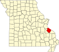
Map of Missouri highlighting Sainte Genevieve County.svg
Location of Ste. Genevieve County, Missouri
Coordinates: 38°3′25″N90°9′55″W / 38.05694°N 90.16528°W / 38.05694; -90.16528 Coordinates: 38°3′25″N90°9′55″W / 38.05694°N 90.16528°W / 38.05694; -90.16528
Country United States
State Missouri
County Sainte Genevieve
Township Jackson
Elevation
384 [1]  ft (117 m)
Time zone UTC-6 (Central (CST))
  Summer (DST) UTC-5 (CDT)
ZIP code
63670
Area code(s) 573
FIPS code 29-14740 [2]
GNIS feature ID740749

Clement is an unincorporated community in Jackson Township in southeastern Sainte Genevieve County, Missouri, United States. It is situated near the Mississippi River, approximately eight miles northwest of Ste. Genevieve. The community was also referred to as Establishment in the past due to its proximity to Establishment Creek and the adjacent Establishment Island in the Mississippi floodplain. A small stream in Staples Hollow joins Establishment Creek at the site. [3]

Unincorporated area Region of land not governed by own local government

In law, an unincorporated area is a region of land that is not governed by a local municipal corporation; similarly an unincorporated community is a settlement that is not governed by its own local municipal corporation, but rather is administered as part of larger administrative divisions, such as a township, parish, borough, county, city, canton, state, province or country. Occasionally, municipalities dissolve or disincorporate, which may happen if they become fiscally insolvent, and services become the responsibility of a higher administration. Widespread unincorporated communities and areas are a distinguishing feature of the United States and Canada. In most other countries of the world, there are either no unincorporated areas at all, or these are very rare; typically remote, outlying, sparsely populated or uninhabited areas.

Jackson Township, Ste. Genevieve County, Missouri Civil Township in Missouri, United States

Jackson Township is a subdivision of Ste. Genevieve County, Missouri, in the United States of America, and is one of the five townships located in Ste. Genevieve County.

Ste. Genevieve County, Missouri Eastern Missouri, United States

Sainte Genevieve County, often abbreviated Ste. Genevieve County, is a county located in the eastern portion of the U.S. state of Missouri. As of the 2010 census, the population was 18,145. The largest city and county seat is Ste. Genevieve. The county was officially organized on October 1, 1812, and is named after the Spanish district once located in the region, after Saint Genevieve, patroness of Paris, France. It includes the earliest settlement west of the Mississippi River outside New Spain, part of the French colonial mid-Mississippi valley villages. It is one of the last places where the Paw Paw French is still spoken.

The current name is derived from the people who had a fishing club at the site. [4] A post office called Clement was established in 1909, and remained in operation until 1911. [5]
Related Research Articles

Ste. Genevieve, Missouri City in Missouri, United States

Ste. Genevieve is a city in Ste. Genevieve Township and is the county seat of Ste. Genevieve County, Missouri, United States. The population was 4,410 at the 2010 census. Founded in 1735 by French Canadian colonists and settlers from east of the river, it was the first organized European settlement west of the Mississippi River in present-day Missouri.

Ste. Genevieve Historic District United States historic place

Ste. Genevieve Historic District is a historic district encompassing much of the built environment of Ste. Genevieve, Missouri. The city was in the late 18th century the capital of Spanish Louisiana, and, at its original location a few miles south, capital of French Louisiana as well. A large area of the city, including fields along the Mississippi River, is a National Historic Landmark District designated in 1960, for its historically French architecture and land-use patterns, while a smaller area, encompasses the parts of the city historically important between about 1790 and 1950, was named separately to the National Register of Historic Places in 2002.

Bois Brule Bottom

The Bois Brule Bottom is an alluvial floodplain in Bois Brule Township in Perry County, Missouri stretching between Bois Brule Creek to the west and the Mississippi River to the east.

La Saline is an abandoned village located in Beauvais Township in Sainte Genevieve County, Missouri, United States. La Saline was located approximately six miles south of Sainte Genevieve.

Apple Creek (Mississippi River) stream originating in Missouri

Apple Creek is a stream that rises in western Perry County, Missouri and empties into the Mississippi River, forming the boundary between Perry and Cape Girardeau counties.

Saline Creek (Mississippi River) river in the United States of America

Saline Creek is a creek that rises in western Ste. Genevieve County and flows east briefly passing through a portion of northern Perry County before emptying into an offshoot of the Mississippi River north of St. Mary across from Kaskaskia Island.

River aux Vases (Mississippi River) river in the United States of America

River aux Vases is a creek that rises in Union Township in western Ste. Genevieve County, Missouri and flows into the Mississippi River about two miles north of St. Marys, Missouri.

Saline Township, Ste. Genevieve County, Missouri Civil Township in Missouri, United States

Saline Township is a subdivision of Ste. Genevieve County, Missouri, in the United States of America, and is one of the five townships located in Ste. Genevieve County.

Ste. Genevieve Township, Ste. Genevieve County, Missouri Civil Township in Missouri, United States

Ste. Genevieve Township is a subdivision of Ste. Genevieve County, Missouri, in the United States of America, and is one of the five townships located in Ste. Genevieve County.

Brickeys, Missouri unincorporated community

Brickey's or Brickeys is an unincorporated community located in Jackson Township in Sainte Genevieve County, Missouri, United States. The town lies 11 miles to the northwest of Ste. Genevieve on the Mississippi River.

Ste. Genevieve Catholic Church is a Roman Catholic church located in Ste. Genevieve, Missouri, the first organized European settlement west of the Mississippi River in the United States of America.

Mosher, Missouri unincorporated community in Missouri, United States

Mosher is an unincorporated community in Ste. Genevieve Township in eastern Sainte Genevieve County, Missouri, United States. It is situated approximately two miles west of Ste. Genevieve. The community most likely was named after a local French colonial family Mosier or Mosieur. English spelling of the French pronunciation may account for the spelling of the community's name. The community developed as a stop along the Missouri-Illinois Railroad.

Thomure, Missouri unincorporated community in Missouri, United States

Thomure is an unincorporated community in Ste. Genevieve Township in eastern Sainte Genevieve County, Missouri, United States. It is situated approximately two miles north of Ste. Genevieve. Thomure was established as a railroad siding for river boats and ferries at Little Rock Landing on the Mississippi River. It was named for F. J. Thomure, superintendent of the Mississippi River and Bonne Terre Railroad.

Establishment Creek is a stream in Ste. Genevieve County in the U.S. state of Missouri. It is a tributary of the Mississippi River.

Hickory Creek is a stream in Ste. Genevieve County in the U.S. state of Missouri. It is a tributary of Establishment Creek.

Mill is an unincorporated community in Ste. Genevieve County, in the U.S. state of Missouri.

Pickel is an unincorporated community in Ste. Genevieve County, in the U.S. state of Missouri.

Quarry Town is an unincorporated community in Ste. Genevieve County, in the U.S. state of Missouri.

Staples Hollow is a valley in Ste. Genevieve County in the U.S. state of Missouri. The upper reaches of the valley lie just east of U.S. Route 61 north of Bloomsdale at 38°02′29″N90°12′44″W and the valley stream flows northeast to enter the Mississippi River floodplain at Clement where it joins Establishment Creek at 38°03′28″N90°09′59″W.

References

  1. U.S. Geological Survey Geographic Names Information System: Clement, Missouri
  2. "Roadsidethoughts.com" . Retrieved October 1, 2016.
  3. Bloomsdale, MO.-IL. 7.5 Minute Topographic Quadrangle, USGS, 1970
  4. "State Historical Society of Missouri – Ste. Genevieve Place Names, 1928-1945". Archived from the original on June 24, 2016. Retrieved October 1, 2016.
  5. "Post Offices". Jim Forte Postal History. Retrieved 22 December 2016.