Peaceful Village, Missouri

Last updated

Peaceful Village, Missouri
Village
USA Missouri location map.svg
Red pog.svg
Peaceful Village, Missouri
Coordinates: 38°28′01″N90°32′34″W / 38.46694°N 90.54278°W / 38.46694; -90.54278
CountryUnited States
State Missouri
County Jefferson
IncorporatedSeptember 9, 2008 [1]
Area
[2]
  Total0.20 sq mi (0.51 km2)
  Land0.20 sq mi (0.51 km2)
  Water0.00 sq mi (0.00 km2)
Elevation
[3]
860 ft (260 m)
Population
 (2020)
  Total95
  Density484.69/sq mi (187.09/km2)
Time zone UTC-6 (Central (CST))
  Summer (DST) UTC-5 (CDT)
ZIP code
63049
Area code 636
FIPS code 29-56620 [4]
GNIS feature ID2585133 [3]

Peaceful Village (also known as Peaceful) is a village in Jefferson County, Missouri, United States. [3] As of the 2010 census, Peaceful Village had a population of nine. [5]

Contents

Geography

According to the United States Census Bureau, the village has a total area of 0.17 square miles (0.44 km2), all land. [4]

Demographics

Historical population
CensusPop.Note
2010 9
2020 95955.6%
U.S. Decennial Census [6]

2010 census

As of the census [7] of 2010, there were 9 people, 4 households, and 3 families residing in the village. The population density was 52.9 inhabitants per square mile (20.4/km2). There were 4 housing units at an average density of 23.5 per square mile (9.1/km2). The racial makeup of the village was 100.0% White.

There were 4 households, of which 25.0% were married couples living together, 50.0% had a female householder with no husband present, and 25.0% were non-families. 25.0% of all households were made up of individuals, and 25% had someone living alone who was 65 years of age or older. The average household size was 2.25 and the average family size was 2.33.

The median age in the village was 44.5 years. 0.0% of residents were under the age of 18; 22.2% were between the ages of 18 and 24; 33.3% were from 25 to 44; 11.1% were from 45 to 64; and 33.3% were 65 years of age or older. The gender makeup of the village was 33.3% male and 66.7% female.

Related Research Articles

<span class="mw-page-title-main">Vandiver, Missouri</span> Village in Missouri, United States

Vandiver is a village in Audrain County, Missouri, United States. As of the 2010 census, the village population was 77.

<span class="mw-page-title-main">McBaine, Missouri</span> Town in Missouri, United States

McBaine is a village in Boone County, Missouri, United States. It is part of the Columbia, Missouri Metropolitan Statistical Area. The population was 10 at the 2010 census. McBaine is located just north of Eagle Bluffs Conservation Area and within sight of The Big Tree.

<span class="mw-page-title-main">St. Cloud, Missouri</span> Village in Missouri, United States

St. Cloud is a village in northeast Crawford County, Missouri, United States. The population was 41 at the 2010 census.

<span class="mw-page-title-main">Hartwell, Missouri</span> Census-designated place in Missouri, US

Hartwell is a former village and census-designated place in Henry County, Missouri, United States. The population was 16 at the 2010 census.

<span class="mw-page-title-main">River Bend, Missouri</span> Village in Missouri, United States

River Bend is a village in Jackson County, Missouri, United States. The population was 3 at the 2020 census. It is the only part of Jackson County that lies north of the Missouri River. In 1951, the Missouri River was relocated to a new channel, creating River Bend,. The county line still follows the original riverbed. It is part of the Kansas City metropolitan area. The mayor is Alex Dockler.

<span class="mw-page-title-main">Aullville, Missouri</span> Village in Missouri, United States

Aullville is a village in Lafayette County, Missouri, and is part of the Kansas City metropolitan area within the United States. The population was 100 at the 2010 census.

<span class="mw-page-title-main">Stoutsville, Missouri</span> Village in Missouri, United States

Stoutsville is a village in Monroe County, Missouri, United States. The population was 37 at the 2020 census.

<span class="mw-page-title-main">Gravois Mills, Missouri</span> Town in Missouri, United States

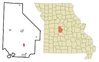
Gravois Mills is a town in Morgan County, Missouri, United States. The population was 144 at the 2010 census.

<span class="mw-page-title-main">Bakersfield, Missouri</span> Village in Missouri, United States

Bakersfield is a village in southeastern Ozark County in the Ozarks of southern Missouri, United States. The population was 186 at the 2020 census.

<span class="mw-page-title-main">Flemington, Missouri</span> Village in Missouri, United States

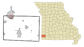
Flemington is a village in Polk County, Missouri, United States. The population was 148 at the 2010 census. It is part of the Springfield, Missouri Metropolitan Statistical Area.

<span class="mw-page-title-main">Bellerive Acres, Missouri</span> City in Missouri, United States

Bellerive Acres is a northern suburban city in St. Louis County, Missouri, United States. The population was 188 at the 2010 census. In April, 2015, the residents voted to change the village of Bellerive to a fourth class city named Bellerive Acres.

<span class="mw-page-title-main">Country Life Acres, Missouri</span> Village in Missouri, United States

Country Life Acres is a village in St. Louis County, Missouri, United States. The population was 74 at the 2010 census.

<span class="mw-page-title-main">Twin Oaks, Missouri</span> City in Missouri, United States

Twin Oaks is a 4th class city in St. Louis County, Missouri, United States. The former Village of Twin Oaks changed its status to that of a city by public election in November 2016. The population was 392 at the 2010 census.

<span class="mw-page-title-main">Baker, Missouri</span> Village in Missouri, United States

Baker is an inactive incorporated village in Stoddard County, Missouri, United States. Per the 2020 census, the population was 3. As of 2017, it is Missouri's smallest incorporated settlement.

<span class="mw-page-title-main">Penermon, Missouri</span> Village in Missouri, United States

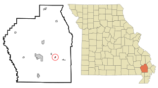
Penermon is a village in Stoddard County, Missouri, United States. The population was 64 at the 2010 census.

<span class="mw-page-title-main">Deerfield, Missouri</span> Village in Missouri, United States

Deerfield is a village in Vernon County, Missouri, United States. The population was 40 at the 2020 census.

<span class="mw-page-title-main">Harwood, Missouri</span> Village in Missouri, United States

Harwood is a village in northeast Vernon County, Missouri, United States. The population was 47 at the 2010 census. It was estimated to be 45 by the City of Harwood as of July 1, 2019.

<span class="mw-page-title-main">Dennis Acres, Missouri</span> Village in Missouri, United States

Dennis Acres is a village in Newton County, Missouri, United States. The population was 76 at the 2010 census.

<span class="mw-page-title-main">Champ, Missouri</span> Village in Missouri, United States

Champ is a village in St. Louis County, Missouri, United States. The population was 10 at the 2020 census.

Three Creeks is a village in Warren County, Missouri, United States. Three Creeks was incorporated on November 4, 2008 and had an estimated population of 4 in 2009. As of the 2010 census, its population had risen to 6.

References

  1. "2010 Entity Changers" (TXT). 2.census.gov. Retrieved July 25, 2018.
  2. "ArcGIS REST Services Directory". United States Census Bureau. Retrieved August 28, 2022.
  3. 1 2 3 U.S. Geological Survey Geographic Names Information System: Peaceful Village, Missouri
  4. 1 2 "US Gazetteer files 2010". United States Census Bureau. Archived from the original on January 25, 2012. Retrieved July 8, 2012.
  5. "U.S. Census website". U.S. Census Bureau . Retrieved March 4, 2011.
  6. "Census of Population and Housing". Census.gov. Retrieved June 4, 2015.
  7. "U.S. Census website". United States Census Bureau . Retrieved July 8, 2012.