Related Research Articles

Jefferson County is located in the eastern portion of the state of Missouri. It is a part of the St. Louis Metropolitan Area. As of the 2020 census, the population was 226,739, making it the sixth-most populous county in Missouri. Its county seat is Hillsboro. The county was organized in 1818 and named in honor of former president Thomas Jefferson.
Goldman is an unincorporated community in Jefferson County, Missouri, United States, approximately 25 miles south of St. Louis, and five miles north of the county courthouse at Hillsboro. Goldman is located on Old Lemay Ferry Road, an old trade route connecting Hillsboro and St. Louis.
Fletcher is an unincorporated community in western Jefferson County, Missouri, United States.

Grubville is an unincorporated community in western Jefferson County, Missouri, United States. It is located approximately one-half mile east of the Jefferson/Franklin County line. Missouri routes WW and Y meet at the community and Route 30 passes approximately one mile to the north. Nearby communities include Dittmer and Morse Mill to the east and Lonedell and Luebbering to the west in Franklin County. Jones Creek flows from the east side of the community to its confluence with Big River approximately five miles to the east.

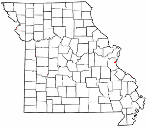
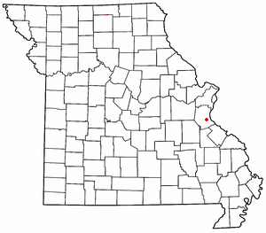
Hematite is an unincorporated community in eastern Jefferson County, Missouri, United States. It is located on Missouri Route P approximately seven miles northeast of De Soto.

House Springs is an unincorporated community in Jefferson County, Missouri, United States. It is located just off Route 30, at the intersection with Routes MM and W near Byrnes Mill.
Sulphur Springs is an unincorporated community in eastern Jefferson County, Missouri, United States. It is located near Barnhart, bordering the banks of Glaize Creek and the Mississippi River.

Morse Mill is an unincorporated community in western Jefferson County, Missouri, United States. It is located approximately five miles northwest of Hillsboro along Missouri Route B. The community and mill were located along Big River.

Valles Mines is an unincorporated community in southern Jefferson County, Missouri, United States. It is located approximately seven miles south of De Soto. It is located on Missouri Route V less than one mile west of U.S. Route 67. Joachim Creek flows past the north side of the community. The ZIP Code for Valles Mines is 63087.
Antonia is an unincorporated community in Jefferson County, in the U.S. state of Missouri.
Danby is an unincorporated community in southeast Jefferson County, in the U.S. state of Missouri.
Flucom is an unincorporated community in southern Jefferson County, in the U.S. state of Missouri. The community is located on Plattin Creek approximately eight miles south of Festus. US Route 67 passes about two miles to the west.
Jarvis is an unincorporated community in Jefferson County, in the U.S. state of Missouri. Jarvis is located approximately 1.5 miles northwest of Mapaville and 2.5 miles southeast of Goldman.
Melzo is an unincorporated community in southern Jefferson County, in the U.S. state of Missouri. The community is located on Missouri Route E just north of the Jefferson-St. Francois county line. DeSoto is eight miles to the north and Bone Terre is approximately six miles to the south.
Oermann is an unincorporated community in western Jefferson County, in the U.S. state of Missouri. The community is located on Missouri Route 30 approximately two miles northeast of Grubville and two miles southwest of Dittmer.
Plattin is an unincorporated community in southeast Jefferson County, in the U.S. state of Missouri.
Riverside is an unincorporated community in Jefferson County, in the U.S. state of Missouri.
Seckman is an unincorporated community in Jefferson County, in the U.S. state of Missouri.
Selma is an unincorporated community in southeastern Jefferson County, in the U.S. state of Missouri. The community is located on the west side of US Route 61 approximately six miles southeast of Festus. The Mississippi River floodplain lies two miles to the east.
Vineland is an unincorporated community in Jefferson County, in the U.S. state of Missouri.
References
- ↑ "Dittmer, Missouri". Geographic Names Information System . United States Geological Survey, United States Department of the Interior.
- ↑ Missouri Atlas & Gazetteer, DeLorme, 1st ed., 1998, p.48 ISBN 0899332242
- ↑ "Jefferson County Place Names, 1928–1945 (archived)". The State Historical Society of Missouri. Archived from the original on 24 June 2016. Retrieved 19 October 2016.
{{cite web}}: CS1 maint: bot: original URL status unknown (link) - ↑ Eaton, David Wolfe (1916). How Missouri Counties, Towns and Streams Were Named. The State Historical Society of Missouri. pp. 180.
- ↑ "Post Offices". Jim Forte Postal History. Archived from the original on 19 October 2016. Retrieved 19 October 2016.
- ↑ For years he's lived with neighbors who are abusive priests; by Lilly Fowler, 12 January 2015 St Louis Post-Dispatch
Municipalities and communities of Jefferson County, Missouri, United States | ||
|---|---|---|
| Cities |  | |
| Villages | ||
| Townships | ||
| CDPs | ||
| Other communities |
| |
Coordinates: 38°20′08″N90°41′17″W / 38.33556°N 90.68806°W
| | This Jefferson County, Missouri state location article is a stub. You can help Wikipedia by expanding it. |