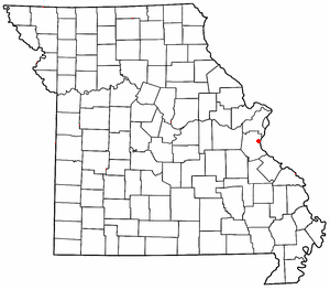
Sulphur Springs is an unincorporated community in eastern Jefferson County, Missouri, United States. [1] It is located near Barnhart, bordering the banks of Glaize Creek and the Mississippi River.
Sulphur Springs was platted in 1860, and named for a sulphur spring near the original town site. [2] A post office was established at Sulphur Springs in 1837, and remained in operation until 1990. [3]
On August 5, 1922, at Sulphur Springs, two trains collided on the Iron Mountain Railroad tracks, resulting in 34 people killed and 150 injured in the largest train accident in Missouri history. [4]
Barnhart is a census-designated place (CDP) in Jefferson County, Missouri, United States, and is a suburb of St. Louis. The population was 5,832, at the 2020 United States Census.
Goldman is an unincorporated community in Jefferson County, Missouri, United States, approximately 25 miles south of St. Louis, and five miles north of the county courthouse at Hillsboro. Goldman is located on Old Lemay Ferry Road, an old trade route connecting Hillsboro and St. Louis.
Dittmer is an unincorporated community in western Jefferson County, Missouri, United States. It is located about 14 miles northwest of Hillsboro on Route 30.
Fletcher is an unincorporated community in western Jefferson County, Missouri, United States.
Grubville is an unincorporated community in western Jefferson County, Missouri, United States. It is located approximately one-half mile east of the Jefferson/Franklin County line. Missouri routes WW and Y meet at the community and Route 30 passes approximately one mile to the north. Nearby communities include Dittmer and Morse Mill to the east and Lonedell and Luebbering to the west in Franklin County. Jones Creek flows from the east side of the community to its confluence with Big River approximately five miles to the east.
House Springs is an unincorporated community in Jefferson County, Missouri, in the greater St. Louis area, in the United States. It is located just off Route 30, at the intersection with Routes MM and W near Byrnes Mill.
Morse Mill is an unincorporated community in western Jefferson County, Missouri, United States. It is located approximately five miles northwest of Hillsboro along Missouri Route B. The community and mill were located along Big River.
Bushburg is an unincorporated community in Jefferson County, in the U.S. state of Missouri.
Danby is an unincorporated community in southeast Jefferson County, in the U.S. state of Missouri.
Frumet is an unincorporated community in Jefferson County, in the U.S. state of Missouri.
Knorpp is an unincorporated community in Jefferson County, in the U.S. state of Missouri.
Local is an unincorporated community in Jefferson County, in the U.S. state of Missouri.
Melzo is an unincorporated community in southern Jefferson County, in the U.S. state of Missouri. The community is located on Missouri Route E just north of the Jefferson-St. Francois county line. DeSoto is eight miles to the north and Bone Terre is approximately six miles to the south.
Oermann is an unincorporated community in western Jefferson County, in the U.S. state of Missouri. The community is located on Missouri Route 30 approximately two miles northeast of Grubville and two miles southwest of Dittmer.
Regina is an unincorporated community in Jefferson County, in the U.S. state of Missouri.
Riverside is an unincorporated community in Jefferson County, in the U.S. state of Missouri.
Selma is an unincorporated community in southeastern Jefferson County, in the U.S. state of Missouri. The community is located on the west side of US Route 61 approximately six miles southeast of Festus. The Mississippi River floodplain lies two miles to the east.
Victoria is an unincorporated community in Jefferson County, in the U.S. state of Missouri.
Vineland is an unincorporated community in Jefferson County, in the U.S. state of Missouri.
Ware is an unincorporated community in Jefferson County, in the U.S. state of Missouri.
{{cite web}}
: CS1 maint: bot: original URL status unknown (link)Coordinates: 38°20′10″N90°22′26″W / 38.33611°N 90.37389°W