Related Research Articles
Mineola is an unincorporated community in western Montgomery County, Missouri, United States. The community is located on Missouri Supplemental Route J and is about one mile south from Interstate 70. Montgomery City is approximately six miles north of the community. It is on the east bank of the Loutre River. Graham Cave within Graham Cave State Park is on the north side of I-70 just north of the community and Mount Horeb Baptist Church is approximately 4.5 miles to the southwest.
Mingo Creek is a stream in Bates County in the U.S. state of Missouri. It is a tributary of the South Grand River.
Indian Creek is a stream in Cape Girardeau County in the U.S. state of Missouri. It is a tributary of the Mississippi River.
Prairie Creek is a stream in Crawford County in the U.S. state of Missouri. It is a tributary of Brush Creek.
Spring Creek is a stream in southeastern Franklin County in the U.S. state of Missouri. It is a tributary of Bourbeuse River.
Butcher Creek is a stream in southern Lincoln County in the U.S. state of Missouri. It is a tributary to Crooked Creek.
Tavern Creek is a stream in Miller and Pulaski counties in the U.S. state of Missouri. It is a tributary of the Osage River. The stream headwaters are at 37°54′42″N92°22′19″W and the confluence with the Osage is at 38°19′04″N92°17′24″W.
Willow Fork is a stream in Moniteau County in the U.S. state of Missouri. It is a tributary of North Moreau Creek.
Coon Creek is a stream in Audrain and Montgomery counties in the U.S. state of Missouri. It is a tributary of the West Fork Cuivre River.
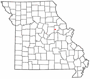
Quick Creek is a stream in southwest Montgomery County in the U.S. state of Missouri. It is a tributary of the Missouri River.
Mill Creek is a stream in Morgan County in the U.S. state of Missouri. It is a tributary to the Gravois Creek arm of the Lake of the Ozarks.
Smelser Creek is a stream in Pettis County in the U.S. state of Missouri. It is a tributary of Muddy Creek.
Guinns Creek is a stream in southeastern Pike County of eastern Missouri. It is a tributary of Bryants Creek.
Bonne Femme Creek is a stream in Howard and Randolph counties in the U.S. state of Missouri. It is a tributary of the Missouri River.
Jonca Creek is a stream in Ste. Genevieve County in the U.S. state of Missouri. It is a tributary to the River aux Vases.

Peers is an unincorporated community in southern Warren County, in the U.S. state of Missouri. The community is on the north edge of the Missouri River floodplain and Treloar is four miles to the west on Missouri Route 94.
Dowling Creek is a stream in Jefferson County in the U.S. state of Missouri. It is a tributary to Heads Creek.
Duncan Creek is a stream in southern Maries, northwestern Phelps and northeastern Pulaski counties in the Ozarks of the U.S. state of Missouri. It is a tributary of the Gasconade River.
Gravois Creek is a stream in south central Morgan County, Missouri. It is a tributary of the Osage River within the Lake of the Ozarks.
Crooked Creek is a stream in Bollinger and Cape Girardeau counties of southeast Missouri. It is a tributary to the Headwater Diversion Channel.
References
- ↑ U.S. Geological Survey Geographic Names Information System: Rush Tower, Missouri
- ↑ Selma, MO, 7.5 Minute Topographic Quadrangle, USGS, 1964 (1982 rev.)
- ↑ Missouri Atlas & Gazetteer, DeLorme 1st ed. 1998, p. 49 ISBN 0899332242
- 1 2 "Ramsay Place Names File | The State Historical Society of Missouri". collections.shsmo.org.
- ↑ Chrystal City, MO, 15 Minute Topographic Quadrangle, USGS, 1915 (1950 rev.)
Municipalities and communities of Jefferson County, Missouri, United States | ||
|---|---|---|
| Cities |  | |
| Villages | ||
| Townships | ||
| CDPs | ||
| Other communities |
| |
38°08′53″N90°17′31″W / 38.14806°N 90.29194°W
| | This Jefferson County, Missouri state location article is a stub. You can help Wikipedia by expanding it. |