Bertrand, Missouri

Last updated

Bertrand, Missouri
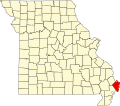
Mississippi County Missouri Incorporated and Unincorporated areas Bertrand Highlighted.svg
Location in Mississippi County and the state of Missouri
Map of USA MO.svg
Location of Missouri in the United States
Coordinates: 36°54′30″N89°27′00″W / 36.90833°N 89.45000°W / 36.90833; -89.45000
Country United States
State Missouri
County Mississippi
Area
[1]
  Total0.82 sq mi (2.14 km2)
  Land0.82 sq mi (2.13 km2)
  Water0.00 sq mi (0.00 km2)
Elevation
[2]
318 ft (97 m)
Population
 (2020) [3]
  Total718
  Density871.36/sq mi (336.52/km2)
Time zone UTC-6 (Central (CST))
  Summer (DST) UTC-5 (CDT)
ZIP code
63823
Area code 573
FIPS code 29-04996 [4]
GNIS feature ID2394153 [2]

Bertrand is a city in Mississippi County, Missouri, United States. The population was 718 at the 2020 census, [5] down from 821 in 2010.

Contents

History

Bertrand was platted in 1859. [6] The community bears the name of one Mr. Bertrand, a railroad promoter. [7] A post office called Bertrand has been in operation since 1874. [8]

Geography

Bertrand is in northwestern Mississippi County, 6 miles (10 km) west of Charleston, the county seat, and 8 miles (13 km) east-northeast of Sikeston. U.S. Route 62 passes through the center of Bertrand as Cedar Street. Interstate 57 passes just south of the city limits, with access from Exit 4 (State Highway B). I-57 leads southwest 4 miles (6 km) to its southern terminus at Interstate 55 near Sikeston and northeast 17 miles (27 km) to its crossing of the Mississippi River near Cairo, Illinois.

According to the U.S. Census Bureau, Bertrand has a total area of 0.82 square miles (2.12 km2), of which 0.001 square miles (0.003 km2), or 0.12%, are water. [1]

Demographics

Bertrand watertower Bertrand MO Watertower.jpg
Bertrand watertower
Historical population
CensusPop.Note
1880 126
1890 22175.4%
1900 26620.4%
1910 34630.1%
1920 3552.6%
1930 322−9.3%
1940 37717.1%
1950 3903.4%
1960 46519.2%
1970 60429.9%
1980 68813.9%
1990 6920.6%
2000 7406.9%
2010 82110.9%
2020 718−12.5%
source: [9]

2010 census

As of the census [10] of 2010, there were 821 people, 341 households, and 232 families living in the city. The population density was 1,052.6 inhabitants per square mile (406.4/km2). There were 355 housing units at an average density of 455.1 per square mile (175.7/km2). The racial makeup of the city was 97.32% White, 1.83% Black or African American, 0.12% Native American, 0.12% Asian, 0.12% from other races, and 0.49% from two or more races. Hispanic or Latino of any race were 1.95% of the population.

There were 341 households, of which 33.4% had children under the age of 18 living with them, 45.2% were married couples living together, 18.8% had a female householder with no husband present, 4.1% had a male householder with no wife present, and 32.0% were non-families. 27.3% of all households were made up of individuals, and 12.6% had someone living alone who was 65 years of age or older. The average household size was 2.30 and the average family size was 2.74.

The median age in the city was 46.1 years. 23% of residents were under the age of 18; 5.9% were between the ages of 18 and 24; 19.8% were from 25 to 44; 28.4% were from 45 to 64; and 22.9% were 65 years of age or older. The gender makeup of the city was 45.2% male and 54.8% female.

2000 census

As of the census [4] of 2000, there were 740 people, 316 households, and 207 families living in the city. The population density was 1,115.2 inhabitants per square mile (430.6/km2). There were 351 housing units at an average density of 528.9 per square mile (204.2/km2). The racial makeup of the city was 95.81% White, 2.84% African American, 0.41% Native American, and 0.95% from two or more races. Hispanic or Latino of any race were 0.41% of the population.

There were 316 households, out of which 21.5% had children under the age of 18 residing with them, 52.2% were married couples living together, 13.0% had a female householder with no husband present, and 34.2% were non-families. 29.7% of all households were made up of individuals, and 13.0% had someone living alone who was 65 years of age or older. The average household size was 2.17 and the average family size was 2.66.

In the city the population was spread out, with 17.0% under the age of 18, 7.6% from 18 to 24, 24.6% from 25 to 44, 27.6% from 45 to 64, and 23.2% who were 65 years of age or older. The median age was 46 years. For every 100 females there were 84.5 males. For every 100 females age 18 and over, there were 80.6 males.

The median income for a household in the city was $26,023, and the median income for a family was $32,833. Males had a median income of $24,643 versus $21,042 for females. The per capita income for the city was $15,346. About 14.6% of families and 15.4% of the population were below the poverty line, including 17.4% of those under age 18 and 11.7% of those age 65 or over.

Related Research Articles

<span class="mw-page-title-main">Thebes, Illinois</span> Village in Illinois, United States

Thebes is a village in and the former county seat of Alexander County, Illinois, United States. The population was 208 at the 2020 census, down from 436 at the 2010 census. It is part of the Cape Girardeau–Jackson, MO-IL Metropolitan Statistical Area. In 1860 the county seat was moved to Cairo, Illinois, at the confluence of the Ohio and Mississippi rivers.

<span class="mw-page-title-main">Alexandria, Missouri</span> City in Missouri, United States

Alexandria is a city in eastern Clark County, Missouri, United States. As of the 2020 census, its population was 105.

<span class="mw-page-title-main">Anniston, Missouri</span> City in Missouri, United States

Anniston is a city in Mississippi County, Missouri, United States. The population was 180 at the 2020 census, down from 232 in 2010.

<span class="mw-page-title-main">Charleston, Missouri</span> City in Missouri, United States

Charleston is a city in Mississippi County, Missouri, United States. The population was 5,056 at the 2020 census, down from 5,947 in 2010. It is the county seat of Mississippi County and is home to the Southeast Correctional Center.

<span class="mw-page-title-main">Wyatt, Missouri</span> City in Missouri, United States

Wyatt is a city in Mississippi County, Missouri, United States. The population was 219 at the 2020 census. It is the easternmost city west of the Mississippi River.

<span class="mw-page-title-main">Canalou, Missouri</span> City in Missouri, United States

Canalou is a city in New Madrid County, Missouri, United States. The population was 338 at the 2010 census. The ZIP code is 63828.

<span class="mw-page-title-main">Matthews, Missouri</span> City in Missouri, United States

Matthews is a city in New Madrid County, Missouri, United States. The population was 628 at the 2010 census.

<span class="mw-page-title-main">Morehouse, Missouri</span> City in Missouri, United States

Morehouse is a city in New Madrid County, Missouri, United States. The population was 973 at the 2010 census.

<span class="mw-page-title-main">Hayti, Missouri</span> City in Missouri, United States

Hayti is a city in eastern Pemiscot County, Missouri, United States. The population was 2,493 at the 2020 census.

<span class="mw-page-title-main">Clarksville, Missouri</span> City in Missouri, United States

Clarksville is a city in Calumet Township, Pike County, Missouri, United States. The population was 442 at the 2010 census.

<span class="mw-page-title-main">Commerce, Missouri</span> Village in Missouri, United States

Commerce is a Mississippi River village in Scott County, Missouri, United States. The population was 67 at the time of the 2010 census.

<span class="mw-page-title-main">Diehlstadt, Missouri</span> Village in Missouri, United States

Diehlstadt is a village in Scott County, Missouri, United States. The population was 161 at the 2010 census. Diehlstadt was founded by John Kirkpatrick.

<span class="mw-page-title-main">West Alton, Missouri</span> City in Missouri, United States

West Alton is a city in St. Charles County, Missouri, United States. The population was 359 at the 2020 census. It is located at the tip of the peninsula formed by the confluence of the Missouri and Mississippi Rivers and is directly across Alton, Illinois.

<span class="mw-page-title-main">Baker, Missouri</span> Village in Missouri, United States

Baker is an inactive incorporated village in Stoddard County, Missouri, United States. Per the 2020 census, the population was 3. As of 2017, it is Missouri's smallest incorporated settlement.

<span class="mw-page-title-main">Bell City, Missouri</span> City in Missouri, United States

Bell City is a city in northeastern Stoddard County, Missouri, United States. It was founded as a sawmill town circa 1900, and lies at the foothills of Crowley's Ridge on Missouri Route 91. The population was 448 at the 2010 census. Dorothy Burton is the current mayor.

<span class="mw-page-title-main">Dexter, Missouri</span> City in Missouri, United States

Dexter is a city in Stoddard County, Missouri, United States, founded in 1873. The population was 7,864 at the 2010 census.

<span class="mw-page-title-main">Essex, Missouri</span> City in Missouri, United States

Essex is a city in Stoddard County, Missouri, United States. The population was 472 at the 2010 census.

<span class="mw-page-title-main">Pinhook, Missouri</span> Inactive Village in Missouri, United States

Pinhook is an inactive village in Mississippi County, Missouri, United States. The population was 6 at the 2020 census.

<span class="mw-page-title-main">Scott City, Missouri</span> City in Missouri, United States

Scott City is a city in Cape Girardeau and Scott counties in the U.S. state of Missouri. The population was 4,346 at the 2020 census. The Scott County portion of Scott City is part of the Sikeston Micropolitan Statistical Area, while the Cape Girardeau County portion is part of the Cape Girardeau–Jackson, MO-IL Metropolitan Statistical Area.

<span class="mw-page-title-main">Miner, Missouri</span> City in Missouri, United States

Miner is a city in Mississippi and Scott counties in the U.S. state of Missouri. It borders the city of Sikeston to the east. The population was 916 at the 2020 census.

References

  1. 1 2 "2023 U.S. Gazetteer Files: Missouri". United States Census Bureau. Retrieved April 18, 2024.
  2. 1 2 U.S. Geological Survey Geographic Names Information System: Bertrand, Missouri
  3. "P1. Race – Bertrand city, Missouri: 2020 DEC Redistricting Data (PL 94-171)". U.S. Census Bureau. Retrieved April 18, 2024.
  4. 1 2 "U.S. Census website". United States Census Bureau . Retrieved January 31, 2008.
  5. "Explore Census Data". data.census.gov. Retrieved January 14, 2022.
  6. Eaton, David Wolfe (1917). How Missouri Counties, Towns and Streams Were Named. The State Historical Society of Missouri. pp.  208.
  7. "Mississippi County Place Names, 1928–1945". The State Historical Society of Missouri. Archived from the original on June 24, 2016. Retrieved November 6, 2016.
  8. "Post Offices". Jim Forte Postal History. Retrieved November 6, 2016.
  9. "Missouri Population 1900 - 1990" (PDF). Missouri Census Data Center. Archived from the original (CSV) on July 4, 2014. Retrieved October 6, 2014.
  10. "U.S. Census website". United States Census Bureau . Retrieved July 8, 2012.