Dogwood, Mississippi County, Missouri

Last updated

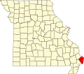
Dogwood is an unincorporated community in Mississippi County, in the U.S. state of Missouri. [1]

Mississippi County, Missouri U.S. county in Missouri

Mississippi County is a county located in the Bootheel of the U.S. state of Missouri, with its eastern border formed by the Mississippi River. As of the 2010 census, the population was 14,358. The largest city and county seat is Charleston. The county was officially organized on February 14, 1845, and was named after the Mississippi River.

U.S. state constituent political entity of the United States

In the United States, a state is a constituent political entity, of which there are currently 50. Bound together in a political union, each state holds governmental jurisdiction over a separate and defined geographic territory and shares its sovereignty with the federal government. Due to this shared sovereignty, Americans are citizens both of the federal republic and of the state in which they reside. State citizenship and residency are flexible, and no government approval is required to move between states, except for persons restricted by certain types of court orders.

Missouri U.S. state in the United States

Missouri is a state in the Midwestern United States. With over six million residents, it is the 18th-most populous state of the Union. The largest urban areas are St. Louis, Kansas City, Springfield and Columbia; the capital is Jefferson City. The state is the 21st-most extensive in area. Missouri is bordered by eight states : Iowa to the north, Illinois, Kentucky and Tennessee to the east, Arkansas to the south and Oklahoma, Kansas and Nebraska to the west. In the South are the Ozarks, a forested highland, providing timber, minerals and recreation. The Missouri River, after which the state is named, flows through the center of the state into the Mississippi River, which makes up Missouri's eastern border.

History

A variant name was "Sands". [1] A post office called Sands was established in 1902, and remained in operation until 1908. [2] Besides the post office, the community contained the Dogwood School. [3] The community derives its present name from a grove of dogwood trees which stood near the schoolhouse. [4]

<i>Cornus</i> genus of plants

Cornus is a genus of about 30–60 species of woody plants in the family Cornaceae, commonly known as dogwoods, which can generally be distinguished by their blossoms, berries, and distinctive bark. Most are deciduous trees or shrubs, but a few species are nearly herbaceous perennial subshrubs, and a few of the woody species are evergreen. Several species have small heads of inconspicuous flowers surrounded by an involucre of large, typically white petal-like bracts, while others have more open clusters of petal-bearing flowers. The various species of dogwood are native throughout much of temperate and boreal Eurasia and North America, with China, Japan, and the southeastern United States being particularly rich in native species.

Related Research Articles

Dorena, Missouri town

Dorena is an unincorporated community in southeastern Mississippi County, Missouri, United States. Route 77 and Route 102 intersect here, approximately thirteen miles southeast of East Prairie. Dorena lends its name to the nearby Dorena-Hickman Ferry, which connects Route 77 with the Kentucky side of the Mississippi River.

Hilliard is an unincorporated community in Butler County, in the U.S. state of Missouri.

Buckeye is an unincorporated community in Mississippi County, in the U.S. state of Missouri.

Catalpa is an unincorporated community in Mississippi County, in the U.S. state of Missouri.

Crosno is an extinct town in Mississippi County, in the U.S. state of Missouri. The GNIS classifies it as a populated place.

Fuget is an extinct town in Mississippi County, in the U.S. state of Missouri. The GNIS classifies it as a populated place.

Greenfield is an extinct town in Mississippi County, in the U.S. state of Missouri. The GNIS classifies it as a populated place.

Hallett is an extinct town in Mississippi County, in the U.S. state of Missouri.

Henson is an unincorporated community in Mississippi County, in the U.S. state of Missouri.

Norfolk is an extinct town in Mississippi County, in the U.S. state of Missouri.

Rushs Ridge is an extinct town in Mississippi County, in the U.S. state of Missouri. The GNIS classifies it as a populated place.

Samos is an unincorporated community in Mississippi County, in the U.S. state of Missouri.

Texas Bend is an unincorporated community in Mississippi County, in the U.S. state of Missouri.

Three States is an extinct town in Mississippi County, in the U.S. state of Missouri. The GNIS classifies it as a populated place.

Whiting is an unincorporated community in Mississippi County, in the U.S. state of Missouri.

Bacon is an unincorporated community in Moniteau County, in the U.S. state of Missouri.

Christopher is an unincorporated community in Newton County, in the U.S. state of Missouri.

Royal Oak is an unincorporated community in Oregon County, in the U.S. state of Missouri. The community is located on U.S. Route 160, approximately five miles northwest of Alton. Dry Creek flows past approximately one half mile east of the location.

Fay is an unincorporated community in southeastern Ozark County, in the Ozarks of south-central Missouri. The Community is located along Missouri Route J about 2.5 miles south of U.S. Route 160. The Fay Cemetery lies just west of Route J and north of the Lick Creek - Sweeten Creek junction.

Concord is an unincorporated community in Pemiscot County, in the U.S. state of Missouri.

References

  1. 1 2 U.S. Geological Survey Geographic Names Information System: Dogwood
  2. "Post Offices". Jim Forte Postal History. Archived from the original on 7 November 2016. Retrieved 6 November 2016.
  3. U.S. Geological Survey Geographic Names Information System: Dogwood School (historical)
  4. "Mississippi County Place Names, 1928–1945". The State Historical Society of Missouri. Archived from the original on June 24, 2016. Retrieved November 6, 2016.
Coordinates: 36°49′31″N89°27′13″W / 36.82528°N 89.45361°W / 36.82528; -89.45361

Geographic coordinate system Coordinate system

A geographic coordinate system is a coordinate system that enables every location on Earth to be specified by a set of numbers, letters or symbols. The coordinates are often chosen such that one of the numbers represents a vertical position and two or three of the numbers represent a horizontal position; alternatively, a geographic position may be expressed in a combined three-dimensional Cartesian vector. A common choice of coordinates is latitude, longitude and elevation. To specify a location on a plane requires a map projection.