Dorena, Missouri

Last updated
DorenaHickman.jpg

Dorena is an unincorporated community in southeastern Mississippi County, Missouri, United States. Route 77 and Route 102 intersect here, about thirteen miles southeast of East Prairie. [1] Dorena lends its name to the nearby Dorena-Hickman Ferry, which connects Route 77 with the Kentucky side of the Mississippi River. [2]

Unincorporated area Region of land not governed by own local government

In law, an unincorporated area is a region of land that is not governed by a local municipal corporation; similarly an unincorporated community is a settlement that is not governed by its own local municipal corporation, but rather is administered as part of larger administrative divisions, such as a township, parish, borough, county, city, canton, state, province or country. Occasionally, municipalities dissolve or disincorporate, which may happen if they become fiscally insolvent, and services become the responsibility of a higher administration. Widespread unincorporated communities and areas are a distinguishing feature of the United States and Canada. In most other countries of the world, there are either no unincorporated areas at all, or these are very rare; typically remote, outlying, sparsely populated or uninhabited areas.

Mississippi County, Missouri County in the United States

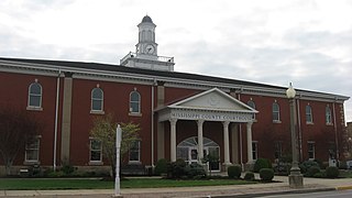
Mississippi County is a county located in the Bootheel of the U.S. state of Missouri, with its eastern border formed by the Mississippi River. As of the 2010 census, the population was 14,358. The largest city and county seat is Charleston. The county was officially organized on February 14, 1845, and was named after the Mississippi River.

Missouri State of the United States of America

Missouri is a state in the Midwestern United States. With over six million residents, it is the 18th-most populous state of the Union. The largest urban areas are St. Louis, Kansas City, Springfield, and Columbia; the capital is Jefferson City. The state is the 21st-most extensive in area. In the South are the Ozarks, a forested highland, providing timber, minerals, and recreation. The Missouri River, after which the state is named, flows through the center of the state into the Mississippi River, which makes up Missouri's eastern border.

A post office called Dorena was established in 1899, and closed in 1973. [3] The name is believed to be derived from an old slang term for money. [4]

Related Research Articles

East Prairie, Missouri City in Missouri, United States

East Prairie is a city in Mississippi County, Missouri, United States. The population was 3,176 at the 2010 census.

Logan, Lawrence County, Missouri unincorporated community in Missouri

Logan is an unincorporated community in eastern Lawrence County, Missouri, United States. It is located off U.S. Route 60, one mile northeast of Marionville. Several homes are located there.

Sand Creek is a stream in Henry County in the U.S. state of Missouri. It is a tributary of Tebo Creek.

Fruitville is an unincorporated community in southeast Howell County, in the U.S. state of Missouri.

Brush Creek is an unincorporated community in southern Laclede County, in the U.S. state of Missouri. The community lies four miles southwest of Lebanon and about one mile north of Caffeyville. I-44 passes about one mile to the southeast.

Belmont is an extinct town in Mississippi County, on the eastern border of the U.S. state of Missouri at the Mississippi River. The GNIS classifies it as a populated place under the name "Belmont Landing".

Buckeye is an unincorporated community in Mississippi County, in the U.S. state of Missouri.

Crosno is an extinct town in Mississippi County, in the U.S. state of Missouri. The GNIS classifies it as a populated place.

Fuget is an extinct town in Mississippi County, in the U.S. state of Missouri. The GNIS classifies it as a populated place.

Greenfield is an extinct town in Mississippi County, in the U.S. state of Missouri. The GNIS classifies it as a populated place.

Henson is an unincorporated community in Mississippi County, in the U.S. state of Missouri.

Norfolk is an extinct town in Mississippi County, in the U.S. state of Missouri.

Samos is an unincorporated community in Mississippi County, in the U.S. state of Missouri.

Texas Bend is an unincorporated community in Mississippi County, in the U.S. state of Missouri.

Three States is an extinct town in Mississippi County, in the U.S. state of Missouri. The GNIS classifies it as a populated place.

Whiting is an unincorporated community in Mississippi County, in the U.S. state of Missouri.

Mississippi Township is an inactive township in Mississippi County, in the U.S. state of Missouri.

Ohio Township is an inactive township in Mississippi County, in the U.S. state of Missouri.

Wolf Island Township is an inactive township in Mississippi County, in the U.S. state of Missouri.

References

  1. U.S. Geological Survey Geographic Names Information System: Dorena, Missouri
  2. Hay, Jerry (1 January 2013). Mississippi River: Historic Sites and Interesting Places. Inland Waterways Books. p. 53. ISBN   978-1-4675-6250-8.
  3. "Post Offices". Jim Forte Postal History. Archived from the original on 7 November 2016. Retrieved 6 November 2016.
  4. "Mississippi County Place Names, 1928–1945". The State Historical Society of Missouri. Archived from the original on June 24, 2016. Retrieved November 6, 2016.

Coordinates: 36°36′58″N89°14′14″W / 36.61611°N 89.23722°W / 36.61611; -89.23722

Geographic coordinate system Coordinate system

A geographic coordinate system is a coordinate system that enables every location on Earth to be specified by a set of numbers, letters or symbols. The coordinates are often chosen such that one of the numbers represents a vertical position and two or three of the numbers represent a horizontal position; alternatively, a geographic position may be expressed in a combined three-dimensional Cartesian vector. A common choice of coordinates is latitude, longitude and elevation. To specify a location on a plane requires a map projection.