St. Paul, Missouri

Last updated

St. Paul, Missouri
St. Charles County Missouri Incorporated and Unincorporated areas St. Paul Highlighted.svg
Location of Saint Paul, Missouri
Coordinates: 38°51′20″N90°44′32″W / 38.85556°N 90.74222°W / 38.85556; -90.74222
Country United States
State Missouri
County St. Charles
Named for St. Paul the Apostle
Area
[1]
  Total7.19 sq mi (18.62 km2)
  Land7.19 sq mi (18.62 km2)
  Water0.00 sq mi (0.00 km2)
Elevation
[2]
522 ft (159 m)
Population
 (2020)
  Total3,005
  Density418.12/sq mi (161.43/km2)
Time zone UTC-6 (Central (CST))
  Summer (DST) UTC-5 (CDT)
ZIP code
63366
Area code 636
FIPS code 29-65108 [3]
GNIS feature ID2396513 [2]
Website http://www.cityofstpaulmissouri.com/

St. Paul is a city in St. Charles County, Missouri, United States. The population was 1,829 at the 2010 census.

Contents

History

A post office called Saint Paul was established in 1875, and remained in operation until 1964. [4] The community takes its name from a local Roman Catholic church of the same name. [5]

Geography

According to the United States Census Bureau, the city has a total area of 6.68 square miles (17.30 km2), all land. [6]

Demographics

Historical population
CensusPop.Note
1880 64
1980 607
1990 1,19296.4%
2000 1,63437.1%
2010 1,82911.9%
2020 3,00564.3%
U.S. Decennial Census [7]

2010 census

As of the census [8] of 2010, there were 1,829 people, 638 households, and 553 families living in the city. The population density was 273.8 inhabitants per square mile (105.7/km2). There were 656 housing units at an average density of 98.2 per square mile (37.9/km2). The racial makeup of the city was 98.7% White, 0.3% African American, 0.2% Native American, 0.1% Asian, 0.3% from other races, and 0.3% from two or more races. Hispanic or Latino of any race were 0.4% of the population.

There were 638 households, of which 34.5% had children under the age of 18 living with them, 81.2% were married couples living together, 3.0% had a female householder with no husband present, 2.5% had a male householder with no wife present, and 13.3% were non-families. 10.8% of all households were made up of individuals, and 5% had someone living alone who was 65 years of age or older. The average household size was 2.87 and the average family size was 3.10.

The median age in the city was 45.6 years. 22.6% of residents were under the age of 18; 9.2% were between the ages of 18 and 24; 16.8% were from 25 to 44; 38.7% were from 45 to 64; and 12.7% were 65 years of age or older. The gender makeup of the city was 51.1% male and 48.9% female.

2000 census

As of the census [3] of 2000, there were 1,634 people, 506 households, and 447 families living in the city. The population density was 243.1 inhabitants per square mile (93.9/km2). There were 517 housing units at an average density of 76.9 per square mile (29.7/km2). The racial makeup of the city was 98.96% White, 0.06% African American, 0.12% Native American, 0.18% from other races, and 0.67% from two or more races. Hispanic or Latino of any race were 1.29% of the population.

There were 506 households, out of which 49.6% had children under the age of 18 living with them, 82.8% were married couples living together, 3.6% had a female householder with no husband present, and 11.5% were non-families. 8.9% of all households were made up of individuals, and 4.9% had someone living alone who was 65 years of age or older. The average household size was 3.23 and the average family size was 3.45.

In the city the population was spread out, with 32.4% under the age of 18, 7.2% from 18 to 24, 28.9% from 25 to 44, 23.6% from 45 to 64, and 7.9% who were 65 years of age or older. The median age was 37 years. For every 100 females there were 101.0 males. For every 100 females age 18 and over, there were 95.7 males.

The median income for a household in the city was $67,841, and the median income for a family was $68,438. Males had a median income of $50,000 versus $27,768 for females. The per capita income for the city was $22,216. About 1.1% of families and 1.3% of the population were below the poverty line, including 0.5% of those under age 18 and 5.3% of those age 65 or over.

Related Research Articles

<span class="mw-page-title-main">St. Paul Park, Minnesota</span> City in Minnesota, United States

St. Paul Park or Saint Paul Park is a city in Washington County, Minnesota, United States. The population was 5,279 at the 2010 census. It is on the east bank of the Mississippi River, five miles (8 km) downstream from St. Paul.

<span class="mw-page-title-main">Bosworth, Missouri</span> City in Missouri, United States

Bosworth is a city in Carroll County, Missouri, United States. The population was 213 at the 2020 U.S. Census.

<span class="mw-page-title-main">Stewartsville, Missouri</span> City in Missouri, United States

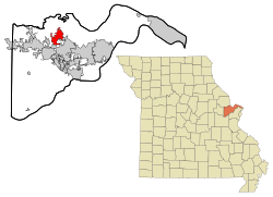
Stewartsville is a city in southwest DeKalb County, Missouri, United States. The population was 733 at the 2020 census. The community is named for Robert M. Stewart, a former Missouri governor. It is part of the St. Joseph, MO–KS Metropolitan Statistical Area.

<span class="mw-page-title-main">Bates City, Missouri</span> City in Missouri, United States

Bates City is a city in western Lafayette County, Missouri, and is part of the Kansas City metropolitan area. The population was 219 at the 2020 census, which is neither a gain nor a loss in population since 2010.

<span class="mw-page-title-main">Corder, Missouri</span> City in Missouri, United States

Corder is a city in Lafayette County, Missouri, and is part of the Kansas City metropolitan area within the United States. The population was 418 at the 2020 census.

<span class="mw-page-title-main">Hawk Point, Missouri</span> City in Missouri, United States

Hawk Point is a city in Lincoln County, Missouri, United States. The population was 669 at the 2010 census.

<span class="mw-page-title-main">Junction City, Missouri</span> Village in Missouri, United States

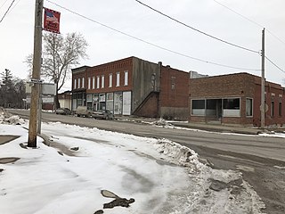
Junction City is a village in Madison County, Missouri, United States. The population was 327 at the 2010 census.

<span class="mw-page-title-main">Laurie, Missouri</span> City in Missouri, United States

Laurie is a city in southern Morgan and northern Camden counties, Missouri, United States. The population was 945 at the 2010 census.

<span class="mw-page-title-main">Granby, Missouri</span> City in Missouri, United States

Granby is a city in Newton County, Missouri, United States. The population was 2,134 at the 2010 census. It is part of the Joplin, Missouri Metropolitan Statistical Area.

<span class="mw-page-title-main">Skidmore, Missouri</span> City in Missouri, United States

Skidmore is a city in western Nodaway County, Missouri, United States. The population was 245 at the 2020 Census. The small farming community is known for the unsolved extrajudicial killing of Ken Rex McElroy, the murders of Wendy Gillenwater and Bobbie Jo Stinnett, and the disappearance of Branson Perry. Skidmore also has a yearly "Punkin' Show."

<span class="mw-page-title-main">Homestown, Missouri</span> City in Missouri, United States

Homestown is a city in Pemiscot County, Missouri, United States. The population was 73 at the 2020 census.

<span class="mw-page-title-main">Ferrelview, Missouri</span> Village in Missouri, United States

Ferrelview is a village in Platte County, Missouri in the United States. It is within the Kansas City metropolitan area. The population was 451 at the 2010 census.

<span class="mw-page-title-main">Malta Bend, Missouri</span> City in Missouri, United States

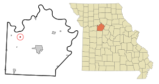
Malta Bend is a city in Saline County, Missouri, United States. The population was 250 at the 2010 census.

<span class="mw-page-title-main">Greendale, Missouri</span> City in Missouri, United States

Greendale is a city in St. Louis County, Missouri, United States. The population was 651 at the 2010 census.

<span class="mw-page-title-main">Norwood Court, Missouri</span> Village in Missouri, United States

Norwood Court is a village in St. Louis County, Missouri, United States. The population was 959 at the 2010 census.

<span class="mw-page-title-main">Westwood, Missouri</span> Village in Missouri, United States

Westwood is a village in west St. Louis County, Missouri, United States. The population was 316 at the 2020 census.

<span class="mw-page-title-main">Harris, Missouri</span> City in Missouri, United States

Harris is a city in Sullivan County, Missouri, United States. The population was 61 at the 2010 census, at which time it was a town.

<span class="mw-page-title-main">Fort Calhoun, Nebraska</span> City in Washington County, Nebraska, United States

Fort Calhoun is a city in Washington County, Nebraska, United States. The population was 1,108 at the 2020 census. The city includes Fort Atkinson, the first fort built west of the Missouri River.

<span class="mw-page-title-main">Moline Acres, Missouri</span> City in Missouri, United States

Moline Acres is a city in St. Louis County, Missouri, United States. The population was 2,442 at the 2010 census.

<span class="mw-page-title-main">Miner, Missouri</span> City in Missouri, United States

Miner is a city in Mississippi and Scott counties in the U.S. state of Missouri. It borders the city of Sikeston to the east. The population was 916 at the 2020 census.

References

  1. "ArcGIS REST Services Directory". United States Census Bureau. Retrieved August 28, 2022.
  2. 1 2 U.S. Geological Survey Geographic Names Information System: St. Paul, Missouri
  3. 1 2 "U.S. Census website". United States Census Bureau . Retrieved January 31, 2008.
  4. "Post Offices". Jim Forte Postal History. Retrieved November 27, 2016.
  5. "St. Charles County Place Names, 1928–1945". The State Historical Society of Missouri. Archived from the original on June 24, 2016. Retrieved November 27, 2016.
  6. "US Gazetteer files 2010". United States Census Bureau. Archived from the original on January 25, 2012. Retrieved July 8, 2012.
  7. "Census of Population and Housing". Census.gov. Retrieved June 4, 2015.
  8. "U.S. Census website". United States Census Bureau . Retrieved July 8, 2012.