Femme Osage, Missouri

Last updated

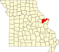
Femme Osage is an unincorporated community in southwest St. Charles County, in the U.S. state of Missouri. [1] The community is on Missouri Route T along the bank of the Femme Osage Creek. [2]

History

A post office Femme Osage was in operation from 1816 until 1933. [3] The community takes its name from nearby Femme Osage Creek. [4]

Related Research Articles

<span class="mw-page-title-main">Osage County, Missouri</span> County in Missouri, United States

Osage County is a county in the central part of the U.S. state of Missouri. As of the 2020 census, the population was 13,274. Its county seat is Linn. The county was organized January 29, 1841, and named from the Osage River.

Frankenstein is an unincorporated community in northwestern Osage County, Missouri, United States. It is located approximately 20 km (12 mi) east of Jefferson City. Frankenstein is located on Missouri Route C, about midway between Luystown to the east and Bonnots Mill to the west. Cedar Creek flows past, about one mile south of the site.

<span class="mw-page-title-main">Loose Creek, Missouri</span>

Loose Creek is an unincorporated community in Osage County, Missouri, United States. It is located north of U.S. Route 50, approximately eight miles east of Missouri's capital of Jefferson City. The ZIP Code for Loose Creek is 65054.

<span class="mw-page-title-main">Harvester, Missouri</span> Unincorporated community in Missouri, US

Harvester is an unincorporated community in St. Charles County, in the U.S. state of Missouri. Much of the community has been annexed by St. Peters.

Tavern Creek is a stream in Miller and Pulaski counties in the U.S. state of Missouri. It is a tributary of the Osage River. The stream headwaters are at 37°54′42″N92°22′19″W and the confluence with the Osage is at 38°19′04″N92°17′24″W.

Capps is an unincorporated community in northern Miller County, in the U.S. state of Missouri.

Riverview is an unincorporated community in southwestern Morgan County, in the U.S. state of Missouri.

Black Walnut is an unincorporated community in St. Charles County, in the U.S. state of Missouri.

Boschertown is an unincorporated community in St. Charles County, in the U.S. state of Missouri.

Callaway Fork is a stream in the U.S. state of Missouri. It is a tributary of Femme Osage Creek.

Cappeln is an unincorporated community in St. Charles County, in the U.S. state of Missouri.

Elm Point is an unincorporated community in St. Charles County, in the U.S. state of Missouri.

Enon is an unincorporated community situated in the northwest region of St. Charles County, in the U.S. state of Missouri.

Howell is an unincorporated community in St. Charles County, in the U.S. state of Missouri. Much of the community has been annexed by St. Peters.

Klondike is an unincorporated community in southern St. Charles County, in the U.S. state of Missouri.

Mechanicsville is an unincorporated community in St. Charles County, in the U.S. state of Missouri.

Pauldingville is an unincorporated community in northwest St. Charles County, in the U.S. state of Missouri. The community is three miles south of Foristell and I-70. Sams Creek flows past approximately one mile to the east.

Peruque is an unincorporated community in St. Charles County, in the U.S. state of Missouri. The community is adjacent to the Mississippi River, approximately five miles north of St. Peters on Missouri Route C. McCann Landing is just to the southeast along the river.

Monegaw Springs is an unincorporated community in St. Clair County, in the U.S. state of Missouri.

Femme Osage Creek is a stream in St. Charles County in the U.S. state of Missouri. It is a tributary of the Missouri River.

References

  1. U.S. Geological Survey Geographic Names Information System: Femme Osage, Missouri
  2. Missouri Atlas & Gazetteer, DeLorme, 1998, First edition, p. 40, ISBN   0-89933-224-2
  3. "Post Offices". Jim Forte Postal History. Retrieved November 27, 2016.
  4. "St. Charles County Place Names, 1928–1945". The State Historical Society of Missouri. Archived from the original on June 24, 2016. Retrieved November 27, 2016.
38°38′12″N90°56′31″W / 38.63667°N 90.94194°W / 38.63667; -90.94194