References
- ↑ U.S. Geological Survey Geographic Names Information System: Machens
- ↑ Rails-to-Trails Conservancy (May 10, 2016). Rail-Trail Hall of Fame: A selection of America's premier rail-trails. Wilderness Press. p. 53. ISBN 978-0-89997-825-3.
- ↑ "Post Offices". Jim Forte Postal History. Retrieved November 27, 2016.
- ↑ "St. Charles County Place Names, 1928–1945". The State Historical Society of Missouri. Archived from the original on June 24, 2016. Retrieved November 27, 2016.
Municipalities and communities of St. Charles County, Missouri, United States | ||
|---|---|---|
| Cities | 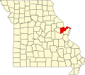 | |
| Villages | ||
| Townships | ||
| CDP | ||
| Other communities | ||
| Ghost towns | ||
| Footnotes | ‡This populated place also has portions in an adjacent county or counties | |
38°54′11″N90°19′56″W / 38.90306°N 90.33222°W
| | This St. Charles County, Missouri state location article is a stub. You can help Wikipedia by expanding it. |