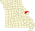
Foristell, Missouri

Last updated

Foristell, Missouri
Forristel, MO.png
Forristel in May 2024
St. Charles County Missouri Incorporated and Unincorporated areas Foristell Highlighted.svg
Location of Foristell, Missouri
Coordinates: 38°48′56″N90°57′46″W / 38.81556°N 90.96278°W / 38.81556; -90.96278 [1]
Country United States
State Missouri
Counties St. Charles, Warren
Named for Pierre Foristell
Government
   Mayor Joseph Goatley
Area
[2]
  Total6.16 sq mi (15.96 km2)
  Land6.06 sq mi (15.70 km2)
  Water0.10 sq mi (0.26 km2)
Elevation
[1]
705 ft (215 m)
Population
 (2020)
  Total550
  Density90.71/sq mi (35.02/km2)
Time zone UTC-6 (Central (CST))
  Summer (DST) UTC-5 (CDT)
ZIP code
63348 [3]
Area code 636
FIPS code 29-25120 [4]
GNIS feature ID2394791 [1]
Website www.cityofforistell.org

Foristell is a city in St. Charles and Warren counties in the U.S. state of Missouri. It is located approximately 43 miles west of St. Louis. The population was 505 at the 2010 census.

Contents

Geography

Foristell is located on I-70 between Wright City to the west and Wentzville to the east. Peruque Creek flows past the south side of the city. [5]

According to the United States Census Bureau, the city has a total area of 5.62 square miles (14.56 km2), of which 5.53 square miles (14.32 km2) is land and 0.09 square miles (0.23 km2) is water. [6]

Demographics

Historical population
CensusPop.Note
1980 119
1990 14421.0%
2000 331129.9%
2010 50552.6%
2020 5508.9%
U.S. Decennial Census [7]

As of 2000 the median income for a household in the city was $52,386, and the median income for a family was $53,750. Males had a median income of $43,750 versus $33,333 for females. The per capita income for the city was $22,331. About 7.1% of families and 8.9% of the population were below the poverty line, including 16.3% of those under age 18 and 4.4% of those age 65 or over.

2010 census

As of the census [8] of 2010, there were 505 people, 192 households, and 151 families residing in the city. The population density was 91.3 inhabitants per square mile (35.3/km2). There were 208 housing units at an average density of 37.6 per square mile (14.5/km2). The racial makeup of the city was 93.3% White, 3.6% African American, 0.2% Native American, 0.2% Asian, 0.8% from other races, and 2.0% from two or more races. Hispanic or Latino of any race were 0.8% of the population.

There were 192 households, of which 31.8% had children under the age of 18 living with them, 69.3% were married couples living together, 5.7% had a female householder with no husband present, 3.6% had a male householder with no wife present, and 21.4% were non-families. 18.2% of all households were made up of individuals, and 4.7% had someone living alone who was 65 years of age or older. The average household size was 2.63 and the average family size was 2.98.

The median age in the city was 44.8 years. 23% of residents were under the age of 18; 6.9% were between the ages of 18 and 24; 20.5% were from 25 to 44; 35.2% were from 45 to 64; and 14.3% were 65 years of age or older. The gender makeup of the city was 51.5% male and 48.5% female.

History

The city now known as Foristell started in 1856 under the name of "Millville". The first homes, as well as a railroad, were constructed in that year. In 1858, Millville built its first post office. [9]

The community saw rapid growth during the Civil War. A mill and a tobacco factory were both established. It was during this time that a man by the name of Pierre Foristell gained respect throughout the community. The town of Millville officially changed its name to Foristell in 1875. [9]

In 1979, Foristell was incorporated into a village. Just nine years later, however, the residents voted to make it a fourth-class city. This transition came about the following year, in 1989.

Recreation

Foristell is home to Indian Camp Creek Park and Towne Park, which are operated by St. Charles County.

Related Research Articles

<span class="mw-page-title-main">Warren County, Missouri</span> County in Missouri, United States

Warren County is a county located in the eastern portion of the U.S. state of Missouri. As of the 2020 census, the population was 35,532. The county is located on the north side of the Missouri River. Its county seat is Warrenton. The county was established on January 5, 1833, and was named for General Joseph Warren, who died in the Battle of Bunker Hill during the American Revolutionary War.

<span class="mw-page-title-main">Millville, California</span> Census-designated place in California, United States

Millville is a census-designated place (CDP) in Shasta County, California, United States. Its population is 724 as of the 2020 census, down from 727 from the 2010 census.

<span class="mw-page-title-main">Millville, Iowa</span> Unincorporated in Iowa, United States

Millville is an unincorporated town and former city in Clayton County, Iowa, United States. The population was 30 at the 2010 census, up from 23 in the 2000 census, before it became unincorporated.

<span class="mw-page-title-main">Blackstone, Massachusetts</span> Town in Massachusetts, United States

Blackstone is a town in Worcester County, Massachusetts, United States. The population was 9,208 at the 2020 census. It is a part of the Providence metropolitan area.

<span class="mw-page-title-main">Millville, Massachusetts</span> Town in Massachusetts, United States

Millville is a town in Worcester County, Massachusetts, United States. The population was 3,174 at the 2020 census. It is part of the Providence metropolitan area.

<span class="mw-page-title-main">Millville, Minnesota</span> City in Minnesota, United States

Millville is a city along the Zumbro River in Wabasha County, Minnesota, United States. The population was 182 at the 2010 census.

<span class="mw-page-title-main">Jamesport, Missouri</span> City in Missouri, United States

Jamesport is a city in eastern Daviess County, Missouri, United States. The population was 559 at the 2020 census.

<span class="mw-page-title-main">Urich, Missouri</span> City in Missouri, United States

Urich is a city in Henry County, Missouri, United States. The population was 505 at the 2010 census.

<span class="mw-page-title-main">Carl Junction, Missouri</span> City in Missouri, United States

Carl Junction is a city in Jasper County, Missouri, United States. The population was 8,143 at the 2020 census.

<span class="mw-page-title-main">Linneus, Missouri</span> City in Missouri, United States

Linneus is a small city in Linn County, Missouri, United States. The population was 281 at the 2020 census. It is the county seat of Linn County.

<span class="mw-page-title-main">Chula, Missouri</span> City in Missouri, United States

Chula is a city in Livingston County, Missouri, United States. The population was 195 at the 2020 census.

<span class="mw-page-title-main">Nelson, Missouri</span> City in Missouri, United States

Nelson is a city in Saline County, Missouri, United States. The population was 152 at the 2020 census.

<span class="mw-page-title-main">Bella Villa, Missouri</span> City in Missouri, United States

Bella Villa is a city in St. Louis County, Missouri, in the United States. As of the 2010 census, the city population was 729.

<span class="mw-page-title-main">Jennings, Missouri</span> City in Missouri, United States

Jennings is a city in St. Louis County, Missouri, United States. Per the 2020 census, the population was 12,895.

<span class="mw-page-title-main">Lakeshire, Missouri</span> City in Missouri, United States

Lakeshire is a city in St. Louis County, Missouri, United States. The population was 1,432 at the 2010 census.

<span class="mw-page-title-main">Manchester, Missouri</span> City in Missouri, United States

Manchester is a city in St. Louis County, Missouri, United States. The population was 18,333 at the 2020 census.

<span class="mw-page-title-main">Clarkson Valley, Missouri</span> City in Missouri, United States

Clarkson Valley is a city in St. Louis County, Missouri, United States. The population was 2,609 at the 2020 census.

<span class="mw-page-title-main">Millville, Ohio</span> Village in Ohio, United States

Millville is a village in Butler County, Ohio, United States. The population was 634 at the 2020 census. Millville sits between Oxford, Ohio and Cincinnati, Ohio along U.S. Route 27.

<span class="mw-page-title-main">Millville, Utah</span> City in Utah, United States

Millville is a city in Cache County, Utah, United States. The population was 2,222 at the 2020 census, with an estimated population of 2,300 in 2022. It is included in the Logan, Utah-Idaho Metropolitan Statistical Area.

<span class="mw-page-title-main">Millville, Wisconsin</span> Town in Wisconsin, United States

The Town of Millville is a town in Grant County, Wisconsin, United States. The population was 147 at the 2000 census.

References

  1. 1 2 3 U.S. Geological Survey Geographic Names Information System: Foristell, Missouri
  2. "ArcGIS REST Services Directory". United States Census Bureau. Retrieved August 28, 2022.
  3. "Foristell MO ZIP Code". zipdatamaps.com. 2023. Retrieved June 16, 2023.
  4. "U.S. Census website". United States Census Bureau . Retrieved January 31, 2008.
  5. Missouri Atlas & Gazetteer, DeLorme, 1998, First edition, p. 40, ISBN   0-89933-224-2
  6. "US Gazetteer files 2010". United States Census Bureau. Archived from the original on July 2, 2012. Retrieved July 8, 2012.
  7. "Census of Population and Housing". Census.gov. Retrieved June 4, 2015.
  8. "U.S. Census website". United States Census Bureau . Retrieved July 8, 2012.
  9. 1 2 "The Official Site of the City of Foristell, Missouri".