
Gilmore is an unincorporated community in St. Charles County, in the U.S. state of Missouri. [1]
Gilmore is an unincorporated community in St. Charles County, in the U.S. state of Missouri. [1]
A post office called Gilmore was established in 1884, and remained in operation until 1959. [2] Gilmore was named for Thomas Gilmore, an early settler who was one of a company to march against the British at Rock Island and who was killed by Indians. [3]
Municipalities and communities of St. Charles County, Missouri, United States | ||
|---|---|---|
| Cities | 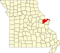 | |
| Villages | ||
| Townships | ||
| CDP | ||
| Other communities | ||
| Ghost towns | ||
| Footnotes | ‡This populated place also has portions in an adjacent county or counties | |
38°48′37″N90°48′22″W / 38.81028°N 90.80611°W
| | This St. Charles County, Missouri state location article is a stub. You can help Wikipedia by expanding it. |