
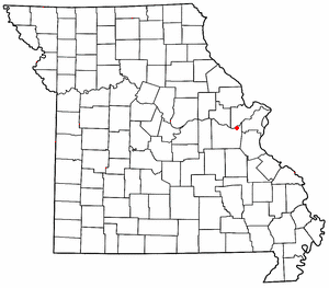
Orchard Farm is an unincorporated community in St. Charles County, Missouri, United States. [1]
Orchard Farm is an unincorporated community in St. Charles County, Missouri, United States. [1]
A post office called Orchard Farm was established in 1894, and remained in operation until 1953. [2] The community was so named on account of orchards near the original town site. [3]
38°52′43″N90°26′46″W / 38.87861°N 90.44611°W
Municipalities and communities of St. Charles County, Missouri, United States | ||
|---|---|---|
| Cities |  | |
| Villages | ||
| Townships | ||
| CDP | ||
| Other communities | ||
| Ghost towns | ||
| Footnotes | ‡This populated place also has portions in an adjacent county or counties | |
| | This St. Charles County, Missouri state location article is a stub. You can help Wikipedia by expanding it. |

Portage Des Sioux is a city in St. Charles County, Missouri, United States. The town sits on the Mississippi River roughly opposite Elsah, Illinois, and is the home of the riverside shrine of Our Lady of the Rivers. The population was 328 at the 2010 census. The city was founded in 1799 by Spanish Lt. Gov. Zenon Trudeau and François Saucier in reaction to American plans to build a military post about twelve miles (19 km) downstream. The French name derives from the overland escape route between the Missouri River and Mississippi River used by a band of Sioux, fleeing enemies; they used this area as a portage for their canoes, outdistancing their rivals who instead paddled all of the way to the confluence of the rivers.
St. Albans is an unincorporated community in northeastern Franklin County, Missouri, United States. It lies approximately five miles northeast of Labadie and about seven miles west of Wildwood. St. Albans is above the Missouri River floodplain. The town borders a small section of St. Charles County which, unlike the rest of the county, lies on the south side of the Missouri River.
Blackwell is an unincorporated community in a small part of Washington County and the extreme northern section of St. Francois County, Missouri, United States. It is located approximately seven and a half miles south of De Soto.

Matson is an unincorporated community in southern St. Charles County, Missouri, United States. It is located approximately three miles south of Defiance on Route 94 and is near the Missouri River.

Harvester is an unincorporated community in St. Charles County, in the U.S. state of Missouri. Much of the community has been annexed by St. Peters.
Black Walnut is an unincorporated community in St. Charles County, in the U.S. state of Missouri.
Boschertown is an unincorporated community in St. Charles County, in the U.S. state of Missouri.
Cappeln is an unincorporated community in St. Charles County, in the U.S. state of Missouri.
Elm Point is an unincorporated community in St. Charles County, in the U.S. state of Missouri.
Enon is an unincorporated community situated in the northwest region of St. Charles County, in the U.S. state of Missouri.
Femme Osage is an unincorporated community in southwest St. Charles County, in the U.S. state of Missouri. The community is on Missouri Route T along the bank of the Femme Osage Creek.
Firma is an extinct town in St. Charles County, in the U.S. state of Missouri. The GNIS classifies it as a populated place.
Howell is an unincorporated community in St. Charles County, in the U.S. state of Missouri. Much of the community has been annexed by St. Peters.
Klondike is an unincorporated community in southern St. Charles County, in the U.S. state of Missouri.
Machens is an extinct town in St. Charles County, in the U.S. state of Missouri. The GNIS classifies it as a populated place. The eastern end of the Katy Trail, a recreational rail trail, is located at Machens.
Mechanicsville is an unincorporated community in St. Charles County, in the U.S. state of Missouri.
Peruque is an unincorporated community in St. Charles County, in the U.S. state of Missouri. The community is adjacent to the Mississippi River, approximately five miles north of St. Peters on Missouri Route C. McCann Landing is just to the southeast along the river.
Schluersburg is an unincorporated hamlet in St. Charles County, in the U.S. state of Missouri. It lies along Schluersburg Road, which was paved during the 1970s, about two miles west of Highway F.
Wilkie is an extinct town in St. Charles County, in the U.S. state of Missouri. The GNIS classifies it as a populated place.
De Lassus is an unincorporated community in St. Francois County, in the U.S. state of Missouri. Much of the community has been annexed by Farmington.