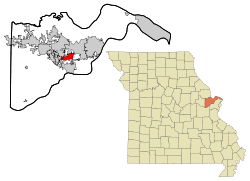
Cottleville, Missouri

Last updated

Cottleville, Missouri
Rainbow, St. Charles Community College.jpg
Rainbow at St. Charles Community College in Cottleville, October 2011
St. Charles County Missouri Incorporated and Unincorporated areas Cottleville Highlighted.svg
Location of Cottleville, Missouri
Coordinates: 38°45′7″N90°39′12″W / 38.75194°N 90.65333°W / 38.75194; -90.65333
CountryUnited States
State Missouri
County St. Charles
Area
[1]
  Total4.74 sq mi (12.27 km2)
  Land4.74 sq mi (12.27 km2)
  Water0.00 sq mi (0.00 km2)
Elevation
[2]
466 ft (142 m)
Population
 (2020)
  Total5,611
  Density1,184.76/sq mi (457.47/km2)
Time zone UTC−6 (Central (CST))
  Summer (DST) UTC−5 (CDT)
FIPS code 29-16678 [3]
GNIS feature ID2393646 [2]
Website www.cityofcottleville.com

Cottleville is a city in St. Charles County, Missouri, United States. The population was 5,611 at the 2020 census.

Contents

History

A post office called Cottleville has been in operation since 1843. [4] The town site was laid out in 1839. [5] It was named by Captain Lorenzo Cottle, an early settler and a veteran of the Black Hawk War and Seminole Wars. [5] [6]

Schools

Cottleville is home to Francis Howell Central High School, Louis C. Saeger Middle School and Warren Elementary School. St. Joseph Catholic School is also located in Cottleville, providing classes for grades K-8; St. Joseph Catholic Church is the largest church by number of parishioners in the Roman Catholic Archdiocese of St. Louis. St. Charles Community College is also located nearby.

Geography

According to the United States Census Bureau, the city has a total area of 4.46 square miles (11.55 km2), all land. [7]

Demographics

Historical population
CensusPop.Note
1880 225
1970 230
1980 184−20.0%
1990 2,9361,495.7%
2000 1,928−34.3%
2010 3,07559.5%
2020 5,61182.5%
U.S. Decennial Census [8]

2010 census

As of the census [9] of 2010, there were 3,075 people, 1,020 households, and 847 families living in the city. The population density was 689.5 inhabitants per square mile (266.2/km2). There were 1,145 housing units at an average density of 256.7 per square mile (99.1/km2). The racial makeup of the city was 92.7% White, 3.7% African American, 0.2% Native American, 1.5% Asian, 0.5% from other races, and 1.4% from two or more races. Hispanic or Latino of any race were 1.8% of the population.

There were 1,020 households, of which 45.5% had children under the age of 18 living with them, 71.3% were married couples living together, 8.0% had a female householder with no husband present, 3.7% had a male householder with no wife present, and 17.0% were non-families. 13.3% of all households were made up of individuals, and 3.6% had someone living alone who was 65 years of age or older. The average household size was 3.01 and the average family size was 3.31.

The median age in the city was 38.2 years. 29.4% of residents were under the age of 18; 7.3% were between the ages of 18 and 24; 25.1% were from 25 to 44; 30.3% were from 45 to 64; and 7.8% were 65 years of age or older. The gender makeup of the city was 50.0% male and 50.0% female.

2000 census

As of the census [3] of 2000, there were 1,928 people, 600 households, and 526 families living in the city. The population density was 493.7 inhabitants per square mile (190.6/km2). There were 616 housing units at an average density of 157.7 per square mile (60.9/km2). The racial makeup of the city was 96.27% White, 1.97% African American, 0.57% Asian, 0.26% from other races, and 0.93% from two or more races. Hispanic or Latino of any race were 0.88% of the population.

There were 600 households, out of which 56.0% had children under the age of 18 living with them, 79.3% were married couples living together, 5.7% had a female householder with no husband present, and 12.2% were non-families. 8.2% of all households were made up of individuals, and 2.2% had someone living alone who was 65 years of age or older. The average household size was 3.20 and the average family size was 3.41.

In the city the age distribution of the population shows 35.2% under the age of 18, 5.4% from 18 to 24, 38.8% from 25 to 44, 17.1% from 45 to 64, and 3.5% who were 65 years of age or older. The median age was 31 years. For every 100 females there were 99.2 males. For every 100 females age 18 and over, there were 99.4 males.

The median income for a household in the city was $74,200, and the median income for a family was $78,017. Males had a median income of $48,714 versus $35,000 for females. The per capita income for the city was $26,729. About 1.5% of families and 1.7% of the population were below the poverty line, including 3.0% of those under age 18 and none of those age 65 or over.

Related Research Articles

<span class="mw-page-title-main">Wheaton, Missouri</span> City in Missouri, United States

Wheaton is a city in Wheaton Township, Barry County, Missouri, United States. The population was 696 at the 2010 census.

<span class="mw-page-title-main">Belton, Missouri</span> City in Missouri, United States

Belton is a city in northwestern Cass County, Missouri, United States. The population was 23,116 at the 2010 census.

<span class="mw-page-title-main">Smithville, Missouri</span> City in Missouri, United States

Smithville is a city in Clay and Platte counties in the U.S. state of Missouri and is part of the Kansas City metropolitan area, along the Little Platte River. The population was 10,406 at the 2020 United States Census.

<span class="mw-page-title-main">St. Martins, Missouri</span> City in Missouri, United States

St. Martins or Saint Martins is a city in Cole County, Missouri, United States. The population was 1,191 at the 2020 census. It is part of the Jefferson City, Missouri Metropolitan Statistical Area.

<span class="mw-page-title-main">Battlefield, Missouri</span> City in Missouri, United States

Battlefield is a city in Greene County, Missouri, United States. As of the 2020 census, the city's population was 5,990. It is part of the Springfield, Missouri Metropolitan Statistical Area. The town has no post office and shares the ZIP code (65619) with Brookline.

<span class="mw-page-title-main">Green Ridge, Missouri</span> City in Missouri, United States

Green Ridge is a city located along Route 127 in Pettis County, Missouri, United States. The population was 476 at the 2010 census.

<span class="mw-page-title-main">Tracy, Missouri</span> City in Missouri, United States

Tracy is a city in Platte County, Missouri within the United States, located along the Platte River. The population was 269 at the 2020 census. The city is part of the Kansas City metropolitan area.

<span class="mw-page-title-main">Bella Villa, Missouri</span> City in Missouri, United States

Bella Villa is a city in St. Louis County, Missouri, in the United States. As of the 2010 census, the city population was 729.

<span class="mw-page-title-main">Breckenridge Hills, Missouri</span> City in Missouri, United States

Breckenridge Hills is a city in St. Louis County, Missouri, United States. As of the 2010 census, the city population was 4,746.

<span class="mw-page-title-main">Crystal Lake Park, Missouri</span> City in Missouri, United States

Crystal Lake Park is a Missouri Class 4 city in St. Louis County, Missouri, United States. The population was 508 at the 2020 census.

<span class="mw-page-title-main">Flordell Hills, Missouri</span> City in Missouri, United States

Flordell Hills is a city in St. Louis County, Missouri, United States. The population was 822 at the 2010 census.

<span class="mw-page-title-main">Green Park, Missouri</span> City in Missouri, United States

Green Park is a city in St. Louis County, Missouri, United States. The population was 2,622 at the 2010 census.

<span class="mw-page-title-main">Hazelwood, Missouri</span> City in Missouri, United States

Hazelwood is a city in St. Louis County, Missouri, within Greater St. Louis. It is a second-ring northern suburb of St. Louis. Based on the 2020 United States census, the city had a total population of 25,485. It is located north of St. Louis-Lambert International Airport and is situated on Interstates 270 and 170, as well as the much-traveled Lindbergh Boulevard and Highway 370.

<span class="mw-page-title-main">Jennings, Missouri</span> City in Missouri, United States

Jennings is a city in St. Louis County, Missouri, United States. Per the 2020 census, the population was 12,895.

<span class="mw-page-title-main">Lakeshire, Missouri</span> City in Missouri, United States

Lakeshire is a city in St. Louis County, Missouri, United States. The population was 1,432 at the 2010 census.

<span class="mw-page-title-main">Pasadena Hills, Missouri</span> City in Missouri, United States

Pasadena Hills is a city in St. Louis County, Missouri, United States. The population was 930 at the 2010 census. The entire city is listed on the National Register of Historic Places.

<span class="mw-page-title-main">Wildwood, Missouri</span> City in Missouri, United States

Wildwood is a city in St. Louis County, Missouri, United States. It is located in the far western portion of the county. As of the 2020 census, the population was 35,417. Wildwood is the home of the Al Foster Trail, and numerous other trails, parks, and reserves such as Rockwoods Reservation and Babler State Park.

<span class="mw-page-title-main">Cowgill, Missouri</span> City in Missouri, United States

Cowgill is a city in southern Caldwell County, Missouri, and is part of the Kansas City metropolitan area with the United States. The population was 168 at the 2020 census.

<span class="mw-page-title-main">Clarkson Valley, Missouri</span> City in Missouri, United States

Clarkson Valley is a city in St. Louis County, Missouri, United States. The population was 2,609 at the 2020 census.

<span class="mw-page-title-main">Warson Woods, Missouri</span> City in Missouri, United States

Warson Woods is a city in St. Louis County, Missouri, United States. The population was 1,962 at the 2010 census.

References

  1. "ArcGIS REST Services Directory". United States Census Bureau. Retrieved August 28, 2022.
  2. 1 2 U.S. Geological Survey Geographic Names Information System: Cottleville, Missouri
  3. 1 2 "U.S. Census website". United States Census Bureau . Retrieved January 31, 2008.
  4. "Post Offices". Jim Forte Postal History. Retrieved November 27, 2016.
  5. 1 2 Eaton, David Wolfe (1917). How Missouri Counties, Towns and Streams Were Named. The State Historical Society of Missouri. p. 355.
  6. Gannett, Henry (1905). The Origin of Certain Place Names in the United States. Govt. Print. Off. p. 93.
  7. "US Gazetteer files 2010". United States Census Bureau. Archived from the original on July 2, 2012. Retrieved July 8, 2012.
  8. "Census of Population and Housing". Census.gov. Retrieved June 4, 2015.
  9. "U.S. Census website". United States Census Bureau . Retrieved July 8, 2012.