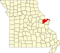
Pauldingville is an unincorporated community in northwest St. Charles County, in the U.S. state of Missouri. [1] The community is three miles south of Foristell and I-70. Sams Creek flows past approximately one mile to the east. [2]
The namesake of Pauldingville is unknown. [3]
Warren County is a county located in the eastern portion of the U.S. state of Missouri. As of the 2020 census, the population was 35,532. The county is located on the north side of the Missouri River. Its county seat is Warrenton. The county was established on January 5, 1833, and was named for General Joseph Warren, who died in the Battle of Bunker Hill during the American Revolutionary War.
Foristell is a city in St. Charles and Warren counties in the U.S. state of Missouri. It is located approximately 43 miles west of St. Louis. The population was 505 at the 2010 census.
St. Charles County is in the central eastern part of the U.S. state of Missouri. As of the 2020 census, the population was 405,262, making it Missouri's third-most populous county. Its county seat is St. Charles. The county was organized October 1, 1812, and named for Saint Charles Borromeo, an Italian cardinal.
Valles Mines is an unincorporated community in southern Jefferson County, Missouri, United States. It is located approximately seven miles south of De Soto. It is located on Missouri Route V less than one mile west of U.S. Route 67. Joachim Creek flows past the north side of the community. The ZIP Code for Valles Mines is 63087.
St. Albans is an unincorporated community in northeastern Franklin County, Missouri, United States. It lies approximately five miles northeast of Labadie and about seven miles west of Wildwood. St. Albans is above the Missouri River floodplain. The town borders a small section of St. Charles County which, unlike the rest of the county, lies on the south side of the Missouri River.
Matson is an unincorporated community in southern St. Charles County, Missouri, United States. It is located approximately three miles south of Defiance on Route 94 and is near the Missouri River.
Harvester is an unincorporated community in St. Charles County, in the U.S. state of Missouri. Much of the community has been annexed by St. Peters.
Montserrat is an unincorporated community in Johnson County, in the U.S. state of Missouri.
Melzo is an unincorporated community in southern Jefferson County, in the U.S. state of Missouri. The community is located on Missouri Route E just north of the Jefferson-St. Francois county line. DeSoto is eight miles to the north and Bone Terre is approximately six miles to the south.
Oermann is an unincorporated community in western Jefferson County, in the U.S. state of Missouri. The community is located on Missouri Route 30 approximately two miles northeast of Grubville and two miles southwest of Dittmer.
Helton is an unincorporated community in Marion County, in the U.S. state of Missouri.
Blase is an unincorporated community in St. Charles County, in the U.S. state of Missouri.
Enon is an unincorporated community in northwest St. Charles County, in the U.S. state of Missouri.
Kampville is an unincorporated community in St. Charles County, in the U.S. state of Missouri.
Klondike is an unincorporated community in southern St. Charles County, in the U.S. state of Missouri.
Marais Croche is an unincorporated community in St. Charles County, in the U.S. state of Missouri.
Peruque is an unincorporated community in St. Charles County, in the U.S. state of Missouri. The community is adjacent to the Mississippi River, approximately five miles north of St. Peters on Missouri Route C. McCann Landing is just to the southeast along the river.
Schluersburg is an unincorporated hamlet in St. Charles County, in the U.S. state of Missouri. It lies along Schluersburg Road, which was paved during the 1970s, about two miles west of Highway F.
Sams Creek is a stream in St. Charles and Warren counties in the U.S. state of Missouri. It is a tributary of Peruque Creek.
Whitecorn is an unincorporated community in St. Charles County, in the U.S. state of Missouri.
38°46′29″N90°57′19″W / 38.77472°N 90.95528°W