Treloar, Missouri

Last updated
MOMap-doton-Treloar.png

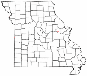
Treloar is an unincorporated community in southern Warren County, Missouri, United States. [1] It is located on the north edge of the Missouri River floodplain and Kochs Creek enters the floodplain just west of the community. Route 94 passes just south of the community and Warrenton is twelve miles to the north. [2]

History

A post office called Treloar has been in operation since 1897. [3] The community has the name of William M. Treloar, a state legislator. [4] [5]

Related Research Articles

<span class="mw-page-title-main">Steedman, Missouri</span>

Steedman is an unincorporated community in southeastern Callaway County in the U.S. state of Missouri. The community is located on Missouri Route CC and Missouri Route 94 between Portland to the east and Mokane to the west above the Missouri River floodplain.

Hopewell is an unincorporated community in Warren County, in the U.S. state of Missouri.

Holstein is an unincorporated community in Warren County, in the U.S. state of Missouri.

New Truxton is an unincorporated community in Warren County, in the U.S. state of Missouri.

Auxvasse Creek is a stream in north and northeast Callaway County, Missouri. Auxvasse Creek is a tributary to the Missouri River.

Dundee is an unincorporated community in northern Franklin County, in the U.S. state of Missouri. The community is above the Missouri River floodplain on Missouri Route 100 approximately six miles northwest of Washington and five miles east of New Haven.

Abattis is an extinct town in Warren County, in the U.S. state of Missouri.

Bernheimer is an unincorporated community in Warren County, in the U.S. state of Missouri.

Bridgeport is an unincorporated community in Warren County, in the U.S. state of Missouri.

Case is an unincorporated community in Warren County, in the U.S. state of Missouri.

Charrette Creek is a stream in Warren County in the U.S. state of Missouri. It is a tributary of the Missouri River. The headwaters of the stream are at 38°43′54″N91°00′29″W and the confluence with the Missouri is at 38°33′36″N90°59′59″W. The stream enters the Missouri River floodplain two miles west of Marthasville and joins the Missouri about four miles to the east just north of Washington.

Concord Hill is an unincorporated community in Warren County, in the U.S. state of Missouri.

Gore is an unincorporated community in southwest Warren County, in the U.S. state of Missouri. The community lies on the north edge of the Missouri River Valley. Missouri Route 94 passes just north of the community and the Katy Trail passes the location. The Loutre Slough joins the Missouri River just south of the community.

<span class="mw-page-title-main">Grand Canyon (Missouri)</span>

Grand Canyon is a valley in Warren County in the U.S. state of Missouri. The valley is an approximately four mile section of Charrette Creek which has a relatively wide floodplain between high canyon walls. The north end of the "canyon" is at 38°43′18″N91°05′21″W and the south or downstream end is at 38°39′32″N91°06′14″W.

Kochs Creek is a stream in Warren County in the U.S. state of Missouri.

Pinckney is an unincorporated community in Warren County, in the U.S. state of Missouri.

Morsey is an extinct town in Warren County, in the U.S. state of Missouri.

<span class="mw-page-title-main">Peers, Missouri</span>

Peers is an unincorporated community in southern Warren County, in the U.S. state of Missouri. The community is on the north edge of the Missouri River floodplain and Treloar is four miles to the west on Missouri Route 94.

Pin Oak Community is an unincorporated community in Warren County, in the U.S. state of Missouri.

Prairieview is an extinct town in Warren County, in the U.S. state of Missouri.

References

  1. U.S. Geological Survey Geographic Names Information System: Treloar, Missouri
  2. Treloar, MO, 7.5 Minute Topographic Quadrangle, USGS, 1973 (1986 rev.)
  3. "Post Offices". Jim Forte Postal History. Retrieved 30 December 2016.
  4. Eaton, David Wolfe (1918). How Missouri Counties, Towns and Streams Were Named. The State Historical Society of Missouri. p. 369.
  5. "Warren County Place Names, 1928–1945". The State Historical Society of Missouri. Archived from the original on June 24, 2016. Retrieved December 30, 2016.

38°38′40″N91°11′17″W / 38.64444°N 91.18806°W / 38.64444; -91.18806