Waverly, Missouri | |
---|---|
Coordinates: 39°12′26″N93°31′07″W / 39.20722°N 93.51861°W | |
Country | United States |
State | Missouri |
County | Lafayette |
Area | |
• Total | 1.42 sq mi (3.68 km2) |
• Land | 1.26 sq mi (3.27 km2) |
• Water | 0.16 sq mi (0.41 km2) |
Elevation | 801 ft (244 m) |
Population (2020) | |
• Total | 784 |
• Density | 621.73/sq mi (239.98/km2) |
Time zone | UTC-6 (Central (CST)) |
• Summer (DST) | UTC-5 (CDT) |
ZIP code | 64096 |
Area code | 660 |
FIPS code | 29-77866 [3] |
GNIS feature ID | 2397227 [2] |
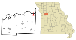
Waverly is a city in Lafayette County, Missouri, and part of the Kansas City metropolitan area within the United States. The population was 849 at the 2010 census.
Waverly is the location of Baltimore Bend Winery, one of the many small wineries established in the state since the 1960s. The Waverly Bridge over the Missouri River is located near here. It is also home to General Jo Shelby, a hemp farmer who joined the Confederate cause in 1861.[ citation needed ]
Waverly was founded in the 1840s. [4] The community was named after Waverly, Illinois, the native home of an early settler. [5] A post office called Waverly has been in operation since 1854. [6]
The Napoleon Buck House was listed on the National Register of Historic Places in 1997. [7]
According to the United States Census Bureau, the city has a total area of 1.42 square miles (3.68 km2), of which 1.26 square miles (3.26 km2) is land and 0.16 square miles (0.41 km2) is water. [8]
Census | Pop. | Note | %± |
---|---|---|---|
1870 | 887 | — | |
1880 | 930 | 4.8% | |
1890 | 826 | −11.2% | |
1900 | 722 | −12.6% | |
1910 | 777 | 7.6% | |
1920 | 810 | 4.2% | |
1930 | 941 | 16.2% | |
1940 | 876 | −6.9% | |
1950 | 809 | −7.6% | |
1960 | 837 | 3.5% | |
1970 | 827 | −1.2% | |
1980 | 941 | 13.8% | |
1990 | 837 | −11.1% | |
2000 | 806 | −3.7% | |
2010 | 849 | 5.3% | |
2020 | 784 | −7.7% | |
U.S. Decennial Census [9] |
As of the census [10] of 2010, there were 849 people, 317 households, and 215 families living in the city. The population density was 673.8 inhabitants per square mile (260.2/km2). There were 362 housing units at an average density of 287.3 per square mile (110.9/km2). The racial makeup of the city was 94.5% White, 2.1% African American, 0.2% Native American, 0.2% Asian, 2.1% from other races, and 0.8% from two or more races. Hispanic or Latino of any race were 6.1% of the population.
There were 317 households, of which 31.5% had children under the age of 18 living with them, 57.1% were married couples living together, 7.3% had a female householder with no husband present, 3.5% had a male householder with no wife present, and 32.2% were non-families. 27.8% of all households were made up of individuals, and 15.4% had someone living alone who was 65 years of age or older. The average household size was 2.44 and the average family size was 3.01.
The median age in the city was 40.6 years. 28.4% of residents were under the age of 18; 4.7% were between the ages of 18 and 24; 21.6% were from 25 to 44; 26.2% were from 45 to 64; and 18.8% were 65 years of age or older. The gender makeup of the city was 51.6% male and 48.4% female.
As of the census [3] of 2000, there were 806 people, 314 households, and 204 families living in the city. The population density was 806.8 inhabitants per square mile (311.5/km2). There were 369 housing units at an average density of 369.4 per square mile (142.6/km2). The racial makeup of the city was 97.15% White, 0.74% African American, 0.12% Native American, 0.12% Asian, 0.50% from other races, and 1.36% from two or more races. Hispanic or Latino of any race were 1.24% of the population.
There were 314 households, out of which 26.8% had children under the age of 18 living with them, 55.1% were married couples living together, 7.3% had a female householder with no husband present, and 35.0% were non-families. 31.8% of all households were made up of individuals, and 16.9% had someone living alone who was 65 years of age or older. The average household size was 2.33 and the average family size was 2.93.
In the city the population was spread out, with 26.6% under the age of 18, 6.1% from 18 to 24, 22.8% from 25 to 44, 24.2% from 45 to 64, and 20.3% who were 65 years of age or older. The median age was 41 years. For every 100 females, there were 102.0 males. For every 100 females age 18 and over, there were 86.8 males.
The median income for a household in the city was $36,806, and the median income for a family was $43,654. Males had a median income of $30,729 versus $22,813 for females. The per capita income for the city was $17,066. About 7.1% of families and 10.4% of the population were below the poverty line, including 13.3% of those under age 18 and 11.5% of those age 65 or over.
Santa Fe R-X School District operates one school at Waverly: Santa Fe Elementary School. [11]
Waverly has a public library, a branch of the Trails Regional Library. [12]
Shell Rock is a city in Butler County, Iowa, United States, along the Shell Rock River. The population was 1,268 at the time of the 2020 census. The city is located along the county's eastern border, between Butler and Bremer counties.
Waverly is a city in Coffey County, Kansas, United States. As of the 2020 census, the population of the city was 574.
Wheaton is a city in Wheaton Township, Barry County, Missouri, United States. The population was 696 at the 2010 census.
Belton is a city in northwestern Cass County, Missouri, United States. The population was 23,953 at the 2020 census. It is a part of the Kansas City Metropolitan Area.
Smithville is a city in Clay and Platte counties in the U.S. state of Missouri and is part of the Kansas City metropolitan area, along the Little Platte River. The population was 10,406 at the 2020 United States Census.
Carl Junction is a city in Jasper County, Missouri, United States. The population was 8,143 at the 2020 census.
Smithton is a city in Pettis County, Missouri, United States. The population was 570 at the 2010 census.
Breckenridge Hills is a city in St. Louis County, Missouri, United States. As of the 2010 census, the city population was 4,746.
Country Club Hills is a city in St. Louis County, Missouri, United States. The population was 1,274 at the 2010 census.
Flordell Hills is a city in St. Louis County, Missouri, United States. The population was 822 at the 2010 census.
Green Park is a city in St. Louis County, Missouri, United States. The population was 2,622 at the 2010 census.
Hazelwood is a city in St. Louis County, Missouri, within Greater St. Louis. It is a second-ring northern suburb of St. Louis. Based on the 2020 United States census, the city had a total population of 25,485. It is located north of St. Louis-Lambert International Airport and is situated on Interstates 270 and 170, as well as the much-traveled Lindbergh Boulevard and Highway 370.
Manchester is a city in St. Louis County, Missouri, United States. The population was 18,333 at the 2020 census.
St. John or Saint John is a city in St. Louis County, Missouri, United States, with its commercial district centered along St. Charles Rock Road. It is a few miles southeast of Lambert-St. Louis International Airport.
Wildwood is a city in St. Louis County, Missouri, United States. It is located in the far western portion of the county. As of the 2020 census, the population was 35,417. Wildwood is the home of the Al Foster Trail, and numerous other trails, parks, and reserves such as Rockwoods Reservation and Babler State Park.
Winchester is a city in St. Louis County, Missouri, United States. The population was 1,447 at the 2020 census.
Woodson Terrace is a city in St. Louis County, Missouri, United States. The population was 4,063 at the 2010 census.
Moscow Mills is a city in Lincoln County, Missouri, United States. The population was 2,509 at the 2010 census.
Moline Acres is a city in St. Louis County, Missouri, United States. The population was 2,442 at the 2010 census.
Warson Woods is a city in St. Louis County, Missouri, United States. The population was 1,962 at the 2010 census.