Appleton City, Missouri | |
---|---|
Nickname: AC | |
Coordinates: 38°11′26″N94°01′51″W / 38.19056°N 94.03083°W | |
Country | United States |
State | Missouri |
County | St. Clair |
Incorporated | 1870 |
Government | |
• Type | 4th Class City |
• Mayor | Tom Holt |
Area | |
• Total | 1.15 sq mi (2.97 km2) |
• Land | 1.15 sq mi (2.97 km2) |
• Water | 0.00 sq mi (0.00 km2) |
Elevation | 873 ft (266 m) |
Population (2020) | |
• Total | 1,032 |
• Density | 898.95/sq mi (347.20/km2) |
Time zone | UTC-6 (Central (CST)) |
• Summer (DST) | UTC-5 (CDT) |
ZIP code | 64724 |
FIPS code | 29-01522 [3] |
GNIS feature ID | 2393969 [2] |
Website | http://www.acmogov.com |
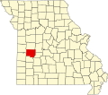
Appleton City is a city in St. Clair County, Missouri, United States. The population was 1,032 as of the 2020 census. [4] It is the largest city in St. Clair County.
Appleton City was originally called Arlington, and under the latter name was platted in 1870. [5] The present name is after D.S. Appleton (1824-1890) of the D. Appleton & Company, who contributed a $500 library to the city. [6]
The Hudson City School was listed on the National Register of Historic Places in 2002. [7]
According to the United States Census Bureau, the city has a total area of 1.15 square miles (2.98 km2), all land. [8]
Climate data for Appleton City, Missouri (1991–2020 normals, extremes 1890–present) | |||||||||||||
---|---|---|---|---|---|---|---|---|---|---|---|---|---|
Month | Jan | Feb | Mar | Apr | May | Jun | Jul | Aug | Sep | Oct | Nov | Dec | Year |
Record high °F (°C) | 77 (25) | 83 (28) | 92 (33) | 94 (34) | 100 (38) | 110 (43) | 116 (47) | 112 (44) | 107 (42) | 100 (38) | 90 (32) | 75 (24) | 116 (47) |
Average high °F (°C) | 40.0 (4.4) | 45.4 (7.4) | 56.1 (13.4) | 65.9 (18.8) | 74.7 (23.7) | 83.6 (28.7) | 88.2 (31.2) | 87.3 (30.7) | 79.4 (26.3) | 68.2 (20.1) | 55.1 (12.8) | 44.0 (6.7) | 65.7 (18.7) |
Daily mean °F (°C) | 30.6 (−0.8) | 35.1 (1.7) | 45.2 (7.3) | 54.9 (12.7) | 64.8 (18.2) | 73.9 (23.3) | 78.4 (25.8) | 77.0 (25.0) | 68.7 (20.4) | 57.1 (13.9) | 44.9 (7.2) | 34.8 (1.6) | 55.4 (13.0) |
Average low °F (°C) | 21.2 (−6.0) | 24.9 (−3.9) | 34.2 (1.2) | 43.9 (6.6) | 54.8 (12.7) | 64.2 (17.9) | 68.5 (20.3) | 66.7 (19.3) | 58.1 (14.5) | 46.1 (7.8) | 34.7 (1.5) | 25.6 (−3.6) | 45.2 (7.3) |
Record low °F (°C) | −22 (−30) | −29 (−34) | −7 (−22) | 13 (−11) | 26 (−3) | 41 (5) | 46 (8) | 44 (7) | 29 (−2) | 18 (−8) | 1 (−17) | −22 (−30) | −29 (−34) |
Average precipitation inches (mm) | 1.57 (40) | 1.74 (44) | 3.19 (81) | 4.63 (118) | 5.88 (149) | 4.66 (118) | 4.50 (114) | 4.13 (105) | 4.33 (110) | 3.35 (85) | 3.19 (81) | 2.32 (59) | 43.49 (1,105) |
Average snowfall inches (cm) | 3.8 (9.7) | 2.3 (5.8) | 1.3 (3.3) | 0.0 (0.0) | 0.0 (0.0) | 0.0 (0.0) | 0.0 (0.0) | 0.0 (0.0) | 0.0 (0.0) | 0.0 (0.0) | 0.3 (0.76) | 2.1 (5.3) | 9.8 (25) |
Average precipitation days (≥ 0.01 in) | 6.0 | 5.3 | 8.7 | 9.9 | 11.8 | 9.7 | 7.8 | 7.4 | 7.4 | 8.2 | 6.6 | 5.9 | 94.7 |
Average snowy days (≥ 0.1 in) | 2.2 | 0.9 | 0.7 | 0.0 | 0.0 | 0.0 | 0.0 | 0.0 | 0.0 | 0.0 | 0.3 | 1.0 | 5.1 |
Source: NOAA [9] [10] |
Census | Pop. | Note | %± |
---|---|---|---|
1880 | 1,034 | — | |
1890 | 1,081 | 4.5% | |
1900 | 1,133 | 4.8% | |
1910 | 1,018 | −10.2% | |
1920 | 1,262 | 24.0% | |
1930 | 1,136 | −10.0% | |
1940 | 1,188 | 4.6% | |
1950 | 1,150 | −3.2% | |
1960 | 1,075 | −6.5% | |
1970 | 1,058 | −1.6% | |
1980 | 1,257 | 18.8% | |
1990 | 1,280 | 1.8% | |
2000 | 1,314 | 2.7% | |
2010 | 1,127 | −14.2% | |
2020 | 1,032 | −8.4% | |
U.S. Decennial Census [11] |
As of the census [12] of 2010, there were 1,127 people, 501 households, and 281 families residing in the city. The population density was 980.0 inhabitants per square mile (378.4/km2). There were 617 housing units at an average density of 536.5 per square mile (207.1/km2). The racial makeup of the city was 96.8% White, 0.6% African American, 0.5% Native American, 0.1% from other races, and 2.0% from two or more races. Hispanic or Latino of any race were 0.7% of the population.
There were 501 households, of which 26.3% had children under the age of 18 living with them, 44.1% were married couples living together, 9.2% had a female householder with no husband present, 2.8% had a male householder with no wife present, and 43.9% were non-families. 40.5% of all households were made up of individuals, and 24.6% had someone living alone who was 65 years of age or older. The average household size was 2.16 and the average family size was 2.91.
The median age in the city was 45.2 years. 21.2% of residents were under the age of 18; 7.6% were between the ages of 18 and 24; 21.1% were from 25 to 44; 24.1% were from 45 to 64; and 26% were 65 years of age or older. The gender makeup of the city was 47.6% male and 52.4% female.
As of the census [3] of 2000, there were 1,314 people, 552 households, and 342 families residing in the city. The population density was 1,147.0 inhabitants per square mile (442.9/km2). There were 635 housing units at an average density of 554.3 per square mile (214.0/km2). The racial makeup of the city was 98.17% White, 0.08% Native American, 0.38% from other races, and 1.37% from two or more races. Hispanic or Latino of any race were 0.46% of the population.
There were 552 households, out of which 28.1% had children under the age of 18 living with them, 48.4% were married couples living together, 10.1% had a female householder with no husband present, and 38.0% were non-families. 36.1% of all households were made up of individuals, and 23.0% had someone living alone who was 65 years of age or older. The average household size was 2.25 and the average family size was 2.89.
In the city the population was spread out, with 25.1% under the age of 18, 5.9% from 18 to 24, 22.3% from 25 to 44, 19.3% from 45 to 64, and 27.5% who were 65 years of age or older. The median age was 43 years. For every 100 females there were 82.8 males. For every 100 females age 18 and over, there were 71.4 males.
The median income for a household in the city was $23,674, and the median income for a family was $30,365. Males had a median income of $25,000 versus $18,864 for females. The per capita income for the city was $12,566. About 16.5% of families and 23.1% of the population were below the poverty line, including 32.4% of those under age 18 and 18.9% of those age 65 or over.
Appleton City R-II School District operates one elementary school and Appleton City High School. [13]
The town has a public library, the Appleton City Library. [14]
St. Clair County is a county located in the western portion of the U.S. state of Missouri. As of the 2020 census, the population was 9,284. Its county seat is Osceola. The largest city is Appleton City. The county was organized in 1841 and named after General Arthur St. Clair, Governor of the Northwest Territory. St. Clair was also the 9th president of the United States in Congress Assembled. Under his presidency, the Northwest Ordinance and United States Constitution were passed.
St. Clair or Saint Clair is a city in Blue Earth County, Minnesota, United States, located along the Le Sueur River. The population was 750 at the 2020 census. It is part of the Mankato-North Mankato Metropolitan Statistical Area.
Parkway is a village in Franklin County, Missouri, United States. The population was 439 at the 2010 census.
Saint Clair is a city in Franklin County, Missouri, United States. The population was 4,791 at the 2020 census.
Syracuse is a city in Morgan County, Missouri, United States. The population was 172 at the 2010 census. In the middle of the 19th century, the city was the western terminus of the Pacific Railway that reached 108 miles from St. Louis. The current mayor of Syracuse is Duane A. Doyle.
Frohna is a city in Perry County, Missouri, United States. The population was 245 at the 2020 census.
Bolivar is a city and county seat of Polk County, Missouri, United States. As of a 2019 estimate by the U. S. Census Bureau, the city population was 11,067.
Eminence is a city in Shannon County, Missouri, United States. The population was 515 at the 2020 census. It is the county seat of Shannon County.
Collins is a village in St. Clair County, Missouri, United States. The population was 125 at the 2020 census.
Lowry City is a city in St. Clair County, Missouri, United States. The population was 613 at the 2020 census. Lowry City is the city where the Ozark Mountains meet the Great Plains.
Osceola is a city in St. Clair County, Missouri, United States. The population was 909 at the 2020 census. It is the county seat of St. Clair County. During the American Civil War, Osceola was the site of the Sacking of Osceola.
Roscoe is a village in St. Clair County, Missouri, United States. The population was 89 at the 2020 census.
Country Club Hills is a city in St. Louis County, Missouri, United States. The population was 1,274 at the 2010 census.
Crystal Lake Park is a Missouri Class 4 city in St. Louis County, Missouri, United States. The population was 508 at the 2020 census.
Greendale is a city in St. Louis County, Missouri, United States. The population was 651 at the 2010 census.
Northwoods is a city in St. Louis County, Missouri, United States. The population was 4,227 at the 2010 census.
Velda City is a city in St. Louis County, Missouri, United States. The population was 1,420 at the 2010 census.
Wildwood is a city in St. Louis County, Missouri, United States. It is located in the far western portion of the county. As of the 2020 census, the population was 35,417. Wildwood is the home of the Al Foster Trail, and numerous other trails, parks, and reserves such as Rockwoods Reservation and Babler State Park.
Winchester is a city in St. Louis County, Missouri, United States. The population was 1,447 at the 2020 census.
Moline Acres is a city in St. Louis County, Missouri, United States. The population was 2,442 at the 2010 census.