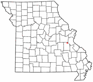
Hickory County is located in the U.S. state of Missouri. As of the 2020 census, the population was 8,279. Its county seat is Hermitage. The county was organized February 14, 1845, and named after President Andrew Jackson, whose nickname was "Old Hickory." The Pomme de Terre Dam, a Corps of Engineers facility, is located three miles south of Hermitage and forms Lake Pomme de Terre by damming the Pomme de Terre River and Lindley Creek. Truman Reservoir, also a Corps of Engineers facility, floods the Pomme de Terre Reservoir from the northern border of the county southward to the city limits of Hermitage.

Roscoe is a village in St. Clair County, Missouri, United States. The population was 89 at the 2020 census.

The Harry S Truman Reservoir, also known as Truman Lake, is located in the state of Missouri, United States. It is located between Clinton and Warsaw, on the Osage River and extends south to Osceola. The dam is located in Benton County, but the reservoir also extends into parts of Henry, St. Clair, and Hickory counties.

The Sac River (pronounced sack) is a river in the Ozarks of Southwest Missouri. It is 118 miles (190 km) long, with headwaters in western Greene County. The stream passes through the northeast corner of Lawrence County then re-enters Greene County. The stream enters Dade County northwest of Ash Grove. The stream enters Stockton Lake in Dade County between Dadeville and Greenfield, then flows north exiting Stockton Lake in Cedar County. The stream meanders north into St. Clair County, passes under US Route 54 and enters the Osage River in Truman Reservoir southeast of Osceola.

Richwoods is an unincorporated community in northeastern Washington County, Missouri, United States. It is located on Missouri Route A one mile east of Missouri Route 47, approximately 15 miles west of De Soto and 19 miles south of St. Clair.
Cedar City is a former incorporated city in southern Callaway County, Missouri, United States. It is located on the Missouri River floodplain across the river channel from Jefferson City and is near the interchange of U.S. Routes 54 and 63. It is part of the Jefferson City, Missouri Metropolitan Statistical Area.
Martin Creek, known locally as Dennis Martin Creek, is a 1.4-mile-long (2.3 km) north by northeastward-flowing stream originating just east of Skyline Boulevard in the Santa Cruz Mountains, near the community of Skylonda in San Mateo County, California. It flows through the town of Woodside before crossing Portola Road and joining Sausal Creek on Stanford University lands just across the border from Woodside. Sausal Creek enters Searsville Reservoir, which flows to San Francisco Bay via San Francisquito Creek.
Tackner is an unincorporated community in Benton County, Missouri, United States. Tackner is located on Missouri Route 7 near the Truman Reservoir, 2.7 miles (4.3 km) west of Warsaw.
Fristoe is an unincorporated community in Benton County, Missouri, United States. Fristoe is located at the junction of U.S. Route 65 and Supplemental Route CC, 10.45 miles (16.82 km) southeast of Warsaw.
Prairie City is an unincorporated community in southeast Bates County, in the U.S. state of Missouri. The community is approximately 11.5 miles east of Rich Hill via Missouri routes B and D. The Harry S Truman Reservoir is adjacent to the south.
Ohio is an unincorporated community in northern St. Clair County, in the U.S. state of Missouri. The community is at the intersection of Missouri routes A and F and south of Cooper Creek. Lowry City is on Missouri Route 13 approximately seven miles to the east and Appleton City is approximately nine miles to the west-northwest on Missouri Route 52.
Cooper Creek is a stream in Henry and St. Clair counties of Missouri. It is a tributary of Deepwater Creek within the Truman Reservoir.
Finey is an unincorporated community in southeastern Henry County, in the U.S. state of Missouri. The community is on Missouri Route Z just over one mile from the Henry-Benton county line. The Osage arm of the Truman Reservoir and the Henry-St Clair county line is approximately one mile to the south. The Grand River arm of the reservoir is about two miles to the north of the community.
Atchley is a former community in Laclede County, in the U.S. state of Missouri. The community was located approximately four miles northwest of Lebanon and 1.5 miles west of Missouri Route 5, roughly at the intersection of present day Hancock Road and Oaklawn Dr. Its land is now entirely under private ownership, for farming. The Atchley Cemetery lies west of Goodwin Hollow Creek.
Fay is an unincorporated community in southeastern Ozark County, in the Ozarks of south-central Missouri, United States. The community is located along Missouri Route J, approximately 2.5 miles south of U.S. Route 160. The Fay Cemetery lies just west of Route J and north of the Lick Creek - Sweeten Creek junction.
Iuka Springs is an extinct town in St. Clair County, in the U.S. state of Missouri. The GNIS classifies it as a populated place.
Tiffin is an unincorporated community in southern St. Clair County, in the U.S. state of Missouri.
Wright Creek is a stream in St. Clair County in the U.S. state of Missouri. It is a tributary to the Osage River within the Truman Reservoir.
Raney is an unincorporated community in southeastern St. Clair County, in the U.S. state of Missouri. The community is located along Missouri Route V approximately four miles southwest of Vista. It is on a ridge between the Sac River to the west and Coon Creek to the east. Waters of the Truman Reservoir reach into the Sac and Coon Creek to the northwest and northeast of the community.
Montgomery Township is an inactive township in Hickory County, in the U.S. state of Missouri. It was named after Judge Joseph C. Montgomery.


