Taberville, Missouri

Last updated

MOMap-doton-Taberville.png

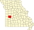
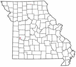
Taberville is an unincorporated community in southwestern St. Clair County, Missouri, United States. [1] It is located approximately sixteen miles west of Osceola, situated on the north side of the Osage River. Taberville formerly had a post office, but it has closed and mail is now delivered from nearby Rockville.

Taberville was originally called Manoa, and under the latter name was platted in 1859. [2] A post office called Taberville was established in 1866, and remained in operation until 1968. [3] The present name is after one Dr. Tabor, the original owner of the town site.The original map misspelled Dr Tabor's name, thus it became Taberville. Before the Louisiana purchase, the location was the site of Fort Manoa, established by the French and Spanish for trade with the Osage tribe there, at the same time that Fort Carondolet was built near Harmony Mission slightly upriver from Schell City. [2] [4]

Related Research Articles

<span class="mw-page-title-main">Quincy, Missouri</span> Unincorporated community in Missouri, U.S.

tation 1858-1861]]

Folk is an unincorporated community in northwestern Osage County, Missouri, United States. It is located approximately ten miles southeast of Jefferson City.

Osage City is an unincorporated community in Cole County, in the U.S. state of Missouri.

Ohio is an unincorporated community in northern St. Clair County, in the U.S. state of Missouri. The community is at the intersection of Missouri routes A and F and south of Cooper Creek. Lowry City is on Missouri Route 13 approximately seven miles to the east and Appleton City is approximately nine miles to the west-northwest on Missouri Route 52.

Finey is an unincorporated community in southeastern Henry County, in the U.S. state of Missouri. The community is on Missouri Route Z just over one mile from the Henry-Benton county line. The Osage arm of the Truman Reservoir and the Henry-St Clair county line is approximately one mile to the south. The Grand River arm of the reservoir is about two miles to the north of the community.

Dingley is an extinct town in Osage County, in the U.S. state of Missouri.

Judge is an unincorporated community in Osage County, in the U.S. state of Missouri.

Lisletown is an extinct town in Osage County, in the U.S. state of Missouri.

Harper is an unincorporated community in St. Clair County, in the U.S. state of Missouri. The community is on Missouri Route 82 approximately ten miles east of Osceola and within one mile of the St. Clair - Hickory county line.

Iuka Springs is an extinct town in St. Clair County, in the U.S. state of Missouri. The GNIS classifies it as a populated place.

Johnson City is an unincorporated community in St. Clair County, in the U.S. state of Missouri.

Monegaw Springs is an unincorporated community in St. Clair County, in the U.S. state of Missouri.

Salt Creek is a stream in St. Clair County in the U.S. state of Missouri. It is a tributary of the Osage River.

Wright Creek is a stream in St. Clair County in the U.S. state of Missouri. It is a tributary to the Osage River within the Truman Reservoir.

Chalk Level is an unincorporated community in St. Clair County, in the U.S. state of Missouri.

Monegaw Township is an inactive township in St. Clair County, in the U.S. state of Missouri.

Osage Township is an inactive township in St. Clair County, in the U.S. state of Missouri.

Taber Township is an inactive township in St. Clair County, in the U.S. state of Missouri.

Raney is an unincorporated community in southeastern St. Clair County, in the U.S. state of Missouri. The community is located along Missouri Route V approximately four miles southwest of Vista. It is on a ridge between the Sac River to the west and Coon Creek to the east. Waters of the Truman Reservoir reach into the Sac and Coon Creek to the northwest and northeast of the community.

Montgomery Township is an inactive township in Hickory County, in the U.S. state of Missouri. It was named after Judge Joseph C. Montgomery.

References

  1. U.S. Geological Survey Geographic Names Information System: Taberville, Missouri
  2. 1 2 "St. Clair County Place Names, 1928–1945". The State Historical Society of Missouri. Archived from the original on June 24, 2016. Retrieved November 27, 2016.
  3. "Post Offices". Jim Forte Postal History. Retrieved November 27, 2016.
  4. Eaton, David Wolfe (1918). How Missouri Counties, Towns and Streams Were Named. The State Historical Society of Missouri. p. 358.

38°00′30″N93°59′41″W / 38.00833°N 93.99472°W / 38.00833; -93.99472