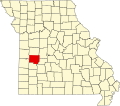
Cobb is an unincorporated community in St. Clair County, in the U.S. state of Missouri. [1]
The community was so named on account of corn cobs a local farmer fed his animals, according to local history. [2] Variant names were "Howards Mill" and "Ritchie Mill". [1] A post office called Howard's Mills was in operation from 1854 until 1886, and the post office was called Cobb from 1889 until it was discontinued in 1918. [3]
Grubville is an unincorporated community in western Jefferson County, Missouri, United States. It is located approximately one-half mile east of the Jefferson/Franklin County line. Missouri routes WW and Y meet at the community and Route 30 passes approximately one mile to the north. Nearby communities include Dittmer and Morse Mill to the east and Lonedell and Luebbering to the west in Franklin County. Jones Creek flows from the east side of the community to its confluence with Big River approximately five miles to the east.
Taberville is an unincorporated community in southwestern St. Clair County, Missouri, United States. It is located approximately sixteen miles west of Osceola, situated on the north side of the Osage River. Taberville formerly had a post office, but it has closed and mail is now delivered from nearby Rockville.
Iconium is an unincorporated community in St. Clair County, Missouri, United States. The town is perhaps best known for "Scott's Iconium Store," a local institution that is a frequent pilgrimage destination for Boy Scouts, due to the community's proximity to the H. Roe Bartle Scout Reservation.
Ohio is an unincorporated community in northern St. Clair County, in the U.S. state of Missouri. The community is at the intersection of Missouri routes A and F and south of Cooper Creek. Lowry City is on Missouri Route 13 approximately seven miles to the east and Appleton City is approximately nine miles to the west-northwest on Missouri Route 52.
Griffin is an unincorporated community in Christian County, in the U.S. state of Missouri.
Hulston is an extinct town in Dade County, in the U.S. state of Missouri. The GNIS classifies it as a populated place.
Seybert is an extinct town in Dade County, in the U.S. state of Missouri. The GNIS classifies it as a populated place.
Howes Mill is an unincorporated community in eastern Dent County, in the U.S. state of Missouri.
Hackney is an unincorporated community in northwest Greene County, in the U.S. state of Missouri. The community was a mill site on the north bank of a meander in the Little Sac River. The old iron Hackney Mill Bridge directly south of the community was constructed in 1895-96 and was replaced in 1996.
Hodge is an unincorporated community in Lafayette County, in the U.S. state of Missouri.
French Mills is an unincorporated community in western Madison County, in the U.S. state of Missouri. The community is on Marble Creek, just west of that stream's confluence with the St. Francis River.
Harper is an unincorporated community in St. Clair County, in the U.S. state of Missouri.
Iuka Springs is an extinct town in St. Clair County, in the U.S. state of Missouri. The GNIS classifies it as a populated place.
Johnson City is an unincorporated community in St. Clair County, in the U.S. state of Missouri.
Monegaw Springs is an unincorporated community in St. Clair County, in the U.S. state of Missouri.
Oyer is an unincorporated community in St. Clair County, in the U.S. state of Missouri.
Pape is an unincorporated community in St. Clair County, in the U.S. state of Missouri.
Tiffin is an unincorporated community in southern St. Clair County, in the U.S. state of Missouri.
Chalk Level is an unincorporated community in St. Clair County, in the U.S. state of Missouri.
Raney is an unincorporated community in southeastern St. Clair County, in the U.S. state of Missouri. The community is located along Missouri Route V approximately four miles southwest of Vista. It is on a ridge between the Sac River to the west and Coon Creek to the east. Waters of the Truman Reservoir reach into the Sac and Coon Creek to the northwest and northeast of the community.
37°53′40″N93°45′17″W / 37.89444°N 93.75472°W