Hayti Heights, Missouri | |
---|---|
Coordinates: 36°13′52″N89°46′06″W / 36.23111°N 89.76833°W [1] | |
Country | United States |
State | Missouri |
County | Pemiscot |
Area | |
• Total | 0.98 sq mi (2.54 km2) |
• Land | 0.98 sq mi (2.54 km2) |
• Water | 0.00 sq mi (0.00 km2) |
Elevation | 266 ft (81 m) |
Population (2020) | |
• Total | 515 |
• Density | 524.97/sq mi (202.77/km2) |
Time zone | UTC-6 (Central (CST)) |
• Summer (DST) | UTC-5 (CDT) |
ZIP code | 63851 |
Area code | 573 |
FIPS code | 29-31168 [3] |
GNIS feature ID | 2394337 [1] |
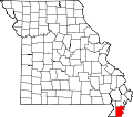
Hayti Heights is a city in eastern Pemiscot County in the bootheel of southeast Missouri, United States. The population was 515 at the 2020 census. [4]
Hayti Heights lies immediately west of Hayti in eastern Pemiscot County. Missouri Route 84 traverses Hayti Heights from west-to-east. U.S. Route 412 passes through the southern tip of the city. [5]
According to the United States Census Bureau, the city has a total area of 0.98 square miles (2.54 km2), all land. [6]
Census | Pop. | Note | %± |
---|---|---|---|
1980 | 1,023 | — | |
1990 | 893 | −12.7% | |
2000 | 771 | −13.7% | |
2010 | 626 | −18.8% | |
2020 | 515 | −17.7% | |
U.S. Decennial Census [7] |
Race / Ethnicity (NH = Non-Hispanic) | Pop 2000 [8] | Pop 2010 [9] | Pop 2020 [10] | % 2000 | % 2010 | % 2020 |
---|---|---|---|---|---|---|
White alone (NH) | 5 | 7 | 28 | 0.65% | 1.12% | 5.44% |
Black or African American alone (NH) | 758 | 614 | 460 | 98.31% | 98.08% | 89.32% |
Native American or Alaska Native alone (NH) | 0 | 1 | 3 | 0.00% | 0.16% | 0.58% |
Asian alone (NH) | 3 | 0 | 0 | 0.39% | 0.00% | 0.00% |
Pacific Islander alone (NH) | 0 | 0 | 0 | 0.00% | 0.00% | 0.00% |
Other race alone (NH) | 0 | 0 | 1 | 0.00% | 0.00% | 0.19% |
Mixed race or Multiracial (NH) | 5 | 2 | 14 | 0.65% | 0.32% | 2.72% |
Hispanic or Latino (any race) | 0 | 2 | 9 | 0.00% | 0.32% | 1.75% |
Total | 771 | 626 | 515 | 100.00% | 100.00% | 100.00% |
As of the census [11] of 2010, there were 626 people, 210 households, and 150 families living in the city. The population density was 638.8 inhabitants per square mile (246.6/km2). There were 244 housing units at an average density of 249.0 per square mile (96.1/km2). The racial makeup of the city was 1.12% White, 98.40% Black or African American, 0.16% Native American, and 0.32% from two or more races. Hispanic or Latino of any race were 0.32% of the population.
There were 210 households, of which 51.0% had children under the age of 18 living with them, 15.2% were married couples living together, 50.5% had a female householder with no husband present, 5.7% had a male householder with no wife present, and 28.6% were non-families. 25.7% of all households were made up of individuals, and 8.6% had someone living alone who was 65 years of age or older. The average household size was 2.98 and the average family size was 3.61.
The median age in the city was 22.8 years. 41.9% of residents were under the age of 18; 10.7% were between the ages of 18 and 24; 20.4% were from 25 to 44; 18.6% were from 45 to 64; and 8.1% were 65 years of age or older. The gender makeup of the city was 45.7% male and 54.3% female.
As of the census [3] of 2000, there were 771 people, 254 households, and 183 families living in the city. The population density was 780.0 inhabitants per square mile (301.2/km2). There were 287 housing units at an average density of 290.4 per square mile (112.1/km2). The racial makeup of the city was 0.65% White, 98.31% African American, 0.39% Asian, and 0.65% from two or more races.
There were 254 households, out of which 46.9% had children under the age of 18 living with them, 19.3% were married couples living together, 49.6% had a female householder with no husband present, and 27.6% were non-families. 24.0% of all households were made up of individuals, and 9.1% had someone living alone who was 65 years of age or older. The average household size was 3.04 and the average family size was 3.64.
In the city, the population was spread out, with 44.7% under the age of 18, 9.9% from 18 to 24, 22.7% from 25 to 44, 13.5% from 45 to 64, and 9.2% who were 65 years of age or older. The median age was 21 years. For every 100 females there were 72.9 males. For every 100 females age 18 and over, there were 62.0 males.
The median income for a household in the city was $12,011, and the median income for a family was $15,417. Males had a median income of $23,750 versus $16,786 for females. The per capita income for the city was $6,398. About 55.5% of families and 57.7% of the population were below the poverty line, including 67.1% of those under age 18 and 40.7% of those age 65 or over.
Pemiscot County is a county located in the southeastern corner in the Bootheel in the U.S. state of Missouri, with the Mississippi River forming its eastern border. As of the 2020 census, the population was 15,661. The largest city and county seat is Caruthersville. The county was officially organized on February 19, 1851. It is named for the local bayou, taken from the word pem-eskaw, meaning "liquid mud", in the language of the native Meskwaki people. This has been an area of cotton plantations and later other commodity crops.
Muskegon Heights is a city in Muskegon County in the U.S. state of Michigan. The population was 9,985 at the 2020 census.
Lamar Heights is a city in Barton County, Missouri, United States. The population was 170 at the 2020 census.
Bragg City is a city in Pemiscot County, Missouri, United States. The population was 72 at the 2020 census.
Cooter is a city in Pemiscot County, Missouri, United States. The population was 343 at the 2020 census.
Hayti is a city in eastern Pemiscot County, Missouri, United States. The population was 2,493 at the 2020 census.
Holland is a town in Pemiscot County, Missouri, United States. The population was 194 at the 2020 census.
Pascola is a village in Pemiscot County, Missouri, United States. The population was 108 at the 2010 census.
Steele is a city in southern Pemiscot County in the Missouri Bootheel of southeastern Missouri, United States. The population was 1,853 at the 2020 census.
Wardell is a city in Pemiscot County, Missouri, United States. The population was 310 at the 2020 census. It annexed North Wardell in 2007.
Wood Heights is a city in western Ray County, Missouri, and part of the Kansas City metropolitan area within the United States. The population was 757 at the 2020 census.
Dellwood is a city in the north St. Louis County, Missouri, United States. The population was 5,025 at the 2010 census. The center of Dellwood or the city of Dellwood was located at the intersections of West Florissant Ave. and Chambers Road.
Flordell Hills is a city in St. Louis County, Missouri, United States. The population was 822 at the 2010 census.
Glen Echo Park was a village in St. Louis County, Missouri, United States. The population was 122 at the 2020 census. The community took its name from the nearby Glen Echo Country Club.
Jennings is a city in St. Louis County, Missouri, United States. Per the 2020 census, the population was 12,895.
Lakeshire is a city in St. Louis County, Missouri, United States. The population was 1,432 at the 2010 census.
Vinita Park is a city in St. Louis County, Missouri, United States, located just east of I-170 and south of St. Charles Rock Road. The population was 1,970 at the 2020 census.
Woodson Terrace is a city in St. Louis County, Missouri, United States. The population was 4,063 at the 2010 census.
Uplands Park is a village in St. Louis County, Missouri, United States. The population was 445 at the 2010 census. The village is one of many small majority black communities located in the Natural Bridge corridor of mid-St. Louis County, characterized by small homes on small lots.
Richmond Heights is a city in Cuyahoga County, Ohio, United States. The population was 10,801 at the 2020 census. A suburb of Cleveland, it is part of the Cleveland metropolitan area.