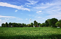
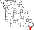
Bragg City, Missouri

Last updated

Bragg City, Missouri
Bragg-City-water-tower-mo.jpg
Bragg City
Pemiscot County Missouri Incorporated and Unincorporated areas Bragg City Highlighted.svg
Location of Bragg City, Missouri
Coordinates: 36°16′05″N89°54′41″W / 36.26806°N 89.91139°W / 36.26806; -89.91139
Country United States
State Missouri
County Pemiscot
Area
[1]
  Total0.20 sq mi (0.53 km2)
  Land0.20 sq mi (0.53 km2)
  Water0.00 sq mi (0.00 km2)
Elevation
[2]
259 ft (79 m)
Population
 (2020)
  Total72
  Density352.94/sq mi (136.04/km2)
Time zone UTC-6 (Central (CST))
  Summer (DST) UTC-5 (CDT)
ZIP code
63827
Area code 573
FIPS code 29-07876 [3]
GNIS feature ID2396600 [2]

Bragg City is a city in Pemiscot County, Missouri, United States. The population was 72 at the 2020 census. [4]

Contents

History

Bragg City was originally named Owl City, and under the latter name was laid out in 1894 when the railroad was extended to that point. [5] Another early variant name was "Clayroot". [5] A post office called Clayroot was established in 1911, and the name was changed to Bragg City in 1917. [6] The present name honors W. G. Bragg, the original owner of the site. [5]

Geography

Bragg City is situated in western Pemiscot County, northeast of Kennett. State Route K traverses Bragg City, connecting it with Pascola to the east. State Route A runs through the northwestern part of Bragg City, connecting it with Wardell to the northeast and U.S. Route 412 to the southwest.

According to the United States Census Bureau, the city has a total area of 0.20 square miles (0.52 km2), all land. [7]

Demographics

Historical population
CensusPop.Note
1920 402
1930 205−49.0%
1940 31855.1%
1950 294−7.5%
1960 274−6.8%
1970 210−23.4%
1980 200−4.8%
1990 117−41.5%
2000 18961.5%
2010 149−21.2%
2020 72−51.7%
U.S. Decennial Census [8]

2010 census

At the 2010 census, [9] there were 149 people, 53 households, and 32 families living in the city. The population density was 745.0 per square mile (287.6/km2). There were 61 housing units at an average density of 305.0 per square mile (117.8/km2). The racial makeup of the city was 87.92% White, 4.03% Black or African American, 2.01% Native American, 3.36% Asian, and 2.68% from two or more races. Hispanic or Latino of any race were 0.67% of the population.

There were 53 households, of which 35.8% had children under the age of 18 living with them, 35.8% were married couples living together, 17.0% had a female householder with no husband present, 7.5% had a male householder with no wife present, and 39.6% were non-families. 35.8% of all households were made up of individuals, and 11.4% had someone living alone who was 65 years of age or older. The average household size was 2.81 and the average family size was 3.59.

The median age was 35.8 years. 32.2% of residents were under the age of 18; 4.8% were between the ages of 18 and 24; 26.2% were from 25 to 44; 24.8% were from 45 to 64; and 12.1% were 65 years of age or older. The gender makeup of the city was 51.0% male and 49.0% female.

2000 census

At the 2000 census, [3] there were 189 people, 69 households and 56 families living in the town. The population density was 923.5 inhabitants per square mile (356.6/km2). There were 76 housing units at an average density of 371.3 per square mile (143.4/km2). The racial makeup of the town was 91.01% White, 5.29% African American, 1.06% Native American, 0.53% from other races, and 2.12% from two or more races. Hispanic or Latino of any race were 3.70% of the population.

There were 69 households, of which 42.0% had children under the age of 18 living with them, 55.1% were married couples living together, 17.4% had a female householder with no husband present, and 17.4% were non-families. 17.4% of all households were made up of individuals, and 10.1% had someone living alone who was 65 years of age or older. The average household size was 2.74 and the average family size was 3.00.

28.6% of the population were under the age of 18, 10.1% from 18 to 24, 32.8% from 25 to 44, 15.3% from 45 to 64, and 13.2% who were 65 years of age or older. The median age was 34 years. For every 100 females there were 103.2 males. For every 100 females age 18 and over, there were 98.5 males.

The median household income was $26,042 and the median family income was $26,042. Males had a median income of $28,750 females $17,917. The per capita income was $12,214. About 20.5% of families and 18.8% of the population were below the poverty line, including 27.7% of those under the age of eighteen and 15.8% of those 65 or over.

Related Research Articles

<span class="mw-page-title-main">Berger, Missouri</span> City in Missouri, United States

Berger is a city in northwest Franklin County, Missouri, United States, located south of the Missouri River. The population was 256 at the 2020 census.

<span class="mw-page-title-main">Linneus, Missouri</span> City in Missouri, United States

Linneus is a small city in Linn County, Missouri, United States. The population was 281 at the 2020 census. It is the county seat of Linn County.

<span class="mw-page-title-main">Caruthersville, Missouri</span> City in Missouri, United States

Caruthersville is a city in and the county seat of Pemiscot County, Missouri, United States, located along the Mississippi River in the Bootheel region of the state's far southeast. The population was 5,562, according to the 2020 census.

<span class="mw-page-title-main">Cooter, Missouri</span> City in Missouri, United States

Cooter is a city in Pemiscot County, Missouri, United States. The population was 343 at the 2020 census.

<span class="mw-page-title-main">Hayti, Missouri</span> City in Missouri, United States

Hayti is a city in eastern Pemiscot County, Missouri, United States. The population was 2,493 at the 2020 census.

<span class="mw-page-title-main">Hayti Heights, Missouri</span> City in Missouri, United States

Hayti Heights is a city in eastern Pemiscot County in the bootheel of southeast Missouri, United States. The population was 515 at the 2020 census.

<span class="mw-page-title-main">Hayward, Missouri</span> Census-designated place in Missouri, United States

Hayward is a census-designated place and former village in Pemiscot County, Missouri, United States. The population was 131 at the 2010 census.

<span class="mw-page-title-main">Holland, Missouri</span> Town in Missouri, United States

Holland is a town in Pemiscot County, Missouri, United States. The population was 194 at the 2020 census.

<span class="mw-page-title-main">Homestown, Missouri</span> City in Missouri, United States

Homestown is a city in Pemiscot County, Missouri, United States. The population was 73 at the 2020 census.

<span class="mw-page-title-main">North Wardell, Missouri</span> Former Village in Missouri, United States

North Wardell was a village in Pemiscot County, Missouri, United States. The population was 170 at the 2000 census.

<span class="mw-page-title-main">Pascola, Missouri</span> Village in Missouri, United States

Pascola is a village in Pemiscot County, Missouri, United States. The population was 108 at the 2010 census.

<span class="mw-page-title-main">Steele, Missouri</span> City in Missouri, United States

Steele is a city in southern Pemiscot County in the Missouri Bootheel of southeastern Missouri, United States. The population was 1,853 at the 2020 census.

<span class="mw-page-title-main">Wardell, Missouri</span> City in Missouri, United States

Wardell is a city in Pemiscot County, Missouri, United States. The population was 310 at the 2020 census. It annexed North Wardell in 2007.

<span class="mw-page-title-main">Country Club Hills, Missouri</span> City in Missouri, United States

Country Club Hills is a city in St. Louis County, Missouri, United States. The population was 1,274 at the 2010 census.

<span class="mw-page-title-main">Crystal Lake Park, Missouri</span> City in Missouri, United States

Crystal Lake Park is a Missouri Class 4 city in St. Louis County, Missouri, United States. The population was 508 at the 2020 census.

<span class="mw-page-title-main">Greendale, Missouri</span> City in Missouri, United States

Greendale is a city in St. Louis County, Missouri, United States. The population was 651 at the 2010 census.

<span class="mw-page-title-main">Northwoods, Missouri</span> City in Missouri, United States

Northwoods is a city in St. Louis County, Missouri, United States. The population was 4,227 at the 2010 census.

<span class="mw-page-title-main">Oakland, Missouri</span> City in Missouri, United States

Oakland is a city in St. Louis County, Missouri, United States. The population was 1,381 at the 2010 census.

<span class="mw-page-title-main">Velda City, Missouri</span> City in Missouri, United States

Velda City is a city in St. Louis County, Missouri, United States. The population was 1,420 at the 2010 census.

<span class="mw-page-title-main">Portageville, Missouri</span> City in Missouri, United States

Portageville is a city in New Madrid and Pemiscot counties in the U.S. state of Missouri. The population was 2,942 according to the 2020 Census.

References

  1. "ArcGIS REST Services Directory". United States Census Bureau. Retrieved August 28, 2022.
  2. 1 2 U.S. Geological Survey Geographic Names Information System: Bragg City, Missouri
  3. 1 2 "U.S. Census website". United States Census Bureau . Retrieved January 31, 2008.
  4. "Explore Census Data". data.census.gov. Retrieved September 30, 2022.
  5. 1 2 3 "Pemiscot County Place Names, 1928–1945". The State Historical Society of Missouri. Archived from the original on June 24, 2016. Retrieved November 29, 2016.
  6. "Post Offices". Jim Forte Postal History. Retrieved November 29, 2016.
  7. "US Gazetteer files 2010". United States Census Bureau. Archived from the original on January 25, 2012. Retrieved July 8, 2012.
  8. "Census of Population and Housing". Census.gov. Retrieved June 4, 2015.
  9. "U.S. Census website". United States Census Bureau . Retrieved July 8, 2012.