Fourteen Bend, Missouri

Last updated

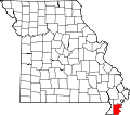
Fourteen Bend is an extinct town in Pemiscot County, in the U.S. state of Missouri. [1]

Pemiscot County, Missouri U.S. county in Missouri

Pemiscot County is a county located in the southeastern corner in the Bootheel in the U.S. state of Missouri, with the Mississippi River forming its eastern border. As of the 2010 census, the population was 18,296. The largest city and county seat is Caruthersville. The county was officially organized on February 19, 1851, and is named for the local bayou, taken from the Fox dialect word, pem-eskaw, meaning "liquid mud". This has been an area of cotton plantations and later other commodity crops.

U.S. state constituent political entity of the United States

In the United States, a state is a constituent political entity, of which there are currently 50. Bound together in a political union, each state holds governmental jurisdiction over a separate and defined geographic territory and shares its sovereignty with the federal government. Due to this shared sovereignty, Americans are citizens both of the federal republic and of the state in which they reside. State citizenship and residency are flexible, and no government approval is required to move between states, except for persons restricted by certain types of court orders.

Missouri U.S. state in the United States

Missouri is a state in the Midwestern United States. With over six million residents, it is the 18th-most populous state of the Union. The largest urban areas are St. Louis, Kansas City, Springfield and Columbia; the capital is Jefferson City. The state is the 21st-most extensive in area. Missouri is bordered by eight states : Iowa to the north, Illinois, Kentucky and Tennessee to the east, Arkansas to the south and Oklahoma, Kansas and Nebraska to the west. In the South are the Ozarks, a forested highland, providing timber, minerals and recreation. The Missouri River, after which the state is named, flows through the center of the state into the Mississippi River, which makes up Missouri's eastern border.

Fourteen Bend was so named on account of the community's location near the fourteenth major meander on the Mississippi River going downstream from Cairo, Illinois. [2]

Meander A sinuous bend in a series in the channel of a river

A meander is one of a series of regular sinuous curves, bends, loops, turns, or windings in the channel of a river, stream, or other watercourse. It is produced by a stream or river swinging from side to side as it flows across its floodplain or shifts its channel within a valley. A meander is produced by a stream or river as it erodes the sediments comprising an outer, concave bank and deposits this and other sediment downstream on an inner, convex bank which is typically a point bar. The result of sediments being eroded from the outside concave bank and their deposition on an inside convex bank is the formation of a sinuous course as a channel migrates back and forth across the down-valley axis of a floodplain. The zone within which a meandering stream shifts its channel across either its floodplain or valley floor from time to time is known as a meander belt. It typically ranges from 15 to 18 times the width of the channel. Over time, meanders migrate downstream, sometimes in such a short time as to create civil engineering problems for local municipalities attempting to maintain stable roads and bridges.

Mississippi River largest river system in North America

The Mississippi River is the second-longest river and chief river of the second-largest drainage system on the North American continent, second only to the Hudson Bay drainage system. Its source is Lake Itasca in northern Minnesota and it flows generally south for 2,320 miles (3,730 km) to the Mississippi River Delta in the Gulf of Mexico. With its many tributaries, the Mississippi's watershed drains all or parts of 32 U.S. states and two Canadian provinces between the Rocky and Appalachian mountains. The main stem is entirely within the United States; the total drainage basin is 1,151,000 sq mi (2,980,000 km2), of which only about one percent is in Canada. The Mississippi ranks as the fourth-longest and fifteenth-largest river by discharge in the world. The river either borders or passes through the states of Minnesota, Wisconsin, Iowa, Illinois, Missouri, Kentucky, Tennessee, Arkansas, Mississippi, and Louisiana.

Cairo, Illinois City in Illinois, United States

Cairo is the southernmost city in the U.S. state of Illinois, and is the county seat of Alexander County.

Related Research Articles

Canady is an extinct town in Pemiscot County, in the U.S. state of Missouri. A variant name was "Canady Switch".

Cunningham is an unincorporated community in Pemiscot County, in the U.S. state of Missouri.

Denton is an unincorporated community in Pemiscot County, in the U.S. state of Missouri.

Gibson is an unincorporated community in Pemiscot County, in the U.S. state of Missouri.

Ingram Ridge is an unincorporated community in Pemiscot County, in the U.S. state of Missouri.

New Survey is an unincorporated community in Pemiscot County, in the U.S. state of Missouri.

Shade is an unincorporated community in Pemiscot County, in the U.S. state of Missouri.

Yama is an unincorporated community in Pemiscot County, in the U.S. state of Missouri.

Braggadocio Township is an inactive township in Pemiscot County, in the U.S. state of Missouri.

Butler Township is an inactive township in Pemiscot County, in the U.S. state of Missouri.

Concord Township is an inactive township in Pemiscot County, in the U.S. state of Missouri.

Cooter Township is an inactive township in Pemiscot County, in the U.S. state of Missouri.

Godair Township is an inactive township in Pemiscot County, in the U.S. state of Missouri.

Hayti Township is an inactive township in Pemiscot County, in the U.S. state of Missouri.

Holland Township is an inactive township in Pemiscot County, in the U.S. state of Missouri.

Little Prairie Township is an inactive township in Pemiscot County, in the U.S. state of Missouri.

Little River Township is an inactive township in Pemiscot County, in the U.S. state of Missouri.

Pascola Township is an inactive township in Pemiscot County, in the U.S. state of Missouri.

Pemiscot Township is an inactive township in Pemiscot County, in the U.S. state of Missouri.

Virginia Township is an inactive township in Pemiscot County, in the U.S. state of Missouri.

References

  1. U.S. Geological Survey Geographic Names Information System: Fourteen Bend (historical)
  2. "Pemiscot County Place Names, 1928–1945". The State Historical Society of Missouri. Archived from the original on June 24, 2016. Retrieved November 29, 2016.

Coordinates: 36°16′49″N89°35′20″W / 36.2803449°N 89.5889669°W / 36.2803449; -89.5889669
Geographic coordinate system Coordinate system

A geographic coordinate system is a coordinate system that enables every location on Earth to be specified by a set of numbers, letters or symbols. The coordinates are often chosen such that one of the numbers represents a vertical position and two or three of the numbers represent a horizontal position; alternatively, a geographic position may be expressed in a combined three-dimensional Cartesian vector. A common choice of coordinates is latitude, longitude and elevation. To specify a location on a plane requires a map projection.