Westboro, Missouri

Last updated

Westboro, Missouri
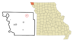
Atchison County Missouri Incorporated and Unincorporated areas Westboro Highlighted.svg
Location of Westboro, Missouri
Coordinates: 40°32′06″N95°19′16″W / 40.53500°N 95.32111°W / 40.53500; -95.32111
Country Flag of the United States.svg United States
State Flag of Missouri.svg  Missouri
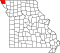
County Atchison
Township Lincoln
Area
[1]
  Total
0.25 sq mi (0.66 km2)
  Land0.25 sq mi (0.66 km2)
  Water0.00 sq mi (0.00 km2)
Elevation
[2]
1,001 ft (305 m)
Population
 (2020)
  Total
116
  Density458.50/sq mi (176.91/km2)
Time zone UTC-6 (Central (CST))
  Summer (DST) UTC-5 (CDT)
ZIP code
64498
Area code 660
FIPS code 29-78622 [3]
GNIS feature ID2397277 [2]

Westboro is a city in Lincoln Township, Atchison County, Missouri, United States. The population was 116 at the 2020 census. [4]

Contents

History

Westboro was laid out in 1881. [5] The name Westboro was selected by railroad officials. [6] A post office has been in operation at Westboro since 1881. [7]

Notable people

Merton F. Utter (1917–1980), a microbiologist and biochemist, was born in Westboro.

Geography

According to the United States Census Bureau, the city has a total area of 0.25 square miles (0.65 km2), all land. [8]

Demographics

Historical population
CensusPop.Note
1890 216
1900 30340.3%
1910 3339.9%
1920 311−6.6%
1930 35815.1%
1940 3682.8%
1950 297−19.3%
1960 262−11.8%
1970 234−10.7%
1980 188−19.7%
1990 182−3.2%
2000 163−10.4%
2010 141−13.5%
2020 116−17.7%
U.S. Decennial Census [9]

2010 census

As of the census [10] of 2010, there were 141 people, 56 households, and 39 families living in the city. The population density was 564.0 inhabitants per square mile (217.8/km2). There were 71 housing units at an average density of 284.0 per square mile (109.7/km2). The racial makeup of the city was 100.0% White. Hispanic or Latino of any race were 2.1% of the population.

There were 56 households, of which 32.1% had children under the age of 18 living with them, 55.4% were married couples living together, 8.9% had a female householder with no husband present, 5.4% had a male householder with no wife present, and 30.4% were non-families. 23.2% of all households were made up of individuals, and 7.2% had someone living alone who was 65 years of age or older. The average household size was 2.52 and the average family size was 3.03.

The median age in the city was 40.5 years. 22.7% of residents were under the age of 18; 9.2% were between the ages of 18 and 24; 29% were from 25 to 44; 25.6% were from 45 to 64; and 13.5% were 65 years of age or older. The gender makeup of the city was 50.4% male and 49.6% female.

2000 census

As of the census [3] of 2000, there were 163 people, 66 households, and 47 families living in the city. The population density was 808.8 inhabitants per square mile (312.3/km2). There were 80 housing units at an average density of 396.9 per square mile (153.2/km2). The racial makeup of the city was 95.71% White, 3.07% from other races, and 1.23% from two or more races. Hispanic or Latino of any race were 4.29% of the population.

There were 66 households, out of which 37.9% had children under the age of 18 living with them, 60.6% were married couples living together, 10.6% had a female householder with no husband present, and 27.3% were non-families. 25.8% of all households were made up of individuals, and 9.1% had someone living alone who was 65 years of age or older. The average household size was 2.47 and the average family size was 2.98.

In the city the population was spread out, with 31.3% under the age of 18, 3.1% from 18 to 24, 28.2% from 25 to 44, 24.5% from 45 to 64, and 12.9% who were 65 years of age or older. The median age was 36 years. For every 100 females, there were 81.1 males. For every 100 females age 18 and over, there were 83.6 males.

The median income for a household in the city was $31,563, and the median income for a family was $32,813. Males had a median income of $23,750 versus $16,563 for females. The per capita income for the city was $12,466. About 7.3% of families and 8.4% of the population were below the poverty line, including 14.3% of those under the age of eighteen and none of those 65 or over.
Education

It is in the Tarkio R-I School District. [11]

The Westboro R-IV school district served the children of Westboro from 1882 to 1995. Westboro High school closed in 1967 and the district began to send High school students to Tarkio. The following year Westboro began to send junior high students to Tarkio as well. The district maintained a K-6 program until 1995 when the district voted to be annexed by Tarkio due to financial issues.

Related Research Articles

<span class="mw-page-title-main">Holt County, Missouri</span> County in Missouri, United States

Holt County is a county located in the northwestern portion of the U.S. state of Missouri. As of the 2020 census, the population was 4,223. Its county seat is Oregon. The county was organized February 15, 1841. Originally named Nodaway County, it was soon renamed for David Rice Holt (1803–1840), a Missouri state legislator from Platte County.

<span class="mw-page-title-main">Atchison County, Missouri</span> County in Missouri, United States

Atchison County is the northwesternmost county in the U.S. state of Missouri. As of the 2020 census, the county had a population of 5,305. Its county seat is Rock Port. It was originally known as Allen County when it was detached from Holt County in 1843. The county was officially organized on February 14, 1845, and named for U.S. Senator David Rice Atchison from Missouri.

<span class="mw-page-title-main">Blanchard, Iowa</span> City in Iowa, United States

Blanchard is a city in Page County, Iowa, United States. The population was 29 at the 2020 census.

<span class="mw-page-title-main">Webber, Kansas</span> City in Jewell County, Kansas

Webber is a city in Jewell County, Kansas, United States. As of the 2020 census, the population of the city was 30.

<span class="mw-page-title-main">Fairfax, Missouri</span> City in Missouri

Fairfax is a city in Clark Township, Atchison County, Missouri, United States. The population was 648 at the 2020 census.

<span class="mw-page-title-main">Rock Port, Missouri</span> City in Missouri, United States

Rock Port is a city in, and the county seat of, Atchison County, Missouri, United States. The population was 1,278 at the 2020 census.

<span class="mw-page-title-main">Tarkio, Missouri</span> City in Missouri

Tarkio is a city in Tarkio Township, Atchison County, Missouri, United States. The population was 1,506 at the 2020 census. It was platted in 1880 and incorporated in 1881. The name "Tarkio" is derived from the Meskwaki language meaning "place where walnuts grow".

<span class="mw-page-title-main">Watson, Missouri</span> Village in Missouri

Watson is a village in Nishnabotna Township, Atchison County, Missouri, United States. The population was 61 at the 2020 census. It is the westernmost settlement in the state of Missouri, about 120 miles northwest of Kansas City.

<span class="mw-page-title-main">Norborne, Missouri</span> City in Missouri, United States

Norborne is a city in southwest Carroll County, Missouri, United States. The population was 634 at the 2020 census.

<span class="mw-page-title-main">Belton, Missouri</span> City in Missouri, US

Belton is a city in northwestern Cass County, Missouri, United States. The population was 23,953 at the 2020 census. It is a part of the Kansas City metropolitan area.

<span class="mw-page-title-main">Wyaconda, Missouri</span> City in Missouri, United States

Wyaconda is a city in Clark County, Missouri, United States. As of the 2020 census, its population was 214. The city was organized in 1888 and is named after a Siouan name for God or the Great Spirit. The first land purchased from the Santa Fe and Land Co. was in 1888.

<span class="mw-page-title-main">Liberty, Missouri</span> City in Missouri, United States

Liberty is a city in and the county seat of Clay County, Missouri, United States and is a suburb of Kansas City, located in the Kansas City Metropolitan Area. As of the 2020 United States Census the population was 30,167. Liberty is home to William Jewell College.

<span class="mw-page-title-main">Missouri City, Missouri</span> City in Missouri, United States

Missouri City is a city in Clay County, Missouri, United States. The population was 217 at the 2020 census. It is part of the Kansas City metropolitan area.

<span class="mw-page-title-main">Craig, Missouri</span> City in Missouri, United States

Craig is a city in northwestern Holt County, Missouri, United States. The population was 105 at the 2020 census.

<span class="mw-page-title-main">Elmer, Missouri</span> City in Missouri, United States

Elmer is a city in Macon County, Missouri, United States. The population was 51 at the 2020 census, down from 80 in 2010.

<span class="mw-page-title-main">Ethel, Missouri</span> Town in Missouri, United States

Ethel is a town in Macon County, Missouri, United States. The population was 41 at the 2020 census, down from 62 in 2010.

<span class="mw-page-title-main">Burlington Junction, Missouri</span> City in Missouri, United States

Burlington Junction is a city in northwestern Nodaway County, Missouri, United States. The population was 521 at the 2020 census and is the second largest city in the county by population.

<span class="mw-page-title-main">Elmo, Missouri</span> City in Missouri, United States

Elmo is a city in Nodaway County, Missouri, United States. The population was 168 at the 2010 census.

<span class="mw-page-title-main">South Gorin, Missouri</span> City in Missouri, United States

South Gorin is a city located in Scotland County, Missouri, United States. As of the 2020 census, its population was 62. The original name of the city was simply "Gorin", and it was changed. The official name for the post office in South Gorin is still Gorin.

<span class="mw-page-title-main">Marceline, Missouri</span> City in Missouri, United States

Marceline is a city in Chariton and Linn counties in the U.S. state of Missouri. The population was 2,123 at the 2020 census.

References

  1. "ArcGIS REST Services Directory". United States Census Bureau. Retrieved August 28, 2022.
  2. 1 2 U.S. Geological Survey Geographic Names Information System: Westboro, Missouri
  3. 1 2 "U.S. Census website". United States Census Bureau . Retrieved January 31, 2008.
  4. "Explore Census Data". data.census.gov. Retrieved December 16, 2021.
  5. Eaton, David Wolfe (1916). How Missouri Counties, Towns and Streams Were Named. The State Historical Society of Missouri. p. 203.
  6. "Atchison County Place Names, 1928-1945 (archived)". The State Historical Society of Missouri. Archived from the original on June 24, 2016. Retrieved August 30, 2016.
  7. "Post Offices". Jim Forte Postal History. Retrieved August 30, 2016.
  8. "US Gazetteer files 2010". United States Census Bureau . Retrieved July 8, 2012.
  9. "Census of Population and Housing". Census.gov. Retrieved June 4, 2015.
  10. "U.S. Census website". United States Census Bureau . Retrieved July 8, 2012.
  11. "2020 CENSUS - SCHOOL DISTRICT REFERENCE MAP: Atchison County, MO" (PDF). U.S. Census Bureau . Retrieved December 15, 2024. - Text list