Excelsior | |
---|---|
Company Town | |
Excelsior, Atchison County, Missouri | |
Country | United States |
State | Missouri |
County | Atchison |
Founded | 1857 |
Movement of Wheel Mill | 1867 |
Named for | The Excelsior Wheel Mill |
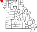
Excelsior is an extinct town in Atchison County, in the U.S. state of Missouri. The GNIS classifies it as a populated place. [1] It was founded in 1857. It was located in the southwest section of Benton Township section 21. [2]
The community took its name from the Excelsior Wheel Mill on the Missouri River. [3] Besides the mill, the community contained a schoolhouse. [4]
In 1869, the Excelsior wheel took the place of an overshot mill in section 33 of Benton Toiwnship, and eight years afterwards, in 1877, a turbine wheel was added. The average grinding capacity of this mill was eighty bushels per day with the new mill at that location. Nothing stands at the original location as the wheel was removed leaving only a dilapidated frame of the wheel house as reported in 1881. [2]
The Nishnabotna River is a tributary of the Missouri River in southwestern Iowa, northwestern Missouri and southeastern Nebraska in the United States. It flows for most of its length as two parallel streams in Iowa, the East Nishnabotna River and the West Nishnabotna River. The east and west branches are each about 120 miles (190 km) long; from their confluence the Nishnabotna flows approximately another 16 miles (26 km).
Langdon is an unincorporated community in Atchison County, Missouri, United States. It is located about six miles southwest of Rock Port. Its post office has closed and mail is now delivered through Fairfax.
Benton Township is one of eleven townships in Atchison County, Missouri, United States. As of the 2010 census, its population was 23.
Benton Township is one of thirteen townships in Fremont County, Iowa, United States. As of the 2010 census, its population was 254 and it contained 122 housing units.
Oak Mills is an unincorporated community in Atchison County, Kansas, United States.
Troy Mills is an unincorporated community in Adair County, in the U.S. state of Missouri.
Cow Branch is a stream in Atchison County in the U.S. state of Missouri.
Dotham is an unincorporated community in Atchison County, in the U.S. state of Missouri.
Linden is an unincorporated community in Atchison County, in the U.S. state of Missouri.
McElroy Creek is a stream in the U.S. states of Iowa and Missouri. It is a tributary of High Creek.
Milton is an unincorporated community in Atchison County, in the U.S. state of Missouri.
Nishnabotna is an extinct town in Atchison County, in the U.S. state of Missouri. The GNIS classifies it as a populated place.
Oswald is an extinct town in Atchison County, in the U.S. state of Missouri. The GNIS classifies it as a populated place.
Rock Creek is a stream in Fremont County, Iowa and Atchison County, Missouri in the United States. It is a tributary of the Missouri River.
Sonora is an extinct town in Atchison County, in the U.S. state of Missouri. The GNIS classifies it as a populated place.
York is an unincorporated community in Atchison County, in the U.S. state of Missouri.
Winthrop is an unincorporated community in southwest Buchanan County, in the U.S. state of Missouri. The community is just east of the Missouri River and Atchison, Kansas on US Route 59 and Missouri routes 45 and 273. Rushville is approximately 4.5 miles northeast on US Route 59 and Lewis and Clark Village adjacent to the Louis and Clark State Park and lake is 3.5 miles southeast.
Dumas is an unincorporated community in Clark County, in the U.S. state of Missouri. The community was located along the banks of Dumas Creek just west (upstream) of the confluence with the Des Moines River. The Atchison, Topeka and Santa Fe Railroad line was adjacent to the community site. Revere lies to the southwest of the location and Argyle, Iowa lies to the northeast along the rail line.
Atchison Township is a township in Nodaway County, in the U.S. state of Missouri.
Washington Township is an inactive township in Ripley County, in the U.S. state of Missouri.
40°19′27″N95°37′20″W / 40.3242°N 95.6222°W