Langdon, Missouri

Last updated

MOMap-doton-Langdon.png

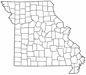
Langdon is an unincorporated community in Atchison County, Missouri, United States. [1] It is located about six miles southwest of Rock Port. Its post office has closed and mail is now delivered through Fairfax.

Langdon was laid out in 1880. [2] The community was named after John Langdon, a railroad official. [3] A post office called Langdon was established in 1880, and remained in operation until 1979. [4]

The Thompson–Campbell Farmstead was listed on the National Register of Historic Places in 2003. [5]

Related Research Articles

<span class="mw-page-title-main">Quincy, Missouri</span> Unincorporated community in Missouri, U.S.

Quincy is a small unincorporated community in northwestern Hickory County, Missouri, United States. It is located on Route 83, north of U.S. Route 54. A post office and a few homes are located there.

Davisville is an unincorporated community in southeastern Crawford County, Missouri, United States. It is located in the Mark Twain National Forest, approximately 13 miles southeast of Steelville.

<span class="mw-page-title-main">Reger, Missouri</span> Unincorporated community in the American state of Missouri

Reger is an unincorporated community in Sullivan County, Missouri, United States. It is located along Missouri Route 6, approximately six miles southwest of Milan. Locust Creek flows past just to the east.

Phelps City is a census-designated place and unincorporated community in Atchison County, Missouri, United States. As of the 2020 census, its population was 0, down from 24 in 2010. The community is 5 miles (8.0 km) west of Rock Port. It is the closest Missouri community to Brownville Bridge, a Missouri River crossing that is listed on the National Register of Historic Places.

Osage City is an unincorporated community in Cole County, in the U.S. state of Missouri.

Roanoke is an unincorporated community in Howard and Randolph counties, in the U.S. state of Missouri.

Monrovia is an unincorporated community in Atchison County, Kansas, United States. Monrovia is located at 39°31′27″N95°20′46″W.

Oak Mills is an unincorporated community in Atchison County, Kansas, United States.

Port Williams is an unincorporated community in Atchison County, Kansas, United States.

Dotham is an unincorporated community in Atchison County, in the U.S. state of Missouri.

<span class="mw-page-title-main">Excelsior, Atchison County, Missouri</span> Company Town in Missouri

Excelsior is an extinct town in Atchison County, in the U.S. state of Missouri. The GNIS classifies it as a populated place. It was founded in 1857. It was located in the southwest section of Benton Township section 21.

Linden is an unincorporated community in Atchison County, in the U.S. state of Missouri.

Milton is an unincorporated community in Atchison County, in the U.S. state of Missouri.

Nishnabotna is an extinct town in Atchison County, in the U.S. state of Missouri. The GNIS classifies it as a populated place.

Oswald is an extinct town in Atchison County, in the U.S. state of Missouri. The GNIS classifies it as a populated place.

Sonora is an extinct town in Atchison County, in the U.S. state of Missouri. The GNIS classifies it as a populated place.

York is an unincorporated community in Atchison County, in the U.S. state of Missouri.

Winthrop is an unincorporated community in southwest Buchanan County, in the U.S. state of Missouri. The community is just east of the Missouri River and Atchison, Kansas on US Route 59 and Missouri routes 45 and 273. Rushville is approximately 4.5 miles northeast on US Route 59 and Lewis and Clark Village adjacent to the Louis and Clark State Park and lake is 3.5 miles southeast.

Dawsonville is an unincorporated community in Nodaway County, in the U.S. state of Missouri.

Busch is an extinct town in Pike County, in the U.S. state of Missouri. The GNIS classifies it as a populated place.

References

  1. U.S. Geological Survey Geographic Names Information System: Langdon, Missouri
  2. Eaton, David Wolfe (1916). How Missouri Counties, Towns and Streams Were Named. The State Historical Society of Missouri. pp.  203.
  3. "Atchison County Place Names, 1928-1945 (archived)". The State Historical Society of Missouri. Archived from the original on June 24, 2016. Retrieved August 30, 2016.{{cite web}}: CS1 maint: bot: original URL status unknown (link)
  4. "Post Offices". Jim Forte Postal History. Retrieved August 30, 2016.
  5. "National Register Information System". National Register of Historic Places . National Park Service. July 9, 2010.

40°21′23″N95°34′47″W / 40.35639°N 95.57972°W / 40.35639; -95.57972