Center Grove, Missouri

Last updated

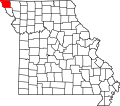
Center Grove is an extinct town in Atchison County, in the U.S. state of Missouri. The GNIS classifies it as a populated place, but the precise location of the town site is unknown. [1]

A post office called Center Grove was established in 1858, and remained in operation until 1866. [2] The community was named for its location at the geographical center of Lincoln Township. [3]

Related Research Articles

<span class="mw-page-title-main">Holt County, Missouri</span> County in Missouri, United States

Holt County is a county located in the northwestern portion of the U.S. state of Missouri. As of the 2020 census, the population was 4,223. Its county seat is Oregon. The county was organized February 15, 1841. Originally named Nodaway County, it was soon renamed for David Rice Holt (1803–1840), a Missouri state legislator from Platte County.

<span class="mw-page-title-main">Langdon, Missouri</span> Unincorporated community in Missouri, U.S.

Langdon is an unincorporated community in Atchison County, Missouri, United States. It is located about six miles southwest of Rock Port. Its post office has closed and mail is now delivered through Fairfax.

Center Point is an extinct town in Atchison County, in the U.S. state of Missouri. The GNIS classifies it as a populated place, but the precise location of the town site is unknown.

Cow Branch is a stream in Atchison County in the U.S. state of Missouri.

Dotham is an unincorporated community in Atchison County, in the U.S. state of Missouri.

Elk Dale is an extinct town in Atchison County, in the U.S. state of Missouri. The GNIS classifies it as a populated place, but the precise location of the town site is unknown.

<span class="mw-page-title-main">Excelsior, Atchison County, Missouri</span> Company Town in Missouri

Excelsior is an extinct town in Atchison County, in the U.S. state of Missouri. The GNIS classifies it as a populated place. It was founded in 1857. It was located in the southwest section of Benton Township section 21.

Linden is an unincorporated community in Atchison County, in the U.S. state of Missouri.

McElroy Creek is a stream in the U.S. states of Iowa and Missouri. It is a tributary of High Creek.

Milton is an unincorporated community in Atchison County, in the U.S. state of Missouri.

Nishnabotna is an extinct town in Atchison County, in the U.S. state of Missouri. The GNIS classifies it as a populated place.

Oswald is an extinct town in Atchison County, in the U.S. state of Missouri. The GNIS classifies it as a populated place.

Rock Creek is a stream in Fremont County, Iowa and Atchison County, Missouri in the United States. It is a tributary of the Missouri River.

Scott City is an extinct town in Atchison County, in the U.S. state of Missouri. The GNIS classifies it as a populated place, but the precise location of the town site is unknown.

Sonora is an extinct town in Atchison County, in the U.S. state of Missouri. The GNIS classifies it as a populated place.

York is an unincorporated community in Atchison County, in the U.S. state of Missouri.

Kings Grove is an extinct town in northeastern Holt County, in the U.S. state of Missouri.

Atchison Township is a township in northwestern Nodaway County, in the U.S. state of Missouri. It contains about 55 sections of land. The town of Clearmont lies in its center.

Lincoln Township is a township in northwestern Nodaway County, in the U.S. state of Missouri. It contains about 68 sections. It's bounded on the east by the Nodaway River and contains one town, Elmo which lies in the center. Dawsonville was a hamlet that existed in its southeast 2.5 miles northwest of Burlington Junction.

Nodaway Township is a township in northwestern Nodaway County, in the U.S. state of Missouri. It contains 46 sections of land and is bounded on the west by the Nodaway River. The town of Burlington Junction is located west of center in the township and Wilcox lies in its southeast.

References

  1. U.S. Geological Survey Geographic Names Information System: Center Grove, Missouri
  2. "Post Offices". Jim Forte Postal History. Archived from the original on March 6, 2016. Retrieved August 30, 2016.
  3. "Atchison County Place Names, 1928-1945 (archived)". The State Historical Society of Missouri. Archived from the original on June 24, 2016. Retrieved August 30, 2016.{{cite web}}: CS1 maint: bot: original URL status unknown (link)

40°31′28″N95°19′02″W / 40.52433°N 95.31712°W / 40.52433; -95.31712 <--Educated guess-->