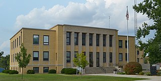
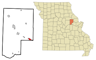
Montgomery County is a county in the east central part of the U.S. state of Missouri. As of the 2020 census, the population was 11,322. Its county seat is Montgomery City. The county was named in honor of Richard Montgomery, an American Revolutionary War general killed in 1775 while attempting to capture Quebec City, Canada.
Floyd is a city in Floyd County, Iowa, United States. The population was 313 at the time of the 2020 census.

Middletown is an independent, home rule-class city in Jefferson County, Kentucky, United States, and a former neighborhood of Louisville. The population was 7,218 at the 2010 census.
Rocheport is a city in Boone County, Missouri, United States. It is part of the Columbia, Missouri Metropolitan Statistical Area. The population was 239 at the 2010 census. Rocheport includes the Rocheport Historic District, an area with buildings dating from 1830 and which is listed on the National Register of Historic Places.

Kahoka is a city in and the county seat of Clark County, in the northeast tip of Missouri, United States. As of the 2020 census, its population was 1,961.

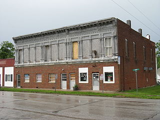
Chain of Rocks is a village in Lincoln County, Missouri, United States. The population was 93 at the 2010 census.

Old Monroe is a city in Lincoln County, Missouri, United States. The population was 249 at the 2020 census.

Troy is a city in Lincoln County, Missouri, United States. As of 2019, the estimated population was 12,820. It is the county seat of Lincoln County. Troy is an exurb of St. Louis, and is part of the St. Louis Metropolitan Statistical Area.

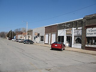
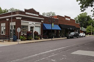
Bellflower is a city in Montgomery County, Missouri, United States. The population was 325 at the 2020 census, down from 393 in 2010.

High Hill is a city in Montgomery County, Missouri, United States. The population was 186 at the 2020 census.
Jonesburg is a city in Montgomery County, Missouri, United States. The population was 726 at the 2020 census.

McKittrick is a city in Montgomery County, Missouri, United States. The population was 77 at the 2020 census.
New Florence is a city in Montgomery County, Missouri, United States. The population was 641 at the 2020 census, down from 769 in 2010.

Wellsville is a city in Montgomery County, Missouri, United States. The population was 998 at the 2020 census.

Greendale is a city in St. Louis County, Missouri, United States. The population was 651 at the 2010 census.

Moscow Mills is a city in Lincoln County, Missouri, United States. The population was 2,509 at the 2010 census.

Montgomery City is a city in and the county seat of Montgomery County, Missouri, United States. The population was 2,811 at the 2020 census.

North Middletown is an unincorporated community and census-designated place (CDP) within Middletown Township, in Monmouth County, in the U.S. state of New Jersey. As of the 2010 United States Census, the CDP's population was 3,295.

Carlisle is a city in northwestern Warren and southern Montgomery counties in the southwestern part of the U.S. state of Ohio. The city is in Franklin Township, Warren County, Ohio and German Township, Montgomery County, Ohio.
Kingston is a town in Green Lake County, Wisconsin, United States. The population was 900 at the 2000 census. The Village of Kingston and the unincorporated community of Dalton are located within the town.

