Moscow Mills, Missouri

Last updated
Moscow Mills, Missouri
Lincoln County Missouri Incorporated and Unincorporated areas Moscow Mills Highlighted.svg
Location of Moscow Mills, Missouri
Coordinates: 38°56′24″N90°55′31″W / 38.94000°N 90.92528°W / 38.94000; -90.92528 Coordinates: 38°56′24″N90°55′31″W / 38.94000°N 90.92528°W / 38.94000; -90.92528 [1]
Country United States
State Missouri
County Lincoln
Government
   Mayor Patrick Flannigan
Area
[2]
  Total3.16 sq mi (8.18 km2)
  Land3.15 sq mi (8.16 km2)
  Water0.01 sq mi (0.02 km2)
Elevation
[1]
538 ft (164 m)
Population
 (2020)
  Total3,317
  Density1,053.02/sq mi (406.55/km2)
Time zone UTC-6 (Central (CST))
  Summer (DST) UTC-5 (CDT)
ZIP code
63362
Area code 636
FIPS code 29-50204 [3]
GNIS feature ID2395417 [1]
Website moscowmillsmo.com

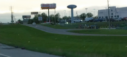
Moscow Mills is a city in Lincoln County, Missouri, United States. The population was 2,509 at the 2010 census.

Contents

History

Moscow Mills was laid out in 1821, and named for a watermill of the same name near the original town site. [4]

The Old Rock House was listed on the National Register of Historic Places in 1972. [5]

Geography

Moscow Mills is located on the west bank of the Cuivre River just east of U.S. Route 61 on Missouri Route C. Troy is approximately 3.25 miles to the northwest on Route 61. [6]

According to the United States Census Bureau, the city has a total area of 3.14 square miles (8.13 km2), of which 3.12 square miles (8.08 km2) is land and 0.02 square miles (0.05 km2) is water. [7]

Demographics

Historical population
CensusPop.Note
1910 395
1920 348−11.9%
1930 3788.6%
1940 347−8.2%
1950 3500.9%
1960 3602.9%
1970 39910.8%
1980 48421.3%
1990 92490.9%
2000 1,74288.5%
2010 2,50944.0%
2020 3,31732.2%
U.S. Decennial Census [8]

2010 census

As of the census [9] of 2010, there were 2,509 people, 873 households, and 641 families living in the city. The population density was 804.2 inhabitants per square mile (310.5/km2). There were 979 housing units at an average density of 313.8 per square mile (121.2/km2). The racial makeup of the city was 91.6% White, 3.7% African American, 0.1% Native American, 0.4% Asian, 0.9% from other races, and 3.1% from two or more races. Hispanic or Latino of any race were 2.0% of the population.

There were 873 households, of which 45.6% had children under the age of 18 living with them, 44.6% were married couples living together, 22.8% had a female householder with no husband present, 6.1% had a male householder with no wife present, and 26.6% were non-families. 20.5% of all households were made up of individuals, and 5.2% had someone living alone who was 65 years of age or older. The average household size was 2.82 and the average family size was 3.21.

The median age in the city was 30.7 years. 32.4% of residents were under the age of 18; 9.1% were between the ages of 18 and 24; 28% were from 25 to 44; 21.6% were from 45 to 64; and 8.9% were 65 years of age or older. The gender makeup of the city was 48.3% male and 51.7% female.

2000 census

As of the census [3] of 2000, there were 1,742 people, 609 households, and 453 families living in the city. The population density was 929.3 inhabitants per square mile (358.8/km2). There were 692 housing units at an average density of 369.2 per square mile (142.5/km2). The racial makeup of the city was 94.32% White, 3.16% African American, 0.34% Native American, 0.11% Asian, 0.29% from other races, and 1.78% from two or more races. Hispanic or Latino of any race were 0.92% of the population.

There were 609 households, out of which 45.8% had children under the age of 18 living with them, 47.5% were married couples living together, 19.0% had a female householder with no husband present, and 25.6% were non-families. 18.4% of all households were made up of individuals, and 3.4% had someone living alone who was 65 years of age or older. The average household size was 2.86 and the average family size was 3.21.

In the city the population was spread out, with 34.4% under the age of 18, 11.1% from 18 to 24, 35.1% from 25 to 44, 14.4% from 45 to 64, and 5.1% who were 65 years of age or older. The median age was 28 years. For every 100 females, there were 94.4 males. For every 100 females age 18 and over, there were 90.5 males.

The median income for a household in the city was $37,067, and the median income for a family was $42,083. Males had a median income of $30,264 versus $21,667 for females. The per capita income for the city was $14,555. About 5.3% of families and 8.7% of the population were below the poverty line, including 8.9% of those under age 18 and 8.7% of those age 65 or over.
Education

The Lincoln County R-III School District serves Moscow Mills.

Related Research Articles

<span class="mw-page-title-main">Mindenmines, Missouri</span> City in Missouri, United States

Mindenmines is a city in Barton County, Missouri, United States. The population was 271 at the 2020 census. The city lies approximately four miles east of Frontenac, Kansas. It has possessed a post office since 1883. It is also the home of the Bank of Minden..

<span class="mw-page-title-main">Bogard, Missouri</span> City in Missouri, United States

Bogard is a city in Carroll County, Missouri, United States. The population was 167 at the 2020 census.

<span class="mw-page-title-main">Pilot Grove, Missouri</span> City in Missouri, United States

Pilot Grove is a city in the Pilot Grove Township in northern Cooper County, Missouri, United States. The population was 768 at the 2010 census.

<span class="mw-page-title-main">Montrose, Missouri</span> City in Missouri, United States

Montrose is a city in Henry County, Missouri, United States. The population was 384 at the 2010 census.

<span class="mw-page-title-main">Jasper, Missouri</span> City in Missouri, United States

Jasper is a city in Jasper County, Missouri, United States. The population within the city limits was 931 at the 2010 census. It is part of the Joplin, Missouri Metropolitan Statistical Area.

<span class="mw-page-title-main">Oronogo, Missouri</span> City in Missouri, United States

Oronogo is a city in Jasper County, Missouri, United States. The population was 2,558 at the 2020 census. It is part of the Joplin, Missouri Metropolitan Statistical Area.

<span class="mw-page-title-main">Byrnes Mill, Missouri</span> City in Missouri, United States

Byrnes Mill is a city in northern Jefferson County, Missouri, United States and is a suburb of St. Louis. The population was 3,173 at the 2020 census.

<span class="mw-page-title-main">Gravois Mills, Missouri</span> Village in Missouri, United States

Gravois Mills is a village in Morgan County, Missouri, United States. The population was 144 at the 2010 census.

<span class="mw-page-title-main">Freeburg, Missouri</span> Village in Missouri, United States

Freeburg is a village in Osage County, Missouri, United States. The population was 409 at the 2020 census. It is part of the Jefferson City, Missouri Metropolitan Statistical Area.

<span class="mw-page-title-main">New London, Missouri</span> City in Missouri, United States

New London is a city in Ralls County, Missouri, United States. The population was 943 at the 2020 census. It is the county seat of Ralls County.

<span class="mw-page-title-main">Country Club Hills, Missouri</span> City in Missouri, United States

Country Club Hills is a city in St. Louis County, Missouri, United States. The population was 1,274 at the 2010 census.

<span class="mw-page-title-main">Bloomsdale, Missouri</span> City in Missouri, United States

Bloomsdale is a city in Ste. Genevieve County, Missouri, United States. The population was 639 at the 2020 census.

<span class="mw-page-title-main">Hurley, Missouri</span> City in Missouri, United States

Hurley is a city in Stone County, Missouri, United States. The population was 176 at the 2020 census. It is part of the Branson, Missouri Micropolitan Statistical Area.

<span class="mw-page-title-main">Mill Spring, Missouri</span> Village in Missouri, United States

Mill Spring is a village in Wayne County, Missouri, United States, along the Black River. The population was 159 at the 2020 census.

<span class="mw-page-title-main">Lake Annette, Missouri</span> City in Missouri, United States

Lake Annette is a city in Cass County, Missouri, United States. The population was 100 at the 2010 census. It is part of the Kansas City metropolitan area.

<span class="mw-page-title-main">Prairie Home, Missouri</span> City in Missouri, United States

Prairie Home is a town, with legal status as a city, in Cooper County, Missouri, United States. The population was 280 at the 2010 census.

<span class="mw-page-title-main">Galt, Missouri</span> City in Missouri, United States

Galt is a city in eastern Grundy County, Missouri, United States. The population was 168 at the 2020 census.

<span class="mw-page-title-main">Moline Acres, Missouri</span> City in Missouri, United States

Moline Acres is a city in St. Louis County, Missouri, United States. The population was 2,442 at the 2010 census.

<span class="mw-page-title-main">Marthasville, Missouri</span> City in Missouri, United States

Marthasville is a city in Warren County, Missouri, United States. The population was 1,136 at the 2010 census. The Katy Trail, a 225-mile long bike path, passes through Marthasville.

<span class="mw-page-title-main">Gower, Missouri</span> City in Missouri, United States

Gower is a city in Buchanan and Clinton counties in the U.S. state of Missouri and is part of the Kansas City metropolitan area. The population was 1,526 at the 2010 census.

References

  1. 1 2 3 U.S. Geological Survey Geographic Names Information System: Moscow Mills, Missouri
  2. "ArcGIS REST Services Directory". United States Census Bureau. Retrieved August 28, 2022.
  3. 1 2 "U.S. Census website". United States Census Bureau . Retrieved 2008-01-31.
  4. "Lincoln County Place Names, 1928–1945 (archived)". The State Historical Society of Missouri. Archived from the original on 24 June 2016. Retrieved 26 October 2016.{{cite web}}: CS1 maint: bot: original URL status unknown (link)
  5. "National Register Information System". National Register of Historic Places . National Park Service. March 13, 2009.
  6. Missouri Atlas & Gazetteer, DeLorme, 1st ed., 1998, p. 31, ISBN   0899332242
  7. "US Gazetteer files 2010". United States Census Bureau. Archived from the original on 2012-07-02. Retrieved 2012-07-08.
  8. "Census of Population and Housing". Census.gov. Retrieved June 4, 2015.
  9. "U.S. Census website". United States Census Bureau . Retrieved 2012-07-08.