Calverton Park, Missouri | |
---|---|
Coordinates: 38°45′56″N90°18′37″W / 38.76556°N 90.31028°W | |
Country | United States |
State | Missouri |
County | St. Louis |
Government | |
• Type | Board of Trustees |
• Mayor | James A. Paunovich |
• Clerk | Jeanne King Blanton |
Area | |
• Total | 0.41 sq mi (1.08 km2) |
• Land | 0.41 sq mi (1.07 km2) |
• Water | 0.00 sq mi (0.01 km2) |
Elevation | 597 ft (182 m) |
Population (2020) | |
• Total | 1,143 |
• Density | 2,781.02/sq mi (1,072.79/km2) |
Time zone | UTC-6 (Central (CST)) |
• Summer (DST) | UTC-5 (CDT) |
ZIP code | 63135 |
Area code | 314 |
FIPS code | 29-10612 [3] |
GNIS feature ID | 2397535 [2] |
Website | http://www.calvertonparkmo.com / Village of Calverton Park |
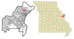
Calverton Park is a city in St. Louis County, Missouri, United States. The population was 1,293 at the 2010 census. [4] The Village of Calverton Park incorporated as the City of Calverton Park in 2014. [5]
According to the United States Census Bureau, the city has a total area of 0.41 square miles (1.06 km2), all land. [6]
Calverton Park is surrounded by three other St. Louis County municipalities: Ferguson, Florissant and Hazelwood. [7]
Census | Pop. | Note | %± |
---|---|---|---|
1940 | 139 | — | |
1950 | 514 | 269.8% | |
1960 | 1,714 | 233.5% | |
1970 | 2,025 | 18.1% | |
1980 | 1,717 | −15.2% | |
1990 | 1,404 | −18.2% | |
2000 | 1,322 | −5.8% | |
2010 | 1,293 | −2.2% | |
2020 | 1,143 | −11.6% | |
U.S. Decennial Census [8] |
Race / Ethnicity (NH = Non-Hispanic) | Pop 2000 [9] | Pop 2010 [10] | Pop 2020 [11] | % 2000 | % 2010 | % 2020 |
---|---|---|---|---|---|---|
White alone (NH) | 984 | 682 | 434 | 74.43% | 52.75% | 37.97% |
Black or African American alone (NH) | 294 | 536 | 605 | 22.24% | 41.45% | 52.93% |
Native American or Alaska Native alone (NH) | 3 | 2 | 0 | 0.23% | 0.15% | 0.00% |
Asian alone (NH) | 4 | 12 | 16 | 0.30% | 0.93% | 1.40% |
Pacific Islander alone (NH) | 0 | 0 | 0 | 0.00% | 0.00% | 0.00% |
Other Race alone (NH) | 1 | 0 | 4 | 0.08% | 0.00% | 0.35% |
Mixed race or Multiracial (NH) | 25 | 24 | 58 | 1.89% | 1.86% | 5.07% |
Hispanic or Latino (any race) | 11 | 37 | 26 | 0.83% | 2.86% | 2.27% |
Total | 1,322 | 1,293 | 1,143 | 100.00% | 100.00% | 100.00% |
At the 2010 census there were 1,293 people, 496 households, and 347 families living in the village. The population density was 3,153.7 inhabitants per square mile (1,217.7/km2). There were 540 housing units at an average density of 1,317.1 per square mile (508.5/km2). The racial makup of the village was 53.4% White, 42.2% African American, 0.2% Native American, 0.9% Asian, 1.1% from other races, and 2.2% from two or more races. Hispanic or Latino of any race were 2.9%. [12]
Of the 496 households 35.3% had children under the age of 18 living with them, 39.9% were married couples living together, 24.4% had a female householder with no husband present, 5.6% had a male householder with no wife present, and 30.0% were non-families. 24.4% of households were one person and 9% were one person aged 65 or older. The average household size was 2.61 and the average family size was 3.08.
The median age in the village was 36.4 years. 25.2% of residents were under the age of 18; 9.1% were between the ages of 18 and 24; 27.4% were from 25 to 44; 26.2% were from 45 to 64; and 12.1% were 65 or older. The gender makeup of the village was 47.2% male and 52.8% female.
At the 2000 census there were 1,322 people, 494 households, and 345 families living in the village. The population density was 3,154.5 inhabitants per square mile (1,218.0/km2). There were 521 housing units at an average density of 1,243.2 per square mile (480.0/km2). The racial makup of the village was 74.96% White, 22.24% African American, 0.23% Native American, 0.30% Asian, 0.30% from other races, and 1.97% from two or more races. Hispanic or Latino of any race were 0.83%. [3]
Of the 494 households 34.2% had children under the age of 18 living with them, 47.6% were married couples living together, 19.2% had a female householder with no husband present, and 30.0% were non-families. 24.3% of households were one person and 9.5% were one person aged 65 or older. The average household size was 2.68 and the average family size was 3.22.
The age distribution was 28.8% under the age of 18, 8.9% from 18 to 24, 28.7% from 25 to 44, 19.2% from 45 to 64, and 14.4% 65 or older. The median age was 35 years. For every 100 females, there were 90.8 males. For every 100 females age 18 and over, there were 87.8 males.
The median household income was $44,632 and the median income for a family was $49,375. Males had a median income of $34,500 versus $26,875 for females. The per capita income for the village was $25,723. About 8.1% of families and 9.1% of the population were below the poverty line, including 15.4% of those under age 18 and none of those age 65 or over.
Walnut Grove Elementary School of the Ferguson-Florissant School District is located in Calverton Park. [13] [14] [15]
Calverton Park was served by the Calverton Park Police Department. The CPPD was dispatched by the neighboring city of Ferguson.
Calverton Park draws 66 percent of its revenue from fines and fees on the local population, which represents the highest percentage of any municipality in St. Louis County. [16]
CPPD was a small police force that currently has a command staff of a Chief, and a Sergeant. They had several officers and reserve officers working around 20 hours a month.
On August 1, 2024 the Calverton Park Police Department was dissolved and policing was taken over by the Florissant Police Department [17]
Bel-Nor is a northwestern suburban city of St. Louis in St. Louis County, Missouri, United States. The population was 1,499 as of the 2010 census. In April 2015, the residents of Bel-Nor voted to become a city.
Bellerive Acres is a northern suburban city in St. Louis County, Missouri, United States. The population was 188 at the 2010 census. In April, 2015, the residents voted to change the village of Bellerive to a fourth class city named Bellerive Acres.
Berkeley is an inner-ring suburb of St. Louis, located in St. Louis County, Missouri, United States. The population was 8,228 at the 2020 census. Portions of St. Louis Lambert International Airport are within the city limits.
Cool Valley is a city in St. Louis County, Missouri, United States in Greater St. Louis. The population was 1,196 at the 2010 census.
Crestwood is a city in south St. Louis County, Missouri, United States, part of the Metropolitan Statistical Area known as Greater St. Louis. The population was 11,912 at the 2010 census.
Crystal Lake Park is a Missouri Class 4 city in St. Louis County, Missouri, United States. The population was 508 at the 2020 census.
Dellwood is a city in the north St. Louis County, Missouri, United States. The population was 5,025 at the 2010 census. The center of Dellwood or the city of Dellwood was located at the intersections of West Florissant Ave. and Chambers Road.
Ferguson is a city in St. Louis County, Missouri, United States. It is part of the Greater St. Louis metropolitan area. Per the 2020 census, the population was 18,527, and predominantly black.
Florissant is a city in St. Louis County, Missouri, within Greater St. Louis. It is a middle-class, second-ring northern suburb of St. Louis. Based on the 2020 United States census, the city had a total population of 52,533. It is the largest city in St. Louis County.
Hillsdale is a village in St. Louis County, Missouri, United States. Greenwood Cemetery is located in Hillsdale. The population was 1,478 at the 2010 census.
Jennings is a city in St. Louis County, Missouri, United States. Per the 2020 census, the population was 12,895.
Normandy is a city in St. Louis County, Missouri, United States. The population was 4,287 at the 2020 census.
Pagedale is a city in St. Louis County, Missouri, United States. The population was 2,554 as of the 2020 census.
Pasadena Park is a village in St. Louis County, Missouri, United States. The population was 470 at the 2010 census. It is part of the Normandy School District, and is distinct from the city of Pasadena Hills.
Pine Lawn is a city in St. Louis County, Missouri, United States. The population was 3,275 at the 2010 census.
Velda Village Hills is a city in northeastern St. Louis County, Missouri, United States. The population was 1,055 at the 2010 census.
Vinita Park is a city in St. Louis County, Missouri, United States, located just east of I-170 and south of St. Charles Rock Road. The population was 1,970 at the 2020 census.
Wellston is a city in St. Louis County, Missouri, United States, along the northwest border of the city of St. Louis. The population was 2,313 at the 2010 census.
Moline Acres is a city in St. Louis County, Missouri, United States. The population was 2,442 at the 2010 census.
Calverton is an unincorporated area and census-designated place located on the boundary between Montgomery and Prince George's counties, Maryland, in the United States. as of the 2020 census, it had a population of 17,316.