Vinita Terrace, Missouri

Last updated
Vinita Terrace, Missouri
Former Village
Vinita Terrace - Population 277 (13528347865).jpg
Vinita Terrace sign, March 2014
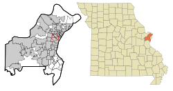
St. Louis County Missouri Incorporated and Unincorporated areas Vinita Terrace Highlighted.svg
Location of Vinita Terrace, Missouri
Coordinates: 38°41′6″N90°19′47″W / 38.68500°N 90.32972°W / 38.68500; -90.32972
Country United States
State Missouri
County St. Louis
Area
[1]
  Total0.06 sq mi (0.16 km2)
  Land0.06 sq mi (0.16 km2)
  Water0 sq mi (0 km2)
Elevation
[2]
614 ft (187 m)
Population
 (2010) [3]
  Total277
  Estimate 
(2016) [4]
276
  Density4,600/sq mi (1,700/km2)
Time zone UTC-6 (Central (CST))
  Summer (DST) UTC-5 (CDT)
FIPS code 29-76264 [5]
GNIS feature ID0756855 [2]

Vinita Terrace was a village in St. Louis County, Missouri, United States. The population was 277 at the 2010 census. [6]

Contents

Voters of both Vinita Park and neighboring Vinita Terrace voted on November 8, 2016, to consolidate into one municipality to be called the City of Vinita Park. [7] [8] The merger took effect May 10, 2017. [9]

Geography

Vinita Terrace is located at 38°41′6″N90°19′47″W / 38.68500°N 90.32972°W / 38.68500; -90.32972 (38.685001, -90.329788). [10]

According to the United States Census Bureau, the village has a total area of 0.06 square miles (0.16 km2), all land. [1]

Municipal Court Revenue

In the fiscal year ending February 28, 2014, Vinita Terrace had general revenue in the amount of $211,150, of which $116,190, or 55%, came from fines and fees collected by its municipal court. Based on its population of 277 from the 2010 census, it collected $419.45 per person. [11]

Demographics

Historical population
CensusPop.Note
1950 389
1960 382−1.8%
1970 344−9.9%
1980 3491.5%
1990 338−3.2%
2000 292−13.6%
2010 277−5.1%
2016 (est.)276 [4] −0.4%
U.S. Decennial Census [12]

Vinita Terrace merged into the city of Vinita Park in 2017.

2010 census

Vinita Terrace, Missouri – Racial and ethnic composition
Note: the US Census treats Hispanic/Latino as an ethnic category. This table excludes Latinos from the racial categories and assigns them to a separate category. Hispanics/Latinos may be of any race.
Race / Ethnicity (NH = Non-Hispanic)Pop 2000 [13] Pop 2010 [6] % 2000% 2010
White alone (NH)756021.66%21.66%
Black or African American alone (NH)21520273.63%72.92%
Native American or Alaska Native alone (NH)000.00%0.00%
Asian alone (NH)110.34%0.36%
Pacific Islander alone (NH)000.00%0.00%
Some Other Race alone (NH)010.00%0.36%
Mixed Race or Multi-Racial (NH)1100.34%3.61%
Hispanic or Latino (any race)030.00%1.08%
Total292277100.00%100.00%

As of the census [3] of 2010, there were 277 people, 108 households, and 73 families living in the village. The population density was 4,616.7 inhabitants per square mile (1,782.5/km2). There were 116 housing units at an average density of 1,933.3 per square mile (746.5/km2). The racial makeup of the village was 22.7% White, 72.9% African American, 0.4% Asian, 0.4% from other races, and 3.6% from two or more races. Hispanic or Latino of any race were 1.1% of the population.

There were 108 households, of which 32.4% had children under the age of 18 living with them, 40.7% were married couples living together, 23.1% had a female householder with no husband present, 3.7% had a male householder with no wife present, and 32.4% were non-families. 26.9% of all households were made up of individuals, and 7.5% had someone living alone who was 65 years of age or older. The average household size was 2.56 and the average family size was 3.07.

The median age in the village was 39.3 years. 22.4% of residents were under the age of 18; 7.9% were between the ages of 18 and 24; 26.3% were from 25 to 44; 32.1% were from 45 to 64; and 11.2% were 65 years of age or older. The gender makeup of the village was 45.1% male and 54.9% female.

2000 census

As of the census [5] of 2000, there were 292 people, 117 households, and 85 families living in the village. The population density was 4,722.9 inhabitants per square mile (1,823.5/km2). There were 124 housing units at an average density of 2,005.6 per square mile (774.4/km2). The racial makeup of the village was 25.68% White, 73.63% African American, 0.34% Asian, and 0.34% from two or more races.

There were 117 households, out of which 29.1% had children under the age of 18 living with them, 47.9% were married couples living together, 21.4% had a female householder with no husband present, and 26.5% were non-families. 23.1% of all households were made up of individuals, and 6.0% had someone living alone who was 65 years of age or older. The average household size was 2.50 and the average family size was 2.93.

In the village, the population was spread out, with 22.9% under the age of 18, 7.5% from 18 to 24, 26.0% from 25 to 44, 30.5% from 45 to 64, and 13.0% who were 65 years of age or older. The median age was 42 years. For every 100 females, there were 90.8 males. For every 100 females age 18 and over, there were 82.9 males.

The median income for a household in the village was $46,250, and the median income for a family was $56,250. Males had a median income of $47,500 versus $28,125 for females. The per capita income for the village was $23,752. About 5.0% of families and 7.9% of the population were below the poverty line, including 12.7% of those under the age of eighteen and 15.9% of those 65 or over.

Related Research Articles

<span class="mw-page-title-main">Sun River Terrace, Illinois</span> Village in Illinois, United States

Sun River Terrace is a village in Kankakee County, Illinois, United States. The population was 455 at the 2020 census. It is included in the Kankakee-Bradley, Illinois Metropolitan Statistical Area.

<span class="mw-page-title-main">Airport Drive, Missouri</span> Village in Missouri, United States

Airport Drive is a village in Jasper County, Missouri, United States. The population was 766 at the 2020 census. It is part of the Joplin, Missouri Metropolitan Statistical Area. The community is still commonly referred to as "Stone's Corner," as the intersection of Route 43 and Route 171 is known.

<span class="mw-page-title-main">North Lilbourn, Missouri</span> Village in Missouri, United States

North Lilbourn is a village in New Madrid County, Missouri, United States. The population was 22 at the 2020 census.

<span class="mw-page-title-main">Shoal Creek Drive, Missouri</span> Village in Missouri, United States

Shoal Creek Drive is a village in Newton County, Missouri, United States. The population was 337 at the 2010 census. It is part of the Joplin, Missouri Metropolitan Statistical Area.

<span class="mw-page-title-main">Shoal Creek Estates, Missouri</span> Village in Missouri, United States

Shoal Creek Estates is a village in Newton County, Missouri, United States. The population was 76 at the 2010 census. It is part of the Joplin, Missouri Metropolitan Statistical Area.

<span class="mw-page-title-main">Bel-Ridge, Missouri</span> City in Missouri, United States

Bel-Ridge is a suburban city in northern St. Louis County, Missouri, United States. The population was 2,737 at the 2010 census. Bel-Ridge is part of the Normandy Schools Collaborative. Bel-Ridge became a city in 2015 by a vote of the voters.

<span class="mw-page-title-main">Bellerive Acres, Missouri</span> City in Missouri, United States

Bellerive Acres is a northern suburban city in St. Louis County, Missouri, United States. The population was 188 at the 2010 census. In April, 2015, the residents voted to change the village of Bellerive to a fourth class city named Bellerive Acres.

<span class="mw-page-title-main">Breckenridge Hills, Missouri</span> City in Missouri, United States

Breckenridge Hills is a city in St. Louis County, Missouri, United States. As of the 2010 census, the city population was 4,746.

<span class="mw-page-title-main">Edmundson, Missouri</span> City in Missouri, United States

Edmundson is a city in St. Louis County, Missouri, United States. The population was estimated to be 860 at the time of the 2020 census.

<span class="mw-page-title-main">Flordell Hills, Missouri</span> City in Missouri, United States

Flordell Hills is a city in St. Louis County, Missouri, United States. The population was 822 at the 2010 census.

<span class="mw-page-title-main">Hillsdale, Missouri</span> Village in Missouri, United States

Hillsdale is a village in St. Louis County, Missouri, United States. Greenwood Cemetery is located in Hillsdale. The population was 1,478 at the 2010 census.

<span class="mw-page-title-main">Riverview, St. Louis County, Missouri</span> Village in Missouri, United States

Riverview is a village in St. Louis County, Missouri, United States. The population was 2,397 at the 2020 census.

<span class="mw-page-title-main">Vinita Park, Missouri</span> City in Missouri, United States

Vinita Park is a city in St. Louis County, Missouri, United States, located just east of I-170 and south of St. Charles Rock Road. The population was 1,970 at the 2020 census.

<span class="mw-page-title-main">Woodson Terrace, Missouri</span> City in Missouri, United States

Woodson Terrace is a city in St. Louis County, Missouri, United States. The population was 4,063 at the 2010 census.

<span class="mw-page-title-main">Baker, Missouri</span> Village in Missouri, United States

Baker is an inactive incorporated village in Stoddard County, Missouri, United States. Per the 2020 census, the population was 3. As of 2017, it is Missouri's smallest incorporated settlement.

<span class="mw-page-title-main">Penermon, Missouri</span> Village in Missouri, United States

Penermon is a village in Stoddard County, Missouri, United States. The population was 64 at the 2010 census.

<span class="mw-page-title-main">Hanley Hills, Missouri</span> Village in Missouri, United States

Hanley Hills is a village in St. Louis County, Missouri, United States. The population was 2,101 at the 2010 census.

<span class="mw-page-title-main">Uplands Park, Missouri</span> Village in Missouri, United States

Uplands Park is a village in St. Louis County, Missouri, United States. The population was 445 at the 2010 census. The village is one of many small majority black communities located in the Natural Bridge corridor of mid-St. Louis County, characterized by small homes on small lots.

<span class="mw-page-title-main">Warson Woods, Missouri</span> City in Missouri, United States

Warson Woods is a city in St. Louis County, Missouri, United States. The population was 1,962 at the 2010 census.

<span class="mw-page-title-main">Popple River, Wisconsin</span> Town in Wisconsin, United States

Popple River is a town in Forest County, Wisconsin, United States. The population was 44 at the 2010 census.

References

  1. 1 2 "US Gazetteer files 2010". United States Census Bureau. Archived from the original on 2012-01-25. Retrieved 2012-07-08.
  2. 1 2 U.S. Geological Survey Geographic Names Information System: Vinita Terrace, Missouri
  3. 1 2 "U.S. Census website". United States Census Bureau . Retrieved 2012-07-08.
  4. 1 2 "Population and Housing Unit Estimates" . Retrieved June 9, 2017.
  5. 1 2 "U.S. Census website". United States Census Bureau . Retrieved 2008-01-31.
  6. 1 2 "P2 Hispanic or Latino, and Not Hispanic or Latino by Race – 2010: DEC Redistricting Data (PL 94-171) – Vinita Terrace village, Missouri". United States Census Bureau .
  7. "Archived copy". Archived from the original on 2016-12-20. Retrieved 2017-05-10.{{cite web}}: CS1 maint: archived copy as title (link)
  8. "Archived copy". Archived from the original on 2016-12-20. Retrieved 2017-05-10.{{cite web}}: CS1 maint: archived copy as title (link)
  9. "Tiny North County community Vinita Terrace merging into Vinita Park". STLtoday.com. Retrieved 21 November 2021.
  10. "US Gazetteer files: 2010, 2000, and 1990". United States Census Bureau. 2011-02-12. Retrieved 2011-04-23.
  11. Barker, Jacob. "With court revenue facing limits, budgets look tenuous in many St. Louis County cities". STLtoday.com. Retrieved 21 November 2021.
  12. "Census of Population and Housing". Census.gov. Retrieved June 4, 2015.
  13. "P004 Hispanic or Latino, and Not Hispanic or Latino by Race – 2000: DEC Summary File 1 – Vinita Terrace village, Missouri". United States Census Bureau .