Sappington, Missouri | |
---|---|
Coordinates: 38°31′34″N90°22′23″W / 38.52611°N 90.37306°W | |
Country | United States |
State | Missouri |
County | St. Louis |
Area | |
• Total | 2.39 sq mi (6.20 km2) |
• Land | 2.39 sq mi (6.20 km2) |
• Water | 0.00 sq mi (0.00 km2) |
Elevation | 617 ft (188 m) |
Population (2020) | |
• Total | 7,995 |
• Density | 3,339.60/sq mi (1,289.62/km2) |
Time zone | UTC-6 (Central (CST)) |
• Summer (DST) | UTC-5 (CDT) |
FIPS code | 29-65954 [3] |
GNIS feature ID | 2393224 [2] |
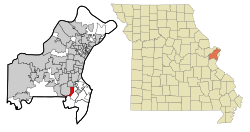
Sappington is an unincorporated community and census-designated place (CDP) in St. Louis County, Missouri, United States. The population was 7,995 at the 2020 census. [4]
Sappington was named for a family of pioneer settlers. [5] After Daniel Boone settled in modern-day Missouri, he would often return to Kentucky to tell residents about the land available in Missouri. John and Jemima Sappington sent two sons and a son-in-law to explore what is now Sappington in 1804. They bought 1,920 acres (3 square miles) of land - more than the area of present-day Sappington. The following year, the rest of the Sappington family arrived in the area. The descendants of the family eventually populated the area, and parts of present-day Crestwood and Sunset Hills. [6] The house of Thomas Sappington, one of the original settlers, still exists and is maintained by the City of Crestwood. [7]
According to the United States Census Bureau, the community has a total area of 2.6 square miles (6.7 km2), of which 0.1 square miles (0.26 km2), or 2.30%, is water.
Year | Pop. | ±% |
---|---|---|
2000 | 7,287 | — |
2010 | 7,580 | +4.0% |
2020 | 7,995 | +5.5% |
Source: U.S. Decennial Census [8] |
At the 2000 census, [9] there were 7,287 people, 3,403 households and 2,038 families living in the community. The population density was 2,850.5 inhabitants per square mile (1,100.6/km2). There were 3,530 housing units at an average density of 1,380.8 per square mile (533.1/km2). The racial makeup of the community was 96.53% White, 0.64% African American, 0.11% Native American, 1.83% Asian, 0.12% from other races, and 0.77% from two or more races. Hispanic or Latino of any race were 1.03% of the population.
There were 3,403 households, of which 21.1% had children under the age of 18 living with them, 49.3% were married couples living together, 8.2% had a female householder with no husband present, and 40.1% were non-families. 36.5% of all households were made up of individuals, and 19.7% had someone living alone who was 65 years of age or older. The average household size was 2.14 and the average family size was 2.81.
18.5% of the population were under the age of 18, 6.7% from 18 to 24, 23.3% from 25 to 44, 25.6% from 45 to 64, and 25.9% who were 65 years of age or older. The median age was 46 years. For every 100 females, there were 85.3 males. For every 100 females age 18 and over, there were 80.0 males.
The median household income was $44,117 and the median family income was $57,897. Males had a median income of $43,565 and females $30,906. The per capita income was $26,727. About 2.1% of families and 2.9% of the population were below the poverty line, including 3.7% of those under age 18 and 3.7% of those age 65 or over.
In 2010, there were 7,580 people, 3,520 households and 2,066 families living in the community. The population density was 2,915 people per square mile. There were 3,756 housing units. The racial makeup of the community was 93.6% White, 1.5% African American, 0.1% Native American, 2.7% Asian, 0.4% from other races, and 1.7% from two or more races. Hispanic or Latino of any race made up 1.9% of the population.
There were 3,520 households, of which 18.6% had children under the age of 18 living with them, 46.1% were married couples living together, 9.3% had a female householder with no husband present, and 41.3% were non-families. 37.6% of all households were made up individuals and 19.5% had someone living alone who was 65 years of age or older. The average household size was 2.15 and the average family size was 2.85.
19.7% of the population were under the age of 18, 4.2% from 18 to 24, 21.3% from 25 to 44, 28.4% from 45 to 64, and 24.1% who were 65 years of age or older. The median age was 47.2 years. For every 100 females, there were 88.63 males.
The Median Household Income was $52,574 and the median family income was $73,364. The per capita income was $31,613. About 5.0% of families and 4.9% of the population were below the poverty line, including 6.6% of those under the age of 18 and 7.6% of those age 65 and over [10]
The school district Lindbergh Schools serves Sappington as well as the surrounding areas. Lindbergh High School is in Sappington, as is Sperreng Middle School, and Concord Elementary School (all part of the Lindbergh School District). [11] [12]
Marmaduke is a city in Greene County, Arkansas, United States. The population was 1,212 in 2020.
Belton is a city in northwestern Cass County, Missouri, United States. The population was 23,953 at the 2020 census. It is a part of the Kansas City Metropolitan Area.
Linneus is a small city in Linn County, Missouri, United States. The population was 281 at the 2020 census. It is the county seat of Linn County.
Park Hills is a city in St. Francois County, Missouri, United States. The population was 8,587 at the 2020 census.
Crestwood is a city in south St. Louis County, Missouri, United States, part of the Metropolitan Statistical Area known as Greater St. Louis. The population was 11,912 at the 2010 census.
Green Park is a city in St. Louis County, Missouri, United States. The population was 2,622 at the 2010 census.
Hazelwood is a city in St. Louis County, Missouri, within Greater St. Louis. It is a second-ring northern suburb of St. Louis. Based on the 2020 United States census, the city had a total population of 25,485. It is located north of St. Louis-Lambert International Airport and is situated on Interstates 270 and 170, as well as the much-traveled Lindbergh Boulevard and Highway 370.
Hillsdale is a village in St. Louis County, Missouri, United States. Greenwood Cemetery is located in Hillsdale. The population was 1,478 at the 2010 census.
Jennings is a city in St. Louis County, Missouri, United States. Per the 2020 census, the population was 12,895.
Lakeshire is a city in St. Louis County, Missouri, United States. The population was 1,432 at the 2010 census.
Manchester is a city in St. Louis County, Missouri, United States. The population was 18,333 at the 2020 census.
Maplewood is an inner-ring suburb of St. Louis, located in St. Louis County, Missouri, United States.
Velda City is a city in St. Louis County, Missouri, United States. The population was 1,420 at the 2010 census.
Wildwood is a city in St. Louis County, Missouri, United States. It is located in the far western portion of the county. As of the 2020 census, the population was 35,417. Wildwood is the home of the Al Foster Trail, and numerous other trails, parks, and reserves such as Rockwoods Reservation and Babler State Park.
Concord is an unincorporated community and census-designated place (CDP) in St. Louis County, Missouri, United States. The population was 16,421 at the 2010 census. It should not be confused with Concord Township, which the CDP shares much land with, but these areas' boundaries are not identical.
Hanley Hills is a village in St. Louis County, Missouri, United States. The population was 2,101 at the 2010 census.
Moline Acres is a city in St. Louis County, Missouri, United States. The population was 2,442 at the 2010 census.
Sunset Hills is a city in south St. Louis County, Missouri, United States. As of the 2020 United States Census, the city's population was 9,198.
Thompsonville is a census-designated place (CDP) in Washington County, Pennsylvania, United States. The population was 3,520 at the 2010 census.
Laguna Vista is a town in Cameron County, Texas, United States. The population was 3,520 at the 2020 census. It is included as part of the Brownsville–Harlingen–Raymondville and the Matamoros–Brownsville metropolitan areas.