Related Research Articles

Creve Coeur is a village in Groveland Township, Tazewell County, Illinois, United States. As of the 2020 census, the village population was 4,934. Creve Coeur is a suburb of Peoria and is part of the Peoria, Illinois Metropolitan Statistical Area.

Creve Coeur is a city located in mid St. Louis County, Missouri, United States, a part of Greater St. Louis. Its population was 18,834 at the 2020 census. Creve Coeur borders and shares a ZIP code (63141) with the neighboring city of Town and Country. It is home to the headquarters of Drury Hotels, and was the home of Monsanto until its acquisition by Bayer in 2018.

Upper Burrell Township is a township in Westmoreland County, Pennsylvania, United States, within the Pittsburgh metropolitan area. The population was 2,159 at the 2020 census.

The River des Peres is a 9.3-mile (15.0 km) metropolitan river in St. Louis, Missouri. It is the backbone of sanitary and storm water systems in the city of St. Louis and portions of St. Louis County. Its largest tributaries are Deer Creek and Gravois Creek. At St. Louis, the river has a mean annual discharge of 79 cubic feet per second.
The Jung-Kellogg Learning Center (JKL) is the library and learning commons of Missouri Baptist University in Creve Coeur, Missouri. It is a member of the Bridges cluster of the MOBIUS Consortium, a network of libraries in the state of Missouri.

Covenant Theological Seminary, informally called Covenant Seminary, is the denominational seminary of the Presbyterian Church in America (PCA). Located in Creve Coeur, Missouri, it trains people to work as leaders in church positions and elsewhere, especially as pastors, missionaries, and counselors. It does not require all students to be members of the PCA, but it is bound to promote the teachings of its denomination. Faculty must subscribe to the system of biblical doctrine outlined in the Westminster Standards.

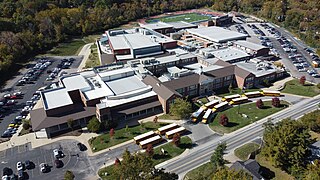
The Ladue School District is a public school district in Ladue, Missouri, with four elementary, one middle, and one high school, with a special Fifth Grade Center. The district serves 4,180 total students, and employs 280 full-time classroom teachers. The total operating revenue is $49.9 mil. with $50.2 mil. operating expenses. Ladue spends $11,903 per student, and pays an average of $62,697 per teacher ($41,000-$101,542). According to Newsweek, Ladue ranks in the top 2% of public schools in the nation. It serves an area encompassing 19 sq. mi. with more than 27,000 residents. It includes all or part of 10 communities including Ladue, Creve Coeur, Crystal Lake Park, Frontenac, Huntleigh, Olivette, Richmond Heights, Town and Country, Unincorporated St. Louis County, and Westwood.

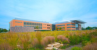
The Donald Danforth Plant Science Center is an independent, not-for-profit research institute dedicated to plant science located in the Creve Coeur community of Saint Louis County, Missouri, United States. It was founded in 1998 by William Henry Danforth, chancellor emeritus of Washington University in St. Louis and named after his father, and established through a $60 million gift from the Danforth Foundation, a $50 million gift from the Monsanto Fund, the donation of 40 acres of land from Monsanto, and $25 million in tax credits from the State of Missouri.

High Gate is an unincorporated community in eastern Maries County, Missouri, United States. It is at the intersection of routes H and U approximately fourteen miles east of Vienna and 1.5 miles from the Maries-Gasconade county line.

Area code 636 is a telephone area code in North American Numbering Plan (NANP) for the east-central part of the U.S. state of Missouri, comprising mainly the western suburbs of St. Louis. It includes parts of Chesterfield and Fenton in St. Louis County, and all of St. Charles, Jefferson, and Warren counties, all of Franklin County with the exception of Sullivan, as well as the towns of High Hill and Jonesburg in Montgomery County and the southern portion of Lincoln County. It was created in 1999 in an area code split from area code 314, which was one of the original North American area codes of 1947.
Missouri's 1st congressional district is in the eastern portion of the state. It includes all of St. Louis City and much of northern St. Louis County, including the cities of Maryland Heights, University City, Ferguson and Florissant. With a Cook Partisan Voting Index rating of D+27, it is the most Democratic district in Missouri. Roughly half of the district's population is African American.
Missouri's second congressional district is in the eastern portion of the state, primarily consisting of the suburbs south and west of St. Louis, including Arnold, Town and Country, Wildwood, Chesterfield, and Oakville. The district includes all of Franklin County and portions of St. Louis, St. Charles, and Warren counties. Following redistricting in 2010, the St. Louis Post-Dispatch reported that the district now included more Democratic-leaning voters than it had its 2001–2010 boundaries, but still leaned Republican as a whole. The latest U.S. Census Electorate Profile for the 2nd congressional district estimates there are 581,131 citizens of voting age living in 293,984 households. A primarily suburban district, MO-02 is the wealthiest of Missouri's congressional districts.

Bartlett is an unincorporated community in southwestern Wesley Township, Washington County, Ohio, United States. It has a post office with the ZIP code 45713. It sits at the intersection of State Routes 550 and 555 near Coal Run, a subsidiary of Wolf Creek, which meets the Muskingum River at Waterford to the north. Near Bartlett is located the Shinn Covered Bridge, which spans Wolf Creek.

Union Township is located in Livingston County, Illinois. As of the 2010 census, its population was 240 and it contained 98 housing units. Union Township formed from Odell Township in 1864.
Pattonville R-III School District is a public school district in the suburbs of mid and north St. Louis County, Missouri.

Upson is an unincorporated community located in Iron County, Wisconsin, United States. Upson is located at the junction of Wisconsin Highway 77 and Wisconsin Highway 122 12 miles (19 km) southwest of Hurley, in the town of Anderson. Upson had an Air Defense Command radar station of the Permanent System radar network and a post office, which closed on March 16, 1985. One of the three people that surveyed the area was named Upson.

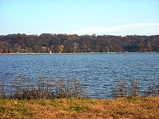
Creve Coeur Lake Memorial Park is a 2,145-acre (8.68 km2) St. Louis County park located in Maryland Heights, Missouri, United States. The park is the largest in the St. Louis County Parks system and includes Creve Coeur Lake, an oxbow lake which is one of the largest natural lakes in Missouri.
Finland is a village and an unincorporated community on the Unami Creek in southern Milford Township, Bucks County, Pennsylvania, United States. It is split between the Green Lane Zip Code of 18054 and the Pennsburg zip code of 18073. The immediate area was known in the 1920s as the "Poconos of Philadelphia" and as "The Fineland," and it is from this latter name that the US post office had put it on the map as Finland in 1886. Multiple summer camps have been located in this area and one of them is still in use. The Unami Creek flows southward to the Perkiomen Creek. The village was established by Finnish immigrants to New Sweden.
Agricola is an unincorporated community in Coffey County, Kansas, United States. It is located along Old Highway 50 and 27th Rd.

Mercy Hospital St. Louis is a Catholic hospital operating in Creve Coeur, Missouri, United States, sponsored by the Sisters of Mercy.
References
- ↑ "Township of Creve Coeur". Geographic Names Information System . United States Geological Survey, United States Department of the Interior . Retrieved September 26, 2018.
38°40′30″N90°25′10″W / 38.67500°N 90.41944°W
