Syracuse, Missouri

Last updated

Syracuse, Missouri
Morgan County Missouri Incorporated and Unincorporated areas Syracuse Highlighted.svg
Location in Morgan County and the state of Missouri
Coordinates: 38°40′10″N92°52′30″W / 38.66944°N 92.87500°W / 38.66944; -92.87500
Country United States
State Missouri
County Morgan
Area
[1]
  Total
0.38 sq mi (0.97 km2)
  Land0.38 sq mi (0.97 km2)
  Water0.00 sq mi (0.00 km2)
Elevation
[2]
909 ft (277 m)
Population
 (2020) [3]
  Total
151
  Density402.67/sq mi (155.46/km2)
Time zone UTC-6 (Central (CST))
  Summer (DST) UTC-5 (CDT)
ZIP code
65354
Area code 660
FIPS code 29-72106 [4]
GNIS feature ID2396022 [2]

Syracuse is a city in Morgan County, Missouri, United States. The population was 151 at the 2020 census. [3] In the middle of the 19th century, the city was the western terminus of the Pacific Railway that reached 108 miles from St. Louis. [5] The current mayor of Syracuse is Duane A. Doyle.

Contents

History

In 1859 with the railroad construction to Syracuse, it became the Terminus of The Butterfield Overland Mail Route. The route was designated a national historic trail in 2023. [6] Syracuse was originally called "Pacific City", and under the latter name was laid out in 1858. [7] The present name is after Syracuse, New York. [8]

Butterfield Overland Mail Route 1858-1861 Period on a 1873 Campbells Map by Greg Wadley 8.Morgan County.En.2a.png
Butterfield Overland Mail Route 1858-1861 Period on a 1873 Campbells Map by Greg Wadley

Geography

Syracuse is in northern Morgan County, along U.S. Route 50, which leads east 5 miles (8 km) to Tipton and west 19 miles (31 km) to Sedalia. Versailles, the Morgan county seat, is 19 miles (31 km) to the south via secondary highways.

According to the U.S. Census Bureau, Syracuse has a total area of 0.38 square miles (0.98 km2), all land. [1] The city sits on a ridge which drains southeast toward Messer Creek and northwest toward Otter Creek, both part of the Lamine River watershed leading north to the Missouri.

Demographics

Historical population
CensusPop.Note
1880 202
1890 187−7.4%
1900 175−6.4%
1910 19310.3%
1920 28849.2%
1930 2880.0%
1940 262−9.0%
1950 221−15.6%
1960 180−18.6%
1970 21418.9%
1980 2223.7%
1990 185−16.7%
2000 172−7.0%
2010 1720.0%
2020 151−12.2%
U.S. Decennial Census [9]

2010 census

As of the census [10] of 2010, there were 172 people, 68 households, and 45 families living in the city. The population density was 452.6 inhabitants per square mile (174.7/km2). There were 79 housing units at an average density of 207.9 per square mile (80.3/km2). The racial makeup of the city was 98.8% White and 1.2% from two or more races. Hispanic or Latino of any race were 3.5% of the population.

There were 68 households, of which 29.4% had children under the age of 18 living with them, 45.6% were married couples living together, 8.8% had a female householder with no husband present, 11.8% had a male householder with no wife present, and 33.8% were non-families. 22.1% of all households were made up of individuals, and 14.7% had someone living alone who was 65 years of age or older. The average household size was 2.53 and the average family size was 3.04.

The median age in the city was 37.7 years. 25% of residents were under the age of 18; 11.6% were between the ages of 18 and 24; 24.3% were from 25 to 44; 23.3% were from 45 to 64; and 15.7% were 65 years of age or older. The gender makeup of the city was 48.3% male and 51.7% female.

2000 census

As of the census [4] of 2000, there were 172 people, 70 households, and 51 families living in the city. The population density was 451.9 inhabitants per square mile (174.5/km2). There were 82 housing units at an average density of 215.4 per square mile (83.2/km2). The racial makeup of the city was 97.67% White, 0.58% Asian, and 1.74% from two or more races. Hispanic or Latino of any race were 2.33% of the population.

There were 70 households, out of which 31.4% had children under the age of 18 living with them, 62.9% were married couples living together, 7.1% had a female householder with no husband present, and 27.1% were non-families. 20.0% of all households were made up of individuals, and 2.9% had someone living alone who was 65 years of age or older. The average household size was 2.46 and the average family size was 2.78.

In the city, the population was spread out, with 22.7% under the age of 18, 9.3% from 18 to 24, 30.2% from 25 to 44, 32.6% from 45 to 64, and 5.2% who were 65 years of age or older. The median age was 37 years. For every 100 females, there were 107.2 males. For every 100 females age 18 and over, there were 107.8 males.

The median income for a household in the city was $34,773, and the median income for a family was $38,214. Males had a median income of $24,750 versus $21,389 for females. The per capita income for the city was $18,463. None of the families and 4.5% of the population were living below the poverty line, including no under eighteens and 18.2% of those over 64.

KMOS-TV

Syracuse is home to the KMOS TV Tower, built in 2003 and operated by the University of Central Missouri. At a height of 2,000 feet (610 m), it is the tallest structure in Missouri.[ citation needed ]

Related Research Articles

<span class="mw-page-title-main">Syracuse, Kansas</span> City in Hamilton County, Kansas

Syracuse is a city in and the county seat of Hamilton County, Kansas, United States. As of the 2020 census, the population of the city was 1,826. It is located along Highway 50.

<span class="mw-page-title-main">Wheaton, Missouri</span> City in Missouri, United States

Wheaton is a city in Wheaton Township, Barry County, Missouri, United States. The population was 696 at the 2010 census.

<span class="mw-page-title-main">Belton, Missouri</span> City in Missouri, US

Belton is a city in northwestern Cass County, Missouri, United States. The population was 23,953 at the 2020 census. It is a part of the Kansas City metropolitan area.

<span class="mw-page-title-main">Otterville, Missouri</span> City in Missouri, United States

Otterville is a city in southwest Cooper County, Missouri, United States. The population was 454 at the 2010 census.

<span class="mw-page-title-main">Linneus, Missouri</span> City in Missouri, United States

Linneus is a small city in Linn County, Missouri, United States. The population was 281 at the 2020 census. It is the county seat of Linn County.
<span class="mw-page-title-main">Gravois Mills, Missouri</span> Town in Missouri, United States

Gravois Mills is a town in Morgan County, Missouri, United States. The population was 129 at the 2020 census.

<span class="mw-page-title-main">Laurie, Missouri</span> City in Missouri, US

Laurie is a city in southern Morgan and northern Camden counties, Missouri, United States. The population was 939 at the 2020 census.

<span class="mw-page-title-main">Versailles, Missouri</span> City in Missouri, United States

Versailles is a city in Morgan County, Missouri, United States. The population was 2,539 at the 2020 census. It is the county seat of Morgan County.

<span class="mw-page-title-main">Green Ridge, Missouri</span> City in Missouri, United States

Green Ridge is a city located along Route 127 in Pettis County, Missouri, United States. The population was 476 at the 2010 census.
<span class="mw-page-title-main">Tracy, Missouri</span> City in Missouri, United States

Tracy is a city in Platte County, Missouri within the United States, located along the Platte River. The population was 269 at the 2020 census. The city is part of the Kansas City metropolitan area.

<span class="mw-page-title-main">Crystal Lake Park, Missouri</span> City in Missouri, United States

Crystal Lake Park is a Missouri Class 4 city in St. Louis County, Missouri, United States. The population was 508 at the 2020 census.
<span class="mw-page-title-main">Flordell Hills, Missouri</span> City in Missouri, United States

Flordell Hills is a city in St. Louis County, Missouri, United States. The population was 822 at the 2010 census.

<span class="mw-page-title-main">Jennings, Missouri</span> City in Missouri, United States

Jennings is a city in St. Louis County, Missouri, United States. Per the 2020 census, the population was 12,895.

<span class="mw-page-title-main">Lakeshire, Missouri</span> City in Missouri, United States

Lakeshire is a city in St. Louis County, Missouri, United States. The population was 1,432 at the 2010 census.
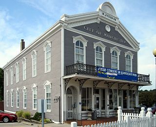
<span class="mw-page-title-main">Manchester, Missouri</span> City in Missouri, United States

Manchester is a city in St. Louis County, Missouri, United States. The population was 18,333 at the 2020 census.

<span class="mw-page-title-main">Woodson Terrace, Missouri</span> City in Missouri, United States

Woodson Terrace is a city in St. Louis County, Missouri, United States. The population was 4,063 at the 2010 census.

<span class="mw-page-title-main">Moscow Mills, Missouri</span> Town in Missouri, US

Moscow Mills is a city in Lincoln County, Missouri, United States. The population was 2,509 at the 2010 census.
<span class="mw-page-title-main">Warson Woods, Missouri</span> City in Missouri, United States

Warson Woods is a city in St. Louis County, Missouri, United States. The population was 1,962 at the 2010 census.
<span class="mw-page-title-main">Sunrise Beach, Missouri</span> Village in Missouri, US

Sunrise Beach is a village in Camden and Morgan counties in the U.S. state of Missouri. The population was 431 at the 2020 census, unchanged from 2010.

<span class="mw-page-title-main">Portageville, Missouri</span> City in Missouri, United States

Portageville is a city in New Madrid and Pemiscot counties in the U.S. state of Missouri. The population was 2,942 according to the 2020 Census.

References

  1. 1 2 "2023 U.S. Gazetteer Files: Missouri". United States Census Bureau. Retrieved May 10, 2024.
  2. 1 2 U.S. Geological Survey Geographic Names Information System: Syracuse, Missouri
  3. 1 2 "P1. Race – Syracuse city, Missouri: 2020 DEC Redistricting Data (PL 94-171)". U.S. Census Bureau. Retrieved May 10, 2024.
  4. 1 2 "U.S. Census website". United States Census Bureau . Retrieved January 31, 2008.
  5. Richards, Thomas Addison, Appletons’ Companion Hand-Book of Travel: Containing a full description of the principal cities, towns, and places of interest together with hotels and routes of travel through the United States and the Canadas (D.Appleton & Company, New York, 1865), pp 270-271.
  6. "S.3519 - Butterfield Overland National Historic Trail Designation Act". Congress.gov.
  7. "Morgan County Place Names, 1928–1945". The State Historical Society of Missouri. Archived from the original on June 24, 2016. Retrieved November 19, 2016.
  8. Ramsay, Robert L. (1952). Our Storehouse of Missouri Place Names. University of Missouri Press. p. 25. ISBN   9780826205865.
  9. "Census of Population and Housing". Census.gov. Retrieved June 4, 2015.
  10. "U.S. Census website". United States Census Bureau . Retrieved July 8, 2012.