Rocky Mount, Morgan County, Missouri

Last updated
Rocky Mount, Missouri
MOMap-doton-Rocky Mount.png
Country United States
State Missouri
County Morgan

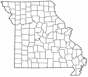
Rocky Mount is an unincorporated community in eastern Morgan County, Missouri, United States. [1] It is located six miles southwest of Eldon, near the Lake of the Ozarks. The ZIP Code for Rocky Mount is 65072. [2]

History

A post office called Rocky Mount was established in 1919 and remained in operation until 1973. [3] The community was most likely so named on account of the local terrain. [4]

Related Research Articles

<span class="mw-page-title-main">Morgan County, Missouri</span> County in Missouri, United States

Morgan County is a county located in the central portion of the U.S. state of Missouri. As of the 2020 census, the population was 21,006. Its county seat is Versailles. The county was organized January 5, 1833 and named for General Daniel Morgan of the American Revolutionary War.

<span class="mw-page-title-main">Roach, Missouri</span>

Roach is an unincorporated community in southern Camden County, Missouri, United States. It is located north of U.S. Route 54 on Missouri Route AA, approximately five miles west of Camdenton and 2.5 miles west of the Niangua River arm of the Lake of the Ozarks. The ZIP Code for Roach is 65787.

<span class="mw-page-title-main">Pottersville, Missouri</span> Unincorporated community in Missouri

Pottersville is an unincorporated hamlet in Howell County, Missouri, United States. It is located approximately ten miles west of West Plains. Besides a few homes, only a post office and fire station are located there. The ZIP Code for Pottersville is 65790.

Dora is an unincorporated community in Ozark County, in the U.S. state of Missouri. The ZIP Code for Dora is 65637.

Bucyrus is an unincorporated community in central Texas County, Missouri, United States. It is located on Route 17, approximately three miles northwest of Houston. The ZIP Code for Bucyrus is 65444.

Eldridge is an unincorporated community in northern Laclede County, Missouri, United States. It is situated approximately twelve miles northwest of Lebanon on Missouri Route E, west of Missouri Route 5. The ZIP Code for Eldridge is 65463.

Falcon is an unincorporated community in eastern Laclede County, Missouri, United States. It is approximately sixteen miles east of Lebanon on Route 32. The Gasconade River lies just east of the community, which is within the Mark Twain National Forest. The community consists of a post office and two houses.

<span class="mw-page-title-main">Vichy, Missouri</span> Unincorporated community in the American state of Missouri

Vichy is an unincorporated community in southern Maries County, Missouri, United States. It is located on U.S. Route 63, approximately ten miles north of Rolla. The community was founded in 1880 and is named after Vichy, France. A post office called Vichy has been in operation since 1880. The Rolla National Airport, a former U.S. Army airfield owned and operated by the City of Rolla, with two 5,500 ft (1,700 m) asphalt runways, is located nearby. The ZIP Code for Vichy is 65580.

<span class="mw-page-title-main">Valles Mines, Missouri</span> Unincorporated community in the American state of Missouri

Valles Mines is an unincorporated community in southern Jefferson County, Missouri, United States. It is located approximately seven miles south of De Soto. It is located on Missouri Route V less than one mile west of U.S. Route 67. Joachim Creek flows past the north side of the community. The ZIP Code for Valles Mines is 63087.

<span class="mw-page-title-main">Lonedell, Missouri</span> Unincorporated community in the American state of Missouri

Lonedell is an unincorporated community in southeastern Franklin County, Missouri, United States. It is at the intersection of Route 30 and routes N and FF and approximately eight miles east of St. Clair. The Little Meramac River flows just south of the community.

Beaufort is an unincorporated community in western Franklin County, Missouri, United States. It is located at the intersection of U.S. Route 50 and Route 185, approximately 11 miles west of Union.

<span class="mw-page-title-main">Williamsburg, Missouri</span> Unincorporated community in the American state of Missouri

Williamsburg is an unincorporated community in eastern Callaway County, Missouri, United States. It is located on Missouri Supplemental Route D just north of Interstate 70, approximately thirteen miles northeast of Fulton. The Whetstone Creek Conservation Area along Whetstone Creek lies about one mile to the north. The ZIP Code for Williamsburg is 63388.

<span class="mw-page-title-main">Loose Creek, Missouri</span>

Loose Creek is an unincorporated community in Osage County, Missouri, United States. It is located north of U.S. Route 50, approximately eight miles east of Missouri's capital of Jefferson City. The ZIP Code for Loose Creek is 65054.

<span class="mw-page-title-main">Kaiser, Missouri</span> Unincorporated community in the American state of Missouri

Kaiser is an unincorporated community in Miller County in the U.S. state of Missouri. It is located on a county road just south of Route 42/134. The zip code is 65047.

<span class="mw-page-title-main">Henley, Missouri</span> Unincorporated community in the American state of Missouri

Henley is an unincorporated community in southwestern Cole County, Missouri, United States. It is located twelve miles east of Eldon. The ZIP Code for Henley is 65040.

Blue Spring Creek is a stream in eastern Morgan County and western Miller County in the U.S. state of Missouri. It is a tributary of Little Gravois Creek.

Rocky Mount is an unincorporated community in western Miller County, Missouri United States. The site is on Missouri Route Y approximately four miles southwest of Eldon. The Rocky Mount church is located at this location, however the post office was moved into neighboring Morgan County about two miles to the southwest in 1919. The Rocky Mount Lookout Tower and Rocky Mount Towersite State Wildlife Area lie approximately two miles to the east.

Indian Creek is a stream in Morgan County in the U.S. state of Missouri. It is a tributary to the Gravois Creek Arm of the Lake of the Ozarks.

Marvin is an unincorporated community in Morgan County, in the U.S. state of Missouri.

Proctor is an unincorporated community in southwest Morgan County, in the U.S. state of Missouri.

References

  1. U.S. Geological Survey Geographic Names Information System: Rocky Mount, Morgan County, Missouri
  2. "Rocky Mount ZIP Code". zipdatamaps.com. 2022. Retrieved November 11, 2022.
  3. "Post Offices". Jim Forte Postal History. Retrieved 17 November 2016.
  4. "Morgan County Place Names, 1928–1945". The State Historical Society of Missouri. Archived from the original on June 24, 2016. Retrieved November 17, 2016.

38°16′16″N92°43′12″W / 38.271°N 92.720°W / 38.271; -92.720