Ionia, Missouri

Last updated

Ionia, Missouri
Benton County Missouri Incorporated and Unincorporated areas Ionia Highlighted.svg
Location of Ionia, Missouri
Coordinates: 38°30′00″N93°19′22″W / 38.5000195°N 93.3227065°W / 38.5000195; -93.3227065
Country United States
State Missouri
Counties Benton, Pettis
Area
[1]
  Total0.15 sq mi (0.38 km2)
  Land0.15 sq mi (0.38 km2)
  Water0.00 sq mi (0.00 km2)
Elevation
[2]
958 ft (292 m)
Population
 (2020)
  Total71
  Density479.73/sq mi (185.17/km2)
Time zone UTC-6 (Central (CST))
  Summer (DST) UTC-5 (CDT)
ZIP code
65335
Area code 660
FIPS code 29-35306 [3]
GNIS feature ID2397008 [2]

Ionia is a village in northern Benton and southern Pettis counties in the U.S. state of Missouri. The population was 88 at the 2010 census.

Contents

History

Ionia was originally called Ionia City, and under the latter name was platted in 1866. [4] A post office called Ionia City was established in 1867, and the name was changed to Ionia in 1895. [5] The community most likely was named after the Ionic order in Freemasonry. [4]

Geography

Ionia is located at along the Pettis-Benton county line on Missouri Route P 1.5 miles west of US Route 65 and approximately seven miles west-northwest of Cole Camp. [6]

According to the United States Census Bureau, the village has a total area of 0.15 square miles (0.39 km2), all land. [7]

Demographics

Historical population
CensusPop.Note
1910 105
1920 13225.7%
1930 1352.3%
1940 116−14.1%
1950 1203.4%
1960 114−5.0%
1970 15132.5%
1980 131−13.2%
1990 126−3.8%
2000 108−14.3%
2010 88−18.5%
2020 71−19.3%
U.S. Decennial Census [8]

2010 census

As of the census [9] of 2010, there were 88 people, 43 households, and 23 families living in the village. The population density was 586.7 inhabitants per square mile (226.5/km2). There were 57 housing units at an average density of 380.0 per square mile (146.7/km2). The racial makeup of the village was 93.2% White, 1.1% African American, 4.5% from other races, and 1.1% from two or more races. Hispanic or Latino of any race were 8.0% of the population.

There were 43 households, of which 23.3% had children under the age of 18 living with them, 32.6% were married couples living together, 11.6% had a female householder with no husband present, 9.3% had a male householder with no wife present, and 46.5% were non-families. 44.2% of all households were made up of individuals, and 23.3% had someone living alone who was 65 years of age or older. The average household size was 2.05 and the average family size was 2.70.

The median age in the village was 41.7 years. 20.5% of residents were under the age of 18; 6.8% were between the ages of 18 and 24; 25% were from 25 to 44; 27.3% were from 45 to 64; and 20.5% were 65 years of age or older. The gender makeup of the village was 50.0% male and 50.0% female.

2000 census

As of the census [3] of 2000, there were 108 people, 47 households, and 28 families living in the town. The population density was 703.6 inhabitants per square mile (271.7/km2). There were 54 housing units at an average density of 351.8 per square mile (135.8/km2). The racial makeup of the town was 98.15% White, and 1.85% from two or more races.

There were 47 households, out of which 31.9% had children under the age of 18 living with them, 53.2% were married couples living together, 6.4% had a female householder with no husband present, and 38.3% were non-families. 34.0% of all households were made up of individuals, and 17.0% had someone living alone who was 65 years of age or older. The average household size was 2.30 and the average family size was 2.97.

In the town the population was spread out, with 26.9% under the age of 18, 6.5% from 18 to 24, 23.1% from 25 to 44, 23.1% from 45 to 64, and 20.4% who were 65 years of age or older. The median age was 38 years. For every 100 females, there were 107.7 males. For every 100 females age 18 and over, there were 92.7 males.

The median income for a household in the town was $21,250, and the median income for a family was $32,500. Males had a median income of $28,125 versus $13,125 for females. The per capita income for the town was $12,317. There were 19.2% of families and 27.6% of the population living below the poverty line, including 44.4% of under eighteens and 12.5% of those over 64.

Related Research Articles

<span class="mw-page-title-main">Ionia, Michigan</span> Largest city and the county seat of Ionia County, Michigan, United States

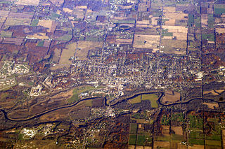
Ionia is the largest city in, and the county seat of, Ionia County, Michigan, United States. The population was 13,378 at the 2020 census. Every July it hosts what is said to be the world's largest free-admission fair. The city is mostly within Ionia Township, with small portion extending into Easton Township and Berlin Township, but is politically autonomous of the townships. The city is named after Ionia, a historic region in Greece.

<span class="mw-page-title-main">Lyons, Michigan</span> Village in Michigan, United States

Lyons is a village in Ionia County in the U.S. state of Michigan. The population was 789 at the 2010 census. Most of the village is within Lyons Township. A small portion extends west into Ionia Township.

<span class="mw-page-title-main">Muir, Michigan</span> Village in Michigan, United States

Muir is a village in Lyons Township, Ionia County in the U.S. state of Michigan. The population was 604 at the 2010 census.

<span class="mw-page-title-main">Otterville, Missouri</span> City in Missouri, United States

Otterville is a city in southwest Cooper County, Missouri, United States. The population was 454 at the 2010 census.

<span class="mw-page-title-main">Airport Drive, Missouri</span> Village in Missouri, United States

Airport Drive is a village in Jasper County, Missouri, United States. The population was 766 at the 2020 census. It is part of the Joplin, Missouri Metropolitan Statistical Area. The community is still commonly referred to as "Stone's Corner," as the intersection of Route 43 and Route 171 is known.

<span class="mw-page-title-main">Green Ridge, Missouri</span> City in Missouri, United States

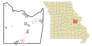
Green Ridge is a city located along Route 127 in Pettis County, Missouri, United States. The population was 476 at the 2010 census.

<span class="mw-page-title-main">Houstonia, Missouri</span> City in Missouri, United States

Houstonia is a city in northwest Pettis County, Missouri, United States. The population was 220 at the 2010 census.

<span class="mw-page-title-main">Hughesville, Missouri</span> Village in Missouri, United States

Hughesville is a village in north central Pettis County, Missouri, United States. The population was 183 at the 2010 census.

<span class="mw-page-title-main">La Monte, Missouri</span> City in Missouri, United States

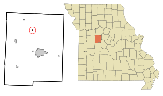
La Monte is a city in Pettis County, Missouri, United States. The population was 1,140 at the 2010 census.

<span class="mw-page-title-main">Smithton, Missouri</span> City in Missouri, United States

Smithton is a city in Pettis County, Missouri, United States. The population was 570 at the 2010 census.

<span class="mw-page-title-main">Bellerive Acres, Missouri</span> City in Missouri, United States

Bellerive Acres is a northern suburban city in St. Louis County, Missouri, United States. The population was 188 at the 2010 census. In April, 2015, the residents voted to change the village of Bellerive to a fourth class city named Bellerive Acres.

<span class="mw-page-title-main">Country Life Acres, Missouri</span> Village in Missouri, United States

Country Life Acres is a village in St. Louis County, Missouri, United States. The population was 74 at the 2010 census.

<span class="mw-page-title-main">Glen Echo Park, Missouri</span> Village in Missouri, United States

Glen Echo Park is a village in St. Louis County, Missouri, United States. The population was 160 at the 2010 census. The community took its name from the Glen Echo Country Club.

<span class="mw-page-title-main">Grantwood Village, Missouri</span> Town in Missouri, United States

Grantwood Village is a town in St. Louis County, Missouri, United States. The population was 863 at the 2010 census.

<span class="mw-page-title-main">Mackenzie, Missouri</span> Village in Missouri, United States

Mackenzie is an unincorporated community in St. Louis County, Missouri, United States. The population was 134 at the 2010 census.

<span class="mw-page-title-main">Pasadena Park, Missouri</span> Village in Missouri, United States

Pasadena Park is a village in St. Louis County, Missouri, United States. The population was 470 at the 2010 census. It is part of the Normandy School District, and is distinct from the city of Pasadena Hills.

<span class="mw-page-title-main">Newcastle, Nebraska</span> Village in Dixon County, Nebraska, United States

Newcastle is a village in Dixon County, Nebraska, United States. It is part of the Sioux City, IA–NE–SD Metropolitan Statistical Area. The population was 325 at the 2010 census.

<span class="mw-page-title-main">Millard, Missouri</span> Village in Missouri, United States

Millard is a village in Pettis Township, Adair County, Missouri, United States. The population was 89 at the 2010 census.

<span class="mw-page-title-main">Uplands Park, Missouri</span> Village in Missouri, United States

Uplands Park is a village in St. Louis County, Missouri, United States. The population was 445 at the 2010 census. The village is one of many small majority black communities located in the Natural Bridge corridor of mid-St. Louis County, characterized by small homes on small lots.

<span class="mw-page-title-main">Windsor, Missouri</span> City in Missouri, United States

Windsor is a city in Henry and Pettis counties, Missouri, United States. The population was 2,901 at the 2010 census.

References

  1. "ArcGIS REST Services Directory". United States Census Bureau. Retrieved August 28, 2022.
  2. 1 2 U.S. Geological Survey Geographic Names Information System: Ionia, Missouri
  3. 1 2 "U.S. Census website". United States Census Bureau . Retrieved January 31, 2008.
  4. 1 2 "Pettis County Place Names, 1928–1945". The State Historical Society of Missouri. Archived from the original on June 24, 2016. Retrieved November 27, 2016.
  5. "Post Offices". Jim Forte Postal History. Retrieved November 27, 2016.
  6. Missouri Atlas & Gazetteer, DeLorme, 1st ed., 1998, p.36 ISBN   0899332242
  7. "US Gazetteer files 2010". United States Census Bureau. Archived from the original on January 25, 2012. Retrieved July 8, 2012.
  8. "Census of Population and Housing". Census.gov. Retrieved June 4, 2015.
  9. "U.S. Census website". United States Census Bureau . Retrieved July 8, 2012.