White Branch, Missouri | |
|---|---|
 White Branch  White Branch | |
| Coordinates: 38°14′3″N93°21′14″W / 38.23417°N 93.35389°W | |
| Country | United States |
| State | Missouri |
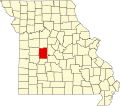
| County | Benton |
| Townships | Fristoe Tom |
| Area | |
• Total | 0.54 sq mi (1.40 km2) |
| • Land | 0.50 sq mi (1.29 km2) |
| • Water | 0.04 sq mi (0.11 km2) |
| Elevation | 680 ft (210 m) |
| Population (2020) | |
• Total | 301 |
| • Density | 605.63/sq mi (233.71/km2) |
| Time zone | UTC-6 (Central (CST)) |
| • Summer (DST) | UTC-5 (CDT) |
| ZIP Code | 65355 (Warsaw) |
| Area code | 660 |
| FIPS code | 29-79288 |
| GNIS feature ID | 2806384 [2] |
White Branch is an unincorporated community and census-designated place (CDP) in Benton County, Missouri, United States. It is southwest of the center of the county, on the south side of the Osage River where it is joined from the south by White Branch, a tributary. To the north, across the Osage, is the city of Warsaw, the Benton county seat. U.S. Route 65 forms the western edge of the CDP, leading north through Warsaw 35 miles (56 km) to Sedalia and south 77 miles (124 km) to Springfield.
White Branch was first listed as a CDP prior to the 2020 census. [2]