
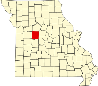
Pettis County is a county located in west central U.S. state of Missouri. As of the 2020 census, the population was 42,980. Its county seat is Sedalia. The county was organized on January 24, 1833, and named after former U.S. Representative Spencer Darwin Pettis.
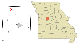
Houstonia is a city in northwest Pettis County, Missouri, United States. The population was 220 at the 2010 census.

Ionia is a village in northern Benton and southern Pettis counties in the U.S. state of Missouri. The population was 88 at the 2010 census.
Clifton City is an unincorporated community in southwestern Cooper County, Missouri, United States. The community is located on Missouri Route 135 and Missouri Route BB. The nearest town is Otterville approximately five miles to the south. It is also 10 miles (16 km) northeast of Sedalia. The Lamine River flows past one half mile east of the town. The Cooper - Pettis county boundary lies three-quarters of a mile west of the location. The Katy Trail State Park passes the south edge of the community.
Beaman is an unincorporated community in Pettis County, Missouri, United States.
Newland is an unincorporated community in northeast Pettis County, in the U.S. state of Missouri. The community is on Missouri Route EE approximately eight miles northeast of Sedalia.
Georgetown is an unincorporated community or populated place located in Pettis County, Missouri, United States.
Dresden is an unincorporated community in Pettis County, Missouri, United States.
Spring Fork is an unincorporated community in Pettis County, Missouri, United States.
Tedieville was an unincorporated community in northern Pettis County, Missouri, United States.
Bahner is a tiy unincorporated rural hamlet in Pettis County, Missouri, United States. There is only a church at Bahner, and a half-dozen homes.
Bryson is an unincorporated community in Pettis County, Missouri, United States.
Postal is an unincorporated community in Pettis County, Missouri, United States.
Arator is an extinct town in Pettis County, in the U.S. state of Missouri.
Beaverdam Creek is a stream in Pettis County in the U.S. state of Missouri. It is a tributary of the South Fork Blackwater River.
Crooked Creek is a stream in Johnson and Pettis counties of the U.S. state of Missouri. It is a tributary of Muddy Creek.
Manila is an unincorporated community in southern Pettis County, in the U.S. state of Missouri.
Muddy Creek is a stream in Johnson and Pettis Counties in the U.S. state of Missouri. It is a tributary of Lamine River.
Stokley is an unincorporated community in northwest Pettis County, in the U.S. state of Missouri.
Longwood Township is an inactive township in Pettis County, in the U.S. state of Missouri.

