Spring Fork, Missouri | |
|---|---|
 | |
 | |
| Coordinates: 38°34′43″N93°14′19″W / 38.57861°N 93.23861°W | |
| Country | United States |
| State | Missouri |
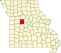
| County | Pettis |
| Elevation | 902 ft (275 m) |
| Time zone | UTC-6 (Central (CST)) |
| • Summer (DST) | UTC-5 (CDT) |
| GNIS feature ID | 741278 [1] |
Spring Fork is an unincorporated community in Pettis County, Missouri, United States. [1]
