Missouri Route 64

Last updated

MO-64.svg

Route 64

Missouri Route 64
Route information
Maintained by MoDOT
Length51.290 mi [1]  (82.543 km)
Existed1922–present
Major junctions
West endMO-254.svg Route 254 near Pomme de Terre Lake
Major intersections
East endMO-5.svg Route 5 in Lebanon
Location
Country United States
State Missouri
Highway system
I-64.svg I-64 US 65.svg US 65

Route 64 is a highway in central Missouri with endpoints of Route 254 south of Hermitage and Route 5 in Lebanon.

Contents

Route 64 is one of the original 1922 state highways and originally ran between Preston and Collins. It would eventually be moved further to the south with its older alignment becoming U.S. Route 54. It would also be extended east. It is also only one of three Missouri state highways bearing the same number as an Interstate highway in Missouri.

Major intersections

CountyLocationmi [1] kmDestinationsNotes
Hickory 0.0000.000MO-254.svg Route 254  Hermitage, Galmey Western terminus
0.8951.440MO-supp-RD.svg Route RDEastern terminus of Route RD
Nemo 3.1285.034MO-supp-D.svgMO-supp-NN.svgTo plate.svg
US 65.svg
Route D / Route NN to US 65  Preston
Western terminus of Route NN
5.5928.999MO-64B.svg Route 64B  Pomme de Terre State Park Southern terminus of Route 64B
Pittsburg 7.27611.710MO-supp-J.svg Route JEastern terminus of Route J
8.04012.939MO-supp-RA.svg Route RAWestern terminus of Route RA
HickoryPolk
county line
9.33115.017MO-supp-TT.svg Route TTEastern terminus of Route TT
Polk 12.61520.302MO-supp-D.svgMO-supp-RB.svg Route D / Route RB Polk Northern terminus of Route RB, Southern is D
15.94525.661MO-supp-HH.svgTo plate.svg
US 65.svg
Route HH to US 65
Southern terminus of Route HH
17.98428.942MO-supp-P.svg Route P Halfway Northern terminus of Route P
Dallas Louisburg 21.95635.335US 65.svg US 65  Urbana, Buffalo
24.21438.969MO-supp-U.svg Route USouthern terminus of Route U
25.74041.425MO-73.svg Route 73  Buffalo, Tunas
28.77546.309MO-supp-T.svg Route T Lead Mine Southern terminus of Route T
32.03351.552MO-supp-K.svg Route K Windyville Northern terminus of Route K
Laclede 40.89165.808MO-64A.svg Route 64A  Bennett Springs Eastern terminus of Route 64A
46.97775.602MO-supp-KK.svg Route KKEastern terminus of Route KK
48.18477.545MO-supp-AA.svg Route AASouthern terminus of Route AA
Lebanon 51.29182.545MO-5.svgMO-32.svg Route 5  / Route 32  Camdenton Eastern terminus
1.000 mi = 1.609 km; 1.000 km = 0.621 mi

Route 64 is the only remaining Missouri highway with lettered branches.

Route 64A

MO-64A.svg

Route 64A

Location Bennett Spring State Park
Length1.509 mi [1]  (2.429 km)

Route 64A is a 1.5-mile-long (2.4 km) spur off Route 64 which ends in Bennett Spring State Park. When Route 64 was on its old alignment, another Route 64A went north to the Benton/Hickory county line and is now part of Route 83.

The entire route is in Bennett Spring State Park.

Countymi [1] kmDestinationsNotes
Laclede 0.0000.000Bennett Springs State Park Road 22Western terminus
0.0240.039MO-supp-OO.svg Route OONorthern terminus of Route OO
Dallas
No major junctions
Laclede 1.5092.429MO-64.svgTo plate.svg
MO-73.svg
Route 64 to Route 73  Lebanon
Eastern terminus
1.000 mi = 1.609 km; 1.000 km = 0.621 mi

Route 64B

MO-64B.svg

Route 64B

Location Pomme de Terre State Park
Length2.257 mi [1]  (3.632 km)

Route 64B is a 2.2-mile-long (3.5 km) spur off Route 64 between Nemo and Pittsburg. It ends at Pomme de Terre Lake.

The entire route is in Hickory County.

Locationmi [1] kmDestinationsNotes
Pomme de Terre State Park 0.0000.000 Pomme de Terre State Park Western terminus at park entrance
2.2573.632MO-64.svg Route 64 Nemo, Pittsburg Eastern terminus
1.000 mi = 1.609 km; 1.000 km = 0.621 mi

Related Research Articles

<span class="mw-page-title-main">New Jersey Route 64</span> State highway in Mercer County, New Jersey, US

Route 64 is a 0.32-mile-long (0.51 km) state highway in the U.S. state of New Jersey. It is a state-maintained bridge over Amtrak's Northeast Corridor line in West Windsor. Route 64 begins at an intersection with County Route 526 and County Route 571 in West Windsor. It heads along the bridge to an intersection with County Route 615, where Route 64 ends. County Routes 526 and 571, which are concurrent with Route 64, continues to Hightstown.

<span class="mw-page-title-main">U.S. Route 412</span> Highway in the United States

U.S. Route 412 is an east–west United States highway, first commissioned in 1982. U.S. 412 overlaps expressway-grade Cimarron Turnpike from Tulsa west to Interstate 35 and the Cherokee Turnpike from 5 miles (8.0 km) east of Chouteau, Oklahoma, to 8 miles (13 km) west of the Arkansas state line. It runs the entire length of the Oklahoma Panhandle and traverses the Missouri Bootheel. Despite its numbering it is not associated with U.S. Route 12.

<span class="mw-page-title-main">U.S. Route 166</span>

U.S. Route 166 (US 166) is a 164-mile (264 km) east–west United States highway. This route and US 266 are the only two remaining spurs of historic U.S. Route 66, since US 666 was renumbered to US 491 in 2003.

<span class="mw-page-title-main">Oklahoma State Highway 97</span>

State Highway 97 is a 19.86-mile (31.96 km) state highway, maintained by the U.S. state of Oklahoma. It connects two towns in the northeast part of the state: Sapulpa and Sand Springs. Several communities of West Tulsa are along the road between these two towns, including Pretty Water, Allen, and Prattville.

<span class="mw-page-title-main">Oregon Route 99E Business</span> State highway business loop in Oregon, United States

Oregon Route 99E Business is a business route through Salem, Oregon for Oregon Route 99E, which bypasses downtown via Interstate 5 (I-5). A portion of this highway was originally planned to be a freeway, signed as Interstate 305; however the proposed freeway was cancelled after community opposition.

<span class="mw-page-title-main">Arkansas Highway 59</span>

Arkansas Highway 59 is a north–south state highway in Northwest Arkansas. The route runs 93.24 miles (150.06 km) from Arkansas Highway 22 in Barling north to the Missouri state line through Van Buren, the county seat of Crawford County. Highway 59 parallels US 59 between Siloam Springs and Fort Smith. Since US 59 goes through Arkansas, AR 59 is the only Arkansas state highway to share its numbering with a federal highway that goes through Arkansas.

<span class="mw-page-title-main">Arkansas Highway 25</span>

Arkansas Highway 25 is a northeast–southwest state highway in north central Arkansas. The route runs 85.66 miles (137.86 km) from US 64 in Conway to US 63/412 in Black Rock through Greers Ferry, Batesville, and the foothills of The Ozarks.

<span class="mw-page-title-main">Florida State Road 865</span>

State Road 865 and County Road 865 are a series of roads serving Lee County, Florida. Originally a continuous state road extending from Bonita Springs to Tice by way of Fort Myers Beach and Fort Myers, SR 865 now consists of two segments connected by a part of CR 865, which also extends to the north and south of the state segments. Both the state and county controlled segments of the route combined stretch a distance of over 40 miles (64.37 km), making it the longest designation in Lee County.

<span class="mw-page-title-main">Arkansas Highway 127</span> State highway in Arkansas

Highway 127 is a designation for four state highways in Northwest Arkansas. One route of 4.13 miles (6.65 km) begins at Madison County Road 3345 (CR 3345) and runs northwest to Highway 23 at Aurora. A second route of 4.86 miles (7.82 km) begins at US Highway 412 (US 412) at Old Alabam and runs north to Highway 23 at Forum. A third route of 8.58 miles (13.81 km) begins at Highway 12 and runs north to Highway 12 near Clifty. A fourth route of 5.82 miles (9.37 km) begins at Lost Bridge Village and runs north to US Highway 62 in Garfield. Highway 127 Spur is a spur route of 0.25 miles (0.40 km) near the southern terminus of the Lost Bridge Village route that provides access to Lost Bridge Marina. All routes are maintained by the Arkansas State Highway and Transportation Department (AHTD).

<span class="mw-page-title-main">Oklahoma State Highway 34</span> Highway in Oklahoma

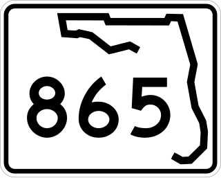
State Highway 34 is a state highway in the U.S. state of Oklahoma. It runs for 188.3 miles (303.0 km) south-to-north in the western part of the state. The highway begins northeast of Eldorado, in the southwest corner of the state, and extends north to the Kansas state line between Woodward and Coldwater, Kansas.

<span class="mw-page-title-main">Oklahoma State Highway 162</span>

State Highway 162 (SH-162/OK-162) is a 1.32-mile-long (2.12 km) (2.1 km) state highway in the U.S. state of Oklahoma that provides access from US-62/US-64/SH-16 to the town of Taft. The highway lies entirely within Muskogee County. Serving as a spur route itself, the highway has no letter-suffixed spur routes of its own.

<span class="mw-page-title-main">Interstate 44 in Missouri</span> Highway in Missouri

Interstate 44 (I-44) in the US state of Missouri runs northeast from the Oklahoma state line near Joplin to I-70 in Downtown St. Louis. It runs for about 293 miles (472 km) in the state, and is the longest Interstate Highway in the state.

<span class="mw-page-title-main">U.S. Route 67 in Arkansas</span> Section of U.S. Highway in Arkansas, United States

U.S. Route 67 is a U.S. highway running from Presidio, Texas northeast to Sabula, Iowa. In the U.S. state of Arkansas, the route runs 279.15 miles (449.25 km) from the Texas border in Texarkana northeast to the Missouri border near Corning. The route passes through several cities and towns, including Hope, Benton, Little Rock, Jacksonville, Cabot, Beebe, Walnut Ridge, and Pocahontas.

<span class="mw-page-title-main">Arkansas Highway 9</span>

Highway 9 is a designation for two north–south state highways in Arkansas. A southern segment of 51.44 miles (82.78 km) begins at U.S. Route 79 at Eagle Mills and heads north to U.S. Route 67 in Malvern before terminating. The northern segment of 174.17 miles (280.30 km) runs from AR 5 to U.S. Route 63 in Mammoth Spring. The route was created during the 1926 Arkansas state highway numbering, and has seen only minor extensions and realignments since. Pieces of both routes are designated as Arkansas Heritage Trails for use during the Civil War and the Trail of Tears.

<span class="mw-page-title-main">Arkansas Highway 264</span> Highway in Arkansas

Arkansas Highway 264 is a designation for three state highways in Benton County, Arkansas. The eastern route begins at US 71B and runs 7.75 miles (12.47 km) east to terminate at Beaver Lake. At 13.15 miles (21.16 km), the Highfill to Lowell route is the longest alignment. The westernmost routes runs 2.73 miles (4.39 km) in Siloam Springs.

<span class="mw-page-title-main">Arkansas Highway 175</span>

Highway 175 is a state highway in Northeast Arkansas. The route begins at Highway 289 and runs north 39.07 miles (62.88 km) to Wirth. The highway was created as a short highway west of Hardy on September 5, 1940, with several reroutings and extensions throughout the 1960s and 1970s. One former alignment change was designated Highway 175 Spur, a spur route in Cherokee Village, in 1980. Both routes are maintained by the Arkansas Department of Transportation (ArDOT).

<span class="mw-page-title-main">Arkansas Highway 163</span>

Highway 163 is a north–south state highway in Northeast Arkansas. The highway begins at Wittsburg and runs 42.57 miles (68.51 km) northeast to Highway 1, Highway 1 Business (AR 1B) and Crowley's Ridge Parkway (CRP) in Jonesboro. A spur route runs in Jonesboro. All routes are maintained by the Arkansas Department of Transportation (ArDOT). Almost all of the route is concurrent with Crowley's Ridge Parkway, with a portion also serving as an Arkansas Heritage Trail for its use during the Civil War.

<span class="mw-page-title-main">Auxiliary routes of Arkansas Highway 25</span>

Three auxiliary routes of Arkansas Highway 25 currently exist. Two are spur routes, with one serving as a business route.

<span class="mw-page-title-main">Louisiana Highway 41</span>

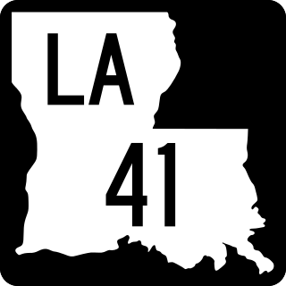
Louisiana Highway 41 (LA 41) is a state highway located in St. Tammany Parish, Louisiana. It runs 23.07 miles (37.13 km) in a north–south direction from the junction of U.S. Highway 11 (US 11) and LA 3081 in Pearl River to LA 21 in Bush.

<span class="mw-page-title-main">U.S. Route 71 in Arkansas</span>

U.S. Highway 71 is a U.S. highway that runs from Krotz Springs, LA to the Fort Frances–International Falls International Bridge at the Canadian border. In Arkansas, the highway runs from the Louisiana state line near Doddridge to the Missouri state line near Bella Vista. In Texarkana, the highway runs along State Line Avenue with US 59 and partially runs in Texas. Other areas served by the highway include Fort Smith and Northwest Arkansas.

References

Template:Attached KML/Missouri Route 64
KML is not from Wikidata
  1. 1 2 3 4 5 6 Missouri Department of Transportation (November 8, 2012). MoDOT HPMAPS (Map). Missouri Department of Transportation. Retrieved November 8, 2012.