Hickory County is located in the U.S. state of Missouri. As of the 2020 census, the population was 8,279. Its county seat is Hermitage. The county was organized February 14, 1845, and named after President Andrew Jackson, whose nickname was "Old Hickory." The Pomme de Terre Dam, a Corps of Engineers facility, is located three miles south of Hermitage and forms Lake Pomme de Terre by damming the Pomme de Terre River and Lindley Creek. Truman Reservoir, also a Corps of Engineers facility, floods the Pomme de Terre Reservoir from the northern border of the county southward to the city limits of Hermitage.

Route 64 is a highway in central Missouri with endpoints of Route 254 south of Hermitage and Route 5 in Lebanon.

Route 254 is a short highway in Hickory County, Missouri with endpoints at U.S. Route 54 (US 54) in Hermitage and Route 83 south of Wheatland. The highway crosses the Pomme de Terre Lake dam.
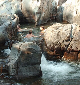
Johnson's Shut-Ins State Park is a public recreation area covering 9,432 acres (3,817 ha) on the East Fork Black River in Reynolds County, Missouri. The state park is jointly administered with adjoining Taum Sauk Mountain State Park, and together the two parks cover more than sixteen thousand acres in the St. Francois Mountains region of the Missouri Ozarks.

Pomme de Terre Lake is located in southwest Missouri at the confluence of Lindley Creek and the Pomme de Terre River. The lake is located in southern Hickory and northern Polk counties, about 50 miles (80 km) north of Springfield. Its name is the French language word for potato.
The Pomme de Terre River is a 130-mile-long (210 km) tributary of the Osage River in southwestern Missouri in the United States. Via the Osage and Missouri rivers, it is part of the watershed of the Mississippi River.

Washington State Park is a public recreation area covering 2,147 acres (869 ha) in Washington County in the central eastern part of the state of Missouri. It is located on Highway 21 about 14 miles (23 km) northeast of Potosi or 7 miles (11 km) southwest of De Soto on the eastern edge of the Ozarks. The state park is noted for its Native American rock carvings and for its finely crafted stonework from the 1930s.

Sam A. Baker State Park is a public recreation area encompassing 5,323 acres (2,154 ha) in the Saint Francois Mountains region of the Missouri Ozarks. The state park offers fishing, canoeing, swimming, camping, and trails for hiking and horseback riding. The visitor and nature center is housed in a historic building that was originally constructed as a stable in 1934. Twenty-five buildings and five structures comprise the Sam A. Baker State Park Historic District, a national historic district listed on the National Register of Historic Places in 1985.
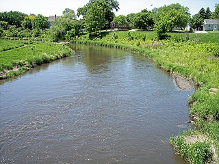
The Pomme de Terre River is a 125-mile-long (201 km) tributary of the Minnesota River in western Minnesota in the United States. Via the Minnesota River, it is part of the watershed of the Mississippi River, draining an area of 875 square miles (2,270 km2) in an agricultural region. The headwaters region of the Pomme de Terre River is the northernmost extremity of the Minnesota River's watershed.
Pomme de Terre may refer to:
St. Francois State Park is a public recreation area occupying 2,735 acres (1,107 ha) of land five miles (8.0 km) north of Bonne Terre in St. Francois County, Missouri. The state park features a campground, trails for hiking and horseback riding, and fishing on the Big River. The 49-acre (20 ha) Coonville Creek Natural Area, made up of Coonville Creek and its narrow valley, is found within the park's boundaries.
Fristoe is an unincorporated community in Benton County, Missouri, United States. Fristoe is located at the junction of U.S. Route 65 and Supplemental Route CC, 10.45 miles (16.82 km) southeast of Warsaw.
Lindley Creek is a stream in Dallas, Hickory and Polk counties the U.S. state of Missouri. It is a tributary of the Pomme de Terre River.
Crane Creek is a stream in Hickory County in the U.S. state of Missouri. It is a tributary of the Pomme de Terre River.
Deer Creek is a stream in Polk County in the Ozarks of southwest Missouri. It is a tributary of the Pomme de Terre River.
Dry Fork is a stream in Polk County in the U.S. state of Missouri. It is a tributary of the Pomme de Terre River.
Hominy Creek is a stream in Dallas and Polk counties in the Ozarks of southwest Missouri. It is a tributary of the Pomme de Terre River.
Stinking Creek is a stream in northern Polk County in the U.S. state of Missouri. It is a tributary of the Pomme de Terre River. The stream headwaters are along Missouri Route D between Polk and Huron. The stream flows north-northwest and enters the southern end of Pomme de Terre Lake just west of Adonis.

Sunset is a rural unincorporated community in Polk County, in the U.S. state of Missouri, located southeast of the county seat in Bolivar.
Montgomery Township is an inactive township in Hickory County, in the U.S. state of Missouri. It was named after Judge Joseph C. Montgomery.