
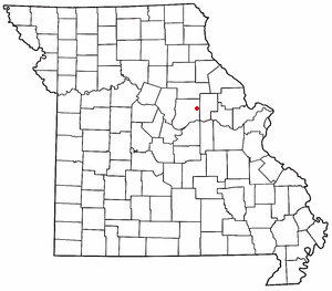
Callaway County is a county located in the U.S. state of Missouri. As of the 2020 United States Census, the county's population was 44,283. Its county seat is Fulton. With a border formed by the Missouri River, the county was organized November 25, 1820, and named for Captain James Callaway, grandson of Daniel Boone. The county has been historically referred to as "The Kingdom of Callaway" after an incident in which some residents confronted Union troops during the U.S. Civil War.

New Bloomfield is a city in Cedar Township, Callaway County, Missouri, United States. The population was 669 at the 2010 census. It is part of the Jefferson City Metropolitan Statistical Area.
Williamsburg is an unincorporated community in eastern Callaway County, Missouri, United States. It is located on Missouri Supplemental Route D just north of Interstate 70, approximately thirteen miles northeast of Fulton. The Whetstone Creek Conservation Area along Whetstone Creek lies about one mile to the north. The ZIP Code for Williamsburg is 63388.
Tebbetts is an unincorporated community in southern Callaway County, Missouri, United States. It is part of the Jefferson City, Missouri Metropolitan Statistical Area. Tebbetts is located on Route 94, approximately 8 miles (13 km) east of Jefferson City, on the north edge of the Missouri River floodplain.
Hams Prairie is an unincorporated community in Callaway County, Missouri, United States. The town is located 5.5 miles south-southeast of Fulton on Missouri Route C. Mokane on the north edge of the Missouri River floodplain is six miles further south along Route C.

Bourbon Township is one of eighteen townships in Callaway County, Missouri, USA. As of the 2010 census, its population was 2,059.

Calwood Township is one of eighteen townships in Callaway County, Missouri, USA. As of the 2010 census, its population was 1,097.

Cote Sans Dessein Township is one of eighteen townships in Callaway County, Missouri, USA. As of the 2010 census, its population was 1,122.

This article is on the Guthrie Township. For information on the town of Guthrie, within the township, see Guthrie, Missouri.
Nine Mile Prairie Township is one of eighteen townships in Callaway County, Missouri, USA. As of the 2010 census, its population was 790.
Readsville is an unincorporated community in southeastern Callaway County, in the U.S. state of Missouri. The community is located along Missouri Route D approximately six miles north of Portland and the Missouri River and seven miles south of Williamsburg and I-70. The community of Yucatan is three miles north along Route D.
Millersburg is an unincorporated community in Callaway County, in the U.S. state of Missouri. It is located near the Boone-Callaway county line on the Owl Creek tributary of Cedar Creek. The Little Dixie Lake and Little Dixie Wildlife Management Area lie on Owl Creek just north of the community. It is on Missouri Route J about four miles south of I-70.
Callaway is an unincorporated community in Callaway County, Missouri. The community was located approximately two miles south of Kingdom City and just west of U.S. Route 54. The site was on the Chicago and Alton Railroad and on the north bank of Richland Creek.
Calwood is an unincorporated community in Callaway County, in the U.S. state of Missouri. The community lies at the intersection of Missouri Routes JJ and Z approximately one mile south of I-70. Fulton is about six miles to the southwest on Route Z. Auxvasse Creek flows past approximately one mile to the northeast.
Concord is an unincorporated community in northern Callaway County, in the U.S. state of Missouri. The community is located approximately four miles west-northwest of Auxvasse and about one-half mile north of Missouri Route E.
Garrett is an extinct town in eastern Callaway County, in the U.S. state of Missouri. The community and Garrett Cemetery are on Missouri Route K, one-half mile west of the Callaway-Montgomery county line. The community of Readsville is approximately 3.5 miles to the west and Americus is about 4.5 miles to the east on route K.
Reform is an unincorporated community in southeastern Callaway County, Missouri, United States. The community is located at the intersection of Routes CC and O approximately six miles north of Steedman and the Missouri River. The Reform Conservation Area lies just to the south. The Callaway Nuclear Generating Station is located at Reform.
Shamrock is an unincorporated community in Shamrock Township in the northeast corner of Callaway County, in the U.S. state of Missouri. The community is on Missouri Route B two miles west of the Loutre River. Auxvasse is ten miles to the west, Montgomery City is about nine miles east and Williamsburg is five miles south.
Stephens is an unincorporated community in northwest Callaway County, in the U.S. state of Missouri. The community is one mile east of Cedar Creek and the Callaway-Boone county line. Lindbergh on I-70 lies 1.5 miles to the south.
Youngers is an unincorporated community in northwest Callaway County, in the U.S. state of Missouri. The community is in the extreme northwest corner of Callaway County and just east of Cedar Creek. Auxvasse is about twelve miles to the east, Mexico is about 14 miles to the northeast in Audrain County and Columbia is about nine miles to the southwest in Boone County.

