Related Research Articles

Callaway County is a county located in the U.S. state of Missouri. As of the 2020 United States Census, the county's population was 44,283. Its county seat is Fulton. With a border formed by the Missouri River, the county was organized November 25, 1820, and named for Captain James Callaway, grandson of Daniel Boone. The county has been historically referred to as "The Kingdom of Callaway" after an incident in which some residents confronted Union troops during the U.S. Civil War.

Steedman is an unincorporated community in southeastern Callaway County in the U.S. state of Missouri. The community is located on Missouri Route CC and Missouri Route 94 between Portland to the east and Mokane to the west above the Missouri River floodplain.
Wainwright is an unincorporated community in southern Callaway County, in the U.S. state of Missouri. The community is on Missouri Route 94 on the north edge of the Missouri River valley. Jefferson City is six miles to the west. The Katy Trail passes through Wainwright at mile 137.6.
Williamsburg is an unincorporated community in eastern Callaway County, Missouri, United States. It is located on Missouri Supplemental Route D just north of Interstate 70, approximately thirteen miles northeast of Fulton. The Whetstone Creek Conservation Area along Whetstone Creek lies about one mile to the north. The ZIP Code for Williamsburg is 63388.
Hams Prairie is an unincorporated community in Callaway County, Missouri, United States. The town is located 5.5 miles south-southeast of Fulton on Missouri Route C. Mokane on the north edge of the Missouri River floodplain is six miles further south along Route C.
Readsville is an unincorporated community in southeastern Callaway County, in the U.S. state of Missouri. The community is located along Missouri Route D approximately six miles north of Portland and the Missouri River and seven miles south of Williamsburg and I-70. The community of Yucatan is three miles north along Route D.
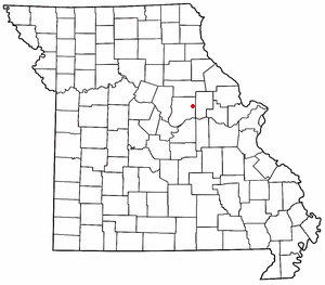
Toledo is an unincorporated community in Callaway County, in the U.S. state of Missouri. The community is on routes JJ and UU, approximately six miles east of Fulton.
Millersburg is an unincorporated community in Callaway County, in the U.S. state of Missouri. It is located near the Boone-Callaway county line on the Owl Creek tributary of Cedar Creek. The Little Dixie Lake and Little Dixie Wildlife Management Area lie on Owl Creek just north of the community. It is on Missouri Route J about four miles south of I-70.
Bachelor Creek is a stream in northeastern Callaway County, in the U.S. state of Missouri. It is a tributary of the Loutre River.
Bachelor is an unincorporated community in northern Callaway County, in the U.S. state of Missouri. The community is on Missouri Route A, approximately six miles east-southeast of Auxvasse. The headwaters of Bachelor Creek are to the northwest of the community.
Boydsville is an unincorporated community in western Callaway County, in the U.S. state of Missouri. The community is in the Mark Twain National Forest 1.5 miles east of Cedar Creek and Fulton is approximately eight miles to the east-northeast.
Callaway is an unincorporated community in Callaway County, Missouri. The community was located approximately two miles south of Kingdom City and just west of U.S. Route 54. The site was on the Chicago and Alton Railroad and on the north bank of Richland Creek.
Calwood is an unincorporated community in Callaway County, in the U.S. state of Missouri. The community lies at the intersection of Missouri Routes JJ and Z approximately one mile south of I-70. Fulton is about six miles to the southwest on Route Z. Auxvasse Creek flows past approximately one mile to the northeast.
Carrington is an unincorporated community in Callaway County, in the U.S. state of Missouri. The community is on Missouri Route H approximately four miles west-southwest of Fulton. It is on the boundary of a section of the Mark Twain National Forest.
Concord is an unincorporated community in northern Callaway County, in the U.S. state of Missouri. The community is located approximately four miles west-northwest of Auxvasse and about one-half mile north of Missouri Route E.
Dixie is an unincorporated community in southwestern Callaway County, in the U.S. state of Missouri. The community is located at the intersection of Missouri Routes BB and PP. It is on a ridge between Middle River to the east and Hillers Creek to the west. Jefferson City on the Missouri River lies 12 miles to the southwest.
Guthrie is an unincorporated community in western Callaway County, in the U.S. state of Missouri. The community lies at the intersection of Missouri routes J and Y. New Bloomfield lies two miles south on Route J and the Pine Ridge Recreation Area of the Mark Twain National Forest along Cedar Creek is four miles east on Route Y.
Hatton is an unincorporated community in northwest Callaway County, in the U.S. state of Missouri. The community is on Missouri Route E 6.5 miles west of Auxvasse.
Reform is an unincorporated community in southeastern Callaway County, Missouri, United States. The community is located at the intersection of Routes CC and O approximately six miles north of Steedman and the Missouri River. The Reform Conservation Area lies just to the south. The Callaway Nuclear Generating Station is located at Reform.
Shamrock is an unincorporated community in Shamrock Township in the northeast corner of Callaway County, in the U.S. state of Missouri. The community is on Missouri Route B two miles west of the Loutre River. Auxvasse is ten miles to the west, Montgomery City is about nine miles east and Williamsburg is five miles south.
References
- ↑ U.S. Geological Survey Geographic Names Information System: Garrett (historical)
- ↑ Montgomery City, Missouri, 15 Minute Topographic Quadrangle, USGS, 1940 (1968 rev.)
- ↑ "Post Offices". Jim Forte Postal History. Archived from the original on 6 March 2016. Retrieved 7 September 2016.
- ↑ "Callaway County Place Names, 1928–1945 (archived)". The State Historical Society of Missouri. Archived from the original on 24 June 2016. Retrieved 7 September 2016.
{{cite web}}: CS1 maint: bot: original URL status unknown (link)
Municipalities and communities of Callaway County, Missouri, United States | ||
|---|---|---|
| Cities |  | |
| Village | ||
| Townships | ||
| CDP | ||
| Other communities | ||
| Ghost towns | ||
| Footnotes | ‡This populated place also has portions in an adjacent county or counties | |
38°48′00″N91°38′56″W / 38.8000425°N 91.6487815°W
| | This United States ghost town-related article is a stub. You can help Wikipedia by expanding it. |
| | This Callaway County, Missouri state location article is a stub. You can help Wikipedia by expanding it. |